MyTopo
Shin Pond Maine US Topo Map
Couldn't load pickup availability
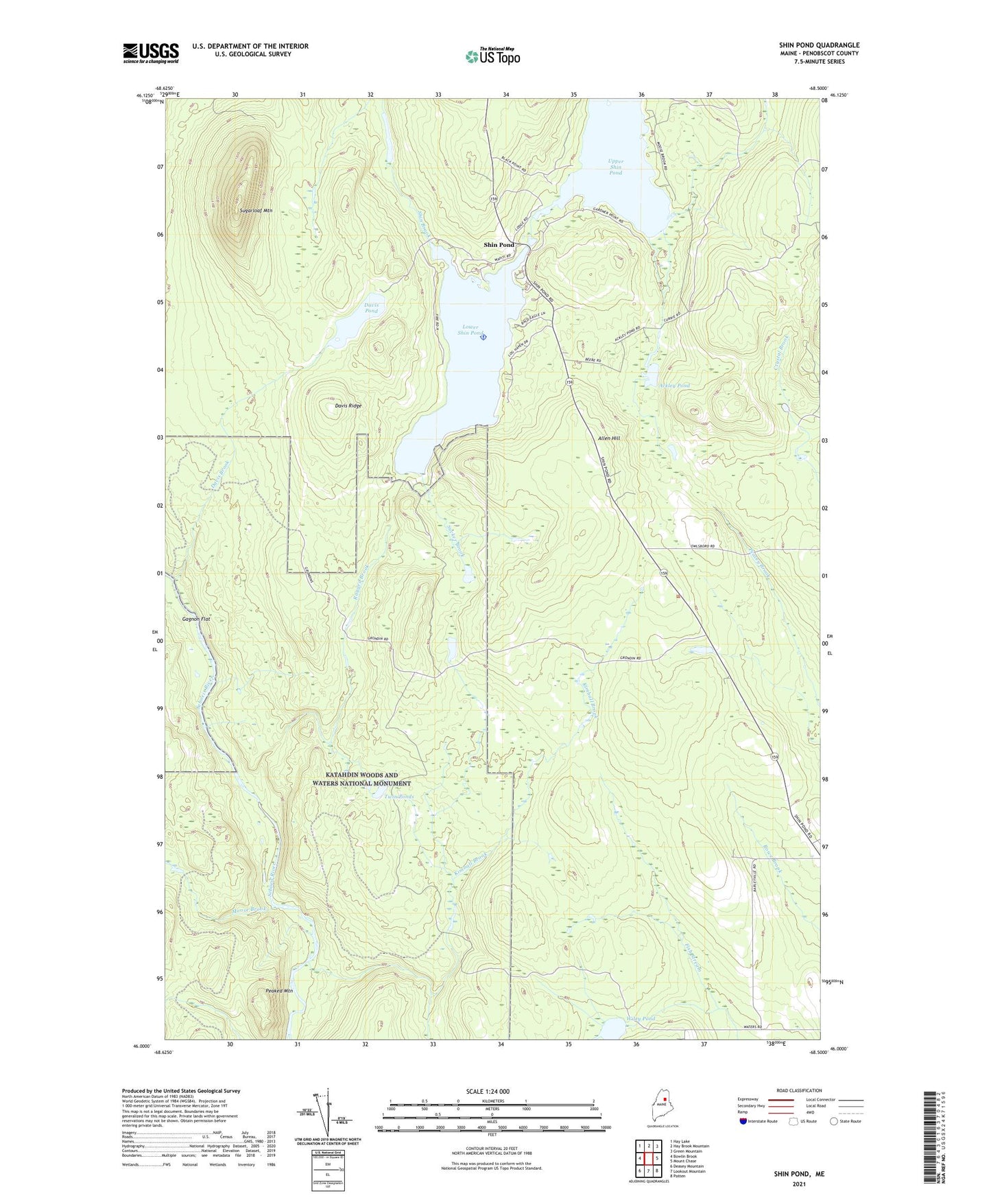
2024 topographic map quadrangle Shin Pond in the state of Maine. Scale: 1:24000. Based on the newly updated USGS 7.5' US Topo map series, this map is in the following counties: Penobscot. The map contains contour data, water features, and other items you are used to seeing on USGS maps, but also has updated roads and other features. This is the next generation of topographic maps. Printed on high-quality waterproof paper with UV fade-resistant inks.
Quads adjacent to this one:
West: Bowlin Brook
Northwest: Hay Lake
North: Hay Brook Mountain
Northeast: Green Mountain
East: Mount Chase
Southeast: Patten
South: Lookout Mountain
Southwest: Deasey Mountain
This map covers the same area as the classic USGS quad with code o46068a5.
Contains the following named places: Ackley Pond, Allen Hill, American Thread Company Road, Davis Brook, Davis Pond, Davis Ridge, Gagnon Flat, Kimball Brook, Lower Shin Pond, Moose Brook, Peaked Mountain, Ragged Brook, Shin Pond, Shin Pond Seaplane Base, Shin Pond Village Campground, Sucker Brook, Sugarloaf Mountain, Town of Mount Chase, Twin Ponds, Upper Shin Pond, Wiley Pond