MyTopo
Wallagrass Lakes Maine US Topo Map
Couldn't load pickup availability
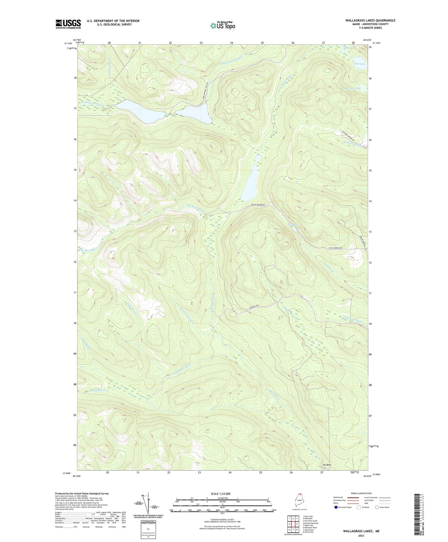
2024 topographic map quadrangle Wallagrass Lakes in the state of Maine. Scale: 1:24000. Based on the newly updated USGS 7.5' US Topo map series, this map is in the following counties: Aroostook. The map contains contour data, water features, and other items you are used to seeing on USGS maps, but also has updated roads and other features. This is the next generation of topographic maps. Printed on high-quality waterproof paper with UV fade-resistant inks.
Quads adjacent to this one:
West: McLean Mountain
Northwest: Saint John
North: Wheelock
Northeast: Fort Kent South
East: Eagle Lake
Southeast: Winterville
South: Island Pond
Southwest: Deboullie Pond
Contains the following named places: Austins Dam, Ben Lake, Birch River Camp, Birch River Dam, Black Brook, Cotes Camp, Deep Brook, Dickwood Lake, Falls Camp, Fire Wardens Camp, First Lake, Gagnon Sugar Camp, Godfrey Brook, Isie Lake, Labbe Camp, Laliberte Camp, Marcial Lake, Mud Lake, Nichols Rapids, North Branch Birch River, Ox Bow, Quellette Brook, Saucier Camp, Sauls Brook, Second Lake, South Branch Birch River, Town of Eagle Lake, Wallagrass Lakes