MyTopo
Doyle Ridge Maine US Topo Map
Couldn't load pickup availability
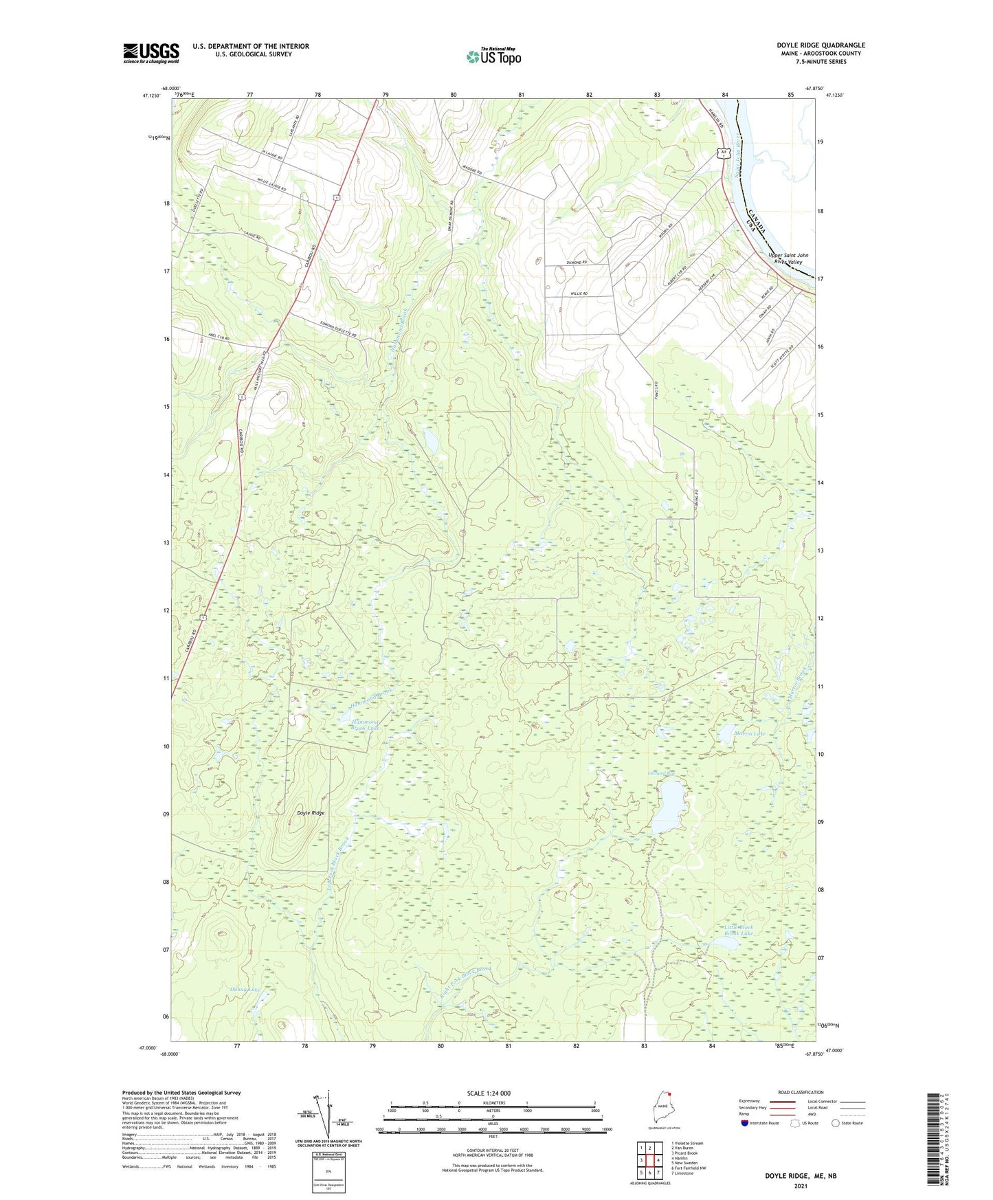
2024 topographic map quadrangle Doyle Ridge in the state of Maine. Scale: 1:24000. Based on the newly updated USGS 7.5' US Topo map series, this map is in the following counties: Aroostook. The map contains contour data, water features, and other items you are used to seeing on USGS maps, but also has updated roads and other features. This is the next generation of topographic maps. Printed on high-quality waterproof paper with UV fade-resistant inks.
Quads adjacent to this one:
West: Picard Brook
Northwest: Violette Stream
North: Van Buren
East: Hamlin
Southeast: Limestone
South: Fort Fairfield NW
Southwest: New Sweden
This map covers the same area as the classic USGS quad with code o47067a8.
Contains the following named places: Big Black Brook Lake, Doyle Ridge, Dubay Lake, Hammond Brook Lake, Little Black Brook Lake, Martin Lake, Morrill Airpark, Orchard Bog, Plantation of Cyr, Town of Hamlin, Township of Connor, Unorganized Territory of Connor