MyTopo
Van Buren Maine US Topo Map
Couldn't load pickup availability
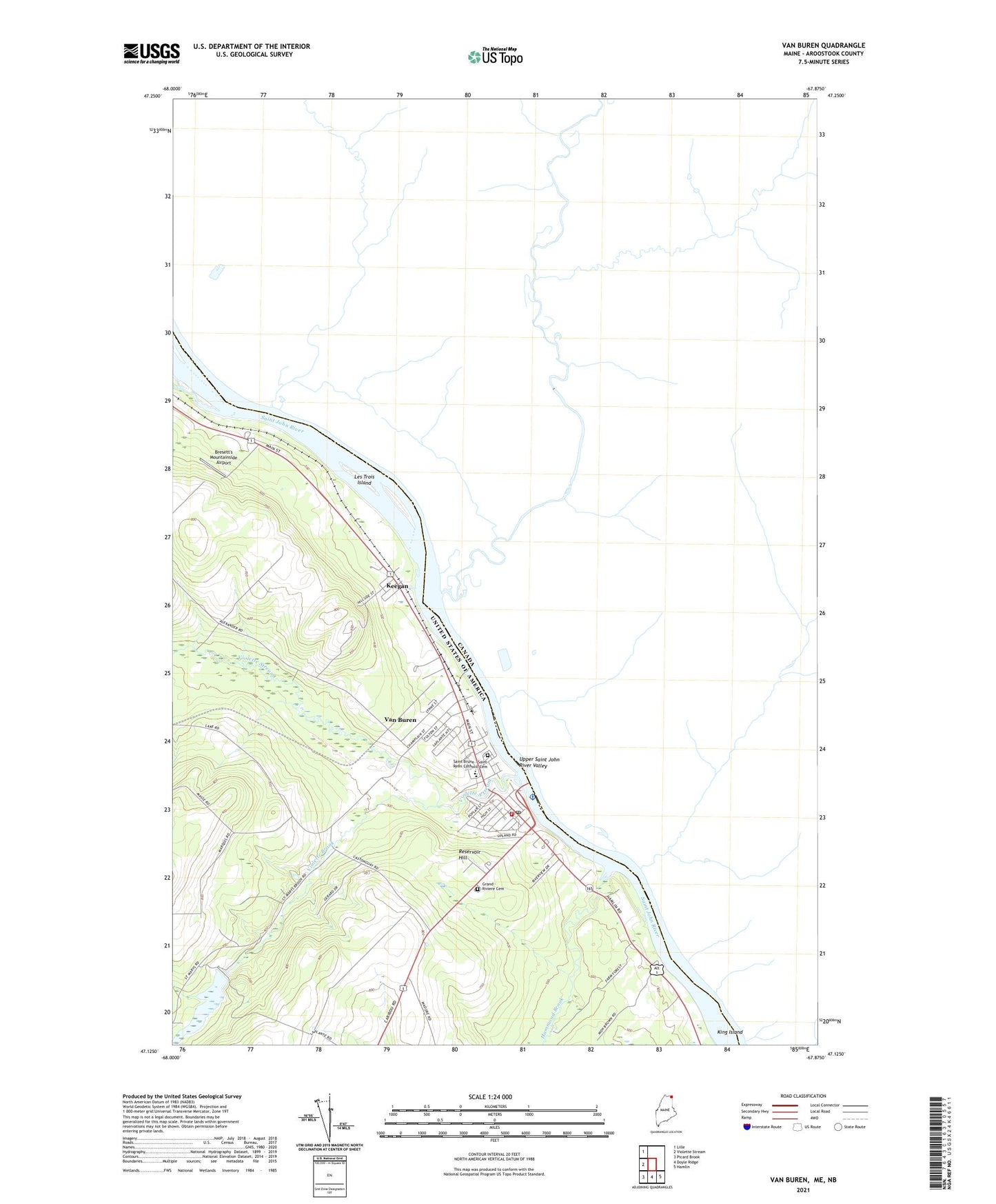
2024 topographic map quadrangle Van Buren in the state of Maine. Scale: 1:24000. Based on the newly updated USGS 7.5' US Topo map series, this map is in the following counties: Aroostook. The map contains contour data, water features, and other items you are used to seeing on USGS maps, but also has updated roads and other features. This is the next generation of topographic maps. Printed on high-quality waterproof paper with UV fade-resistant inks.
Quads adjacent to this one:
West: Violette Stream
Northwest: Lille
Southeast: Hamlin
South: Doyle Ridge
Southwest: Picard Brook
This map covers the same area as the classic USGS quad with code o47067b8.
Contains the following named places: Abel J Morneault Memorial Library, Bresett's Mountainside Airport, Fire Station Number Two, Gateway Elementary School, Grand - Riviere Cemetery, Hammond Brook, Keegan, Keegan Community Hall, Kennedy Terrace, King Island, Les Trois Island, Old Water Reservoir Dam, Reservoir Hill, Saint Bruno - Saint Remi Catholic Cemetery, Saint John Valley Health Center, Septiemel Island, United States Customs Office, Van Buren, Van Buren Ambulance Service, Van Buren Census Designated Place, Van Buren Community Center, Van Buren District Secondary School, Van Buren Elementary School, Van Buren Fire Department, Van Buren Municipal Building, Van Buren Police Department, Van Buren Post Office, Van Buren Regional Technical Center, Van Buren Regional Technology Center, Van Buren Seaplane Base, Violette Brook, Violette Brook Reservoir, Violette Lake, Violette Lake Dam, Violette Stream, WCXV-FM (Van Buren), ZIP Code: 04785