MyTopo
Rocky Pond Maine US Topo Map
Couldn't load pickup availability
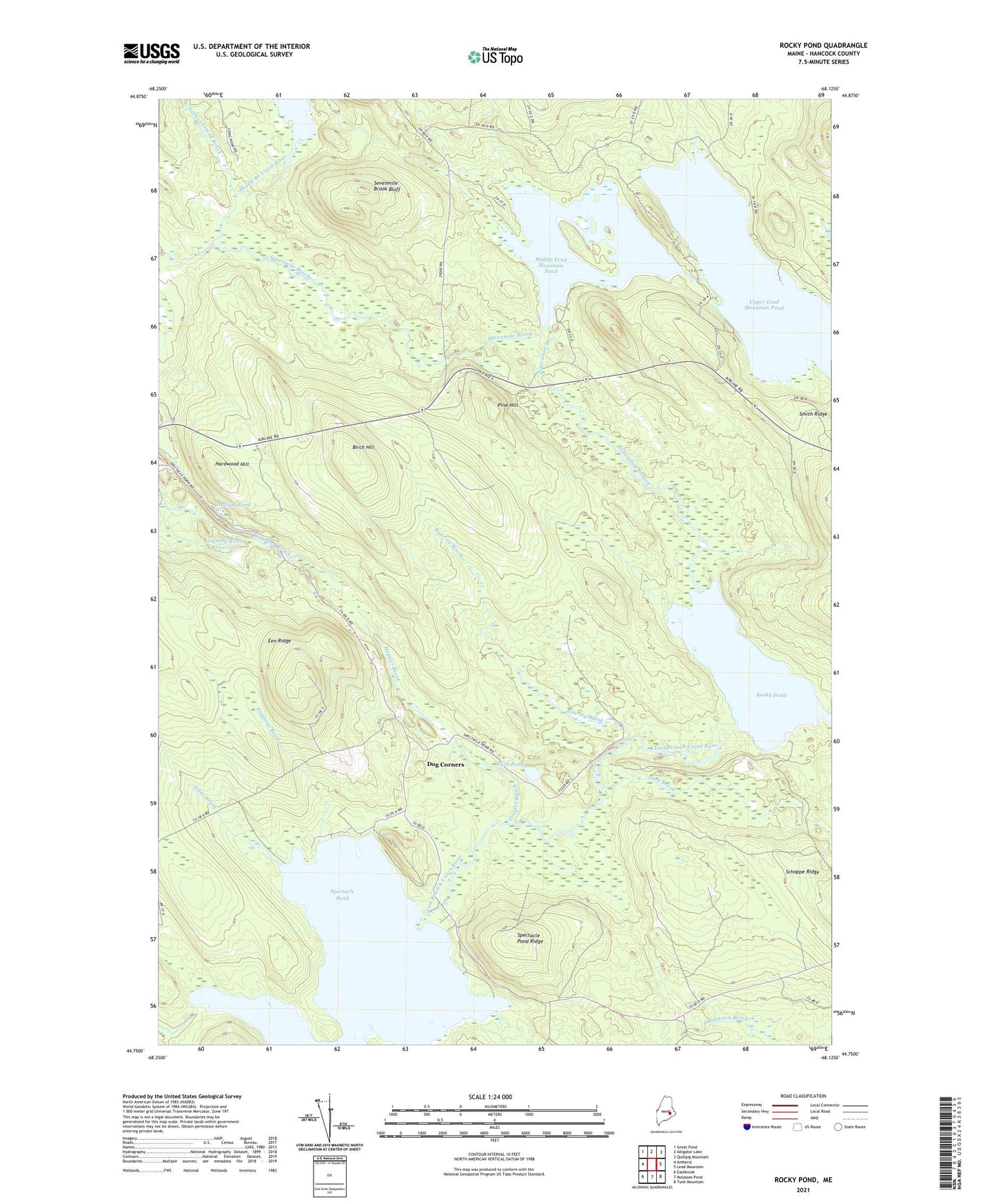
2024 topographic map quadrangle Rocky Pond in the state of Maine. Scale: 1:24000. Based on the newly updated USGS 7.5' US Topo map series, this map is in the following counties: Hancock. The map contains contour data, water features, and other items you are used to seeing on USGS maps, but also has updated roads and other features. This is the next generation of topographic maps. Printed on high-quality waterproof paper with UV fade-resistant inks.
Quads adjacent to this one:
West: Amherst
Northwest: Great Pond
North: Alligator Lake
Northeast: Quillpig Mountain
East: Lead Mountain
Southeast: Tunk Mountain
South: Molasses Pond
Southwest: Eastbrook
This map covers the same area as the classic USGS quad with code o44068g2.
Contains the following named places: Birch Hill, Dark Brook, Dog Corners, Duck Pond, Een Ridge, Garden Eden Brook, Hardwood Hill, Hazlam Pond, Hopper Brook, Johns Brook, Kingman Brook, Leighton River Dam, Leighton River Reservoir, Lower Lead Mountain Dam, Lower Lead Mountain Pond, Middle Lead Mountain Pond, Pine Hill, Roaring Brook, Rocky Pond, Salmon Island Brook, Schoppe Ridge, Sevenmile Brook, Sevenmile Brook Bluff, Spectacle Pond, Spectacle Pond Ridge, Starvation Branch, Steep Landing, T22 MD BPP, The Narrows, Upper Lead Mountain Dam, Upper Lead Mountain Pond