MyTopo
Fort Kent South Maine US Topo Map
Couldn't load pickup availability
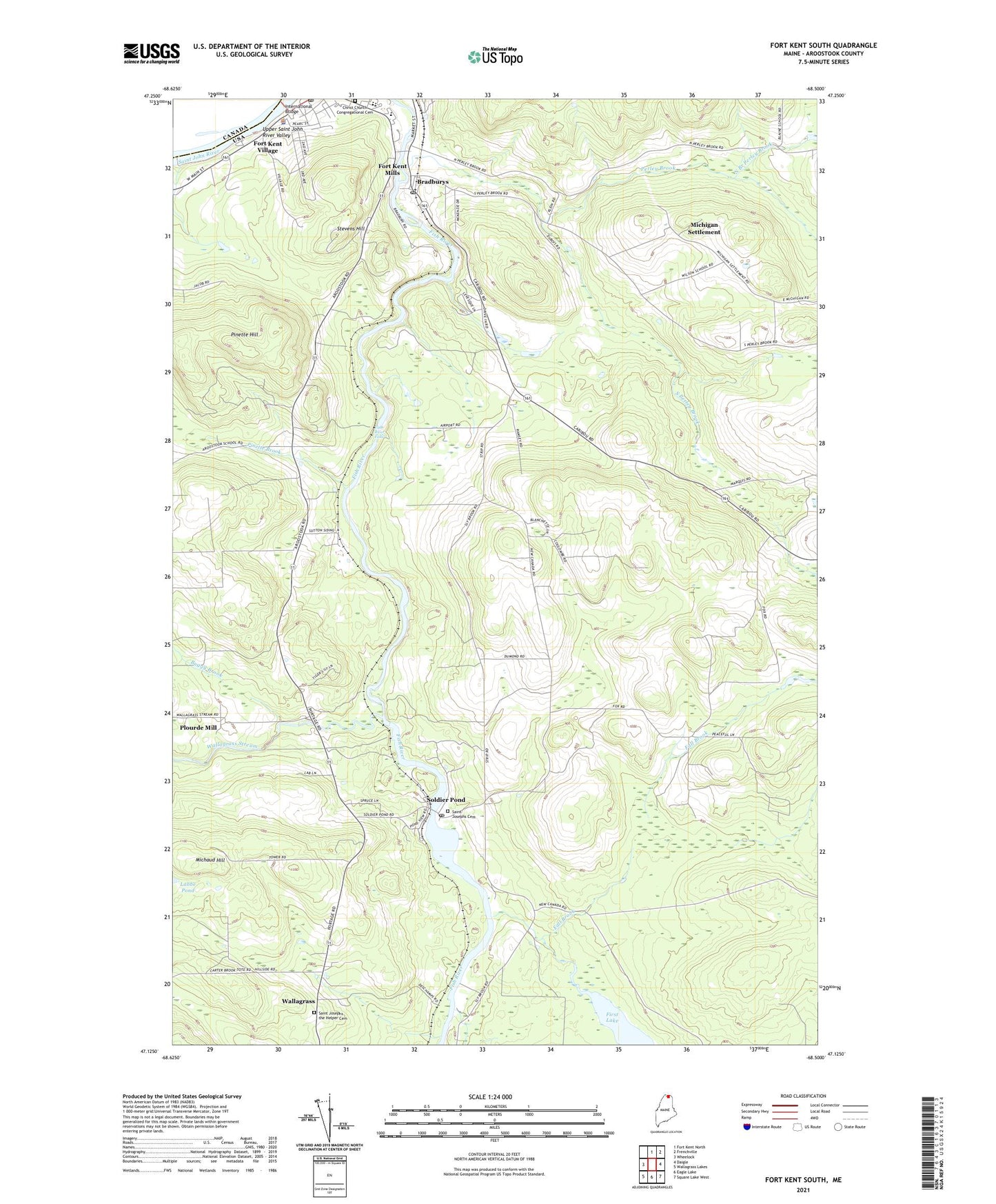
2024 topographic map quadrangle Fort Kent South in the state of Maine. Scale: 1:24000. Based on the newly updated USGS 7.5' US Topo map series, this map is in the following counties: Aroostook. The map contains contour data, water features, and other items you are used to seeing on USGS maps, but also has updated roads and other features. This is the next generation of topographic maps. Printed on high-quality waterproof paper with UV fade-resistant inks.
Quads adjacent to this one:
West: Wheelock
North: Fort Kent North
Northeast: Frenchville
East: Daigle
Southeast: Square Lake West
South: Eagle Lake
Southwest: Wallagrass Lakes
This map covers the same area as the classic USGS quad with code o47068b5.
Contains the following named places: Acadian Archives, Baxter School, Bradburys, Buggy Brook, Christ Church Congregational Cemetery, Christ Congregational Church, Coolidge School, Dumond School, Fall Brook, First Lake, Fish River Falls, Fort Kent Community High School, Fort Kent Elementary School, Fort Kent Mills, Fort Kent Mills Post Office, Fort Kent Municipal Airport, Fort Kent Pit, Fort Kent Police Department, Fort Kent Post Office, Fort Kent Village, Harding School, International Bridge, Labby, Lincoln School, Michaud Hill, Michaud Siding, Michigan School, Michigan Settlement, North Branch Perley Brook, North Perley Brook School, Perley Brook, Pinette Brook, Pinette Hill, Plourde Mill, Roosevelt School, Saint Euzebe School, Saint George School, Saint Johns School, Saint Josephs Cemetery, Saint Josephs Church, Saint Josephs the Helper Cemetery, Shakespere School, Soldier Pond, Soldier Pond Post Office, South Perley Brook, Stevens Hill, Town of Fort Kent, Town of New Canada, Valley Rivers Middle School, Wallagrass, Wallagrass Elementary School, Wallagrass Post Office, Wallagrass Stream, Washington School, Wilson School, WLVC-AM (Fort Kent), ZIP Codes: 04743, 04781