MyTopo
Wheelock Maine US Topo Map
Couldn't load pickup availability
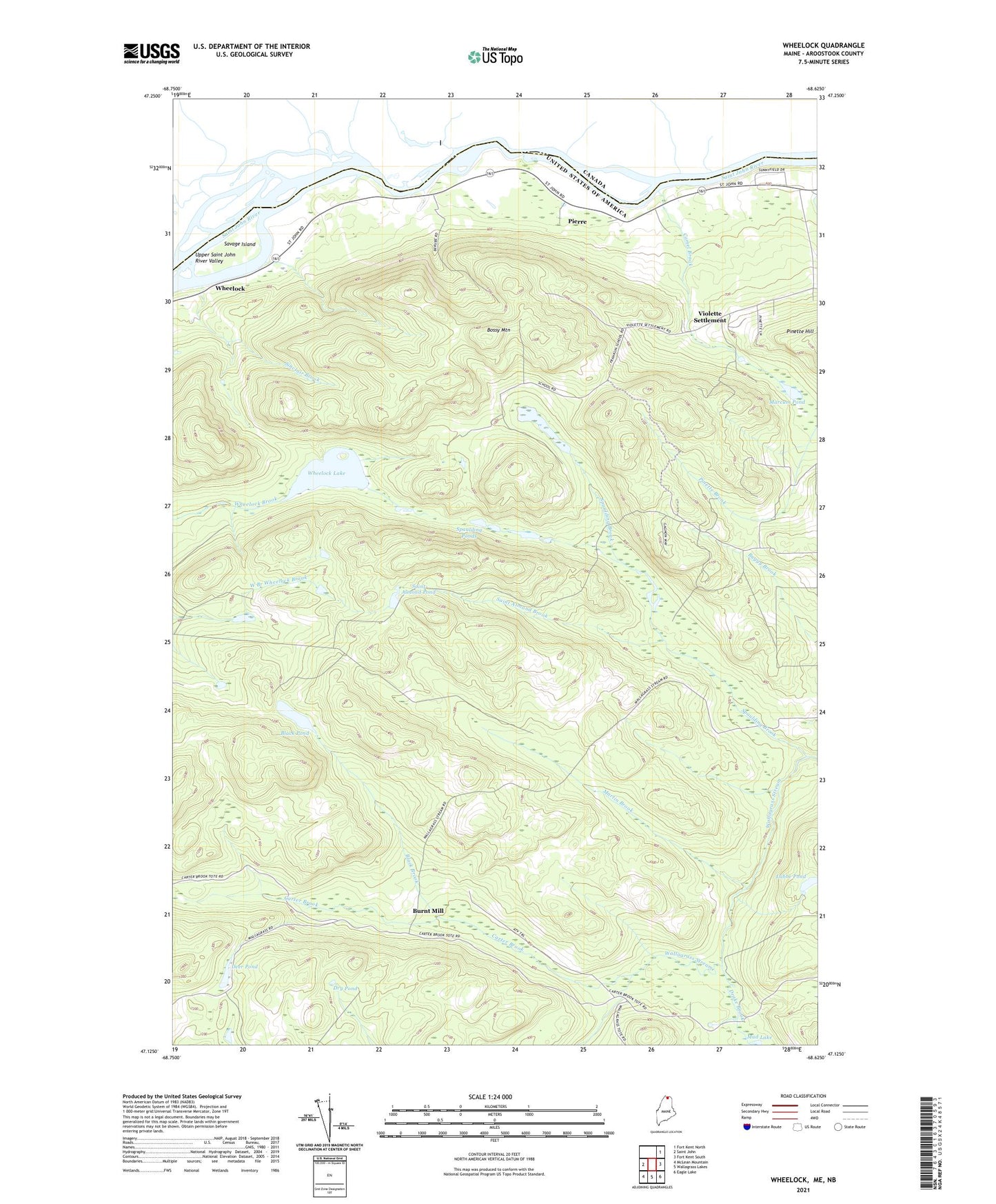
2024 topographic map quadrangle Wheelock in the state of Maine. Scale: 1:24000. Based on the newly updated USGS 7.5' US Topo map series, this map is in the following counties: Aroostook. The map contains contour data, water features, and other items you are used to seeing on USGS maps, but also has updated roads and other features. This is the next generation of topographic maps. Printed on high-quality waterproof paper with UV fade-resistant inks.
Quads adjacent to this one:
West: Saint John
Northeast: Fort Kent North
East: Fort Kent South
Southeast: Eagle Lake
South: Wallagrass Lakes
Southwest: McLean Mountain
This map covers the same area as the classic USGS quad with code o47068b6.
Contains the following named places: Belanger Settlement, Belanger Sugar Camp, Black Brook, Black Pond, Bossy Mountain, Burnt Mill, Camel Brook, Carter Brook, Carter Brook Camp, Deer Pond, Drake Brook, Dry Pond, Franklin School, Labbe Pond, Ledges, Lincoln School, Longfellow School, Marcum Pond, Martin Brook, Pierre, Saint Almond Brook, Saint Almond Pond, Saint Anthony School, Savage Island, Sinclair Brook, Spaulding Brook, Spaulding Ponds, Sugar Camp, Town of Wallagrass, Violette Settlement, Wheelock, Wheelock Lake, Wheelock Siding