MyTopo
Green Mountain Maine US Topo Map
Couldn't load pickup availability
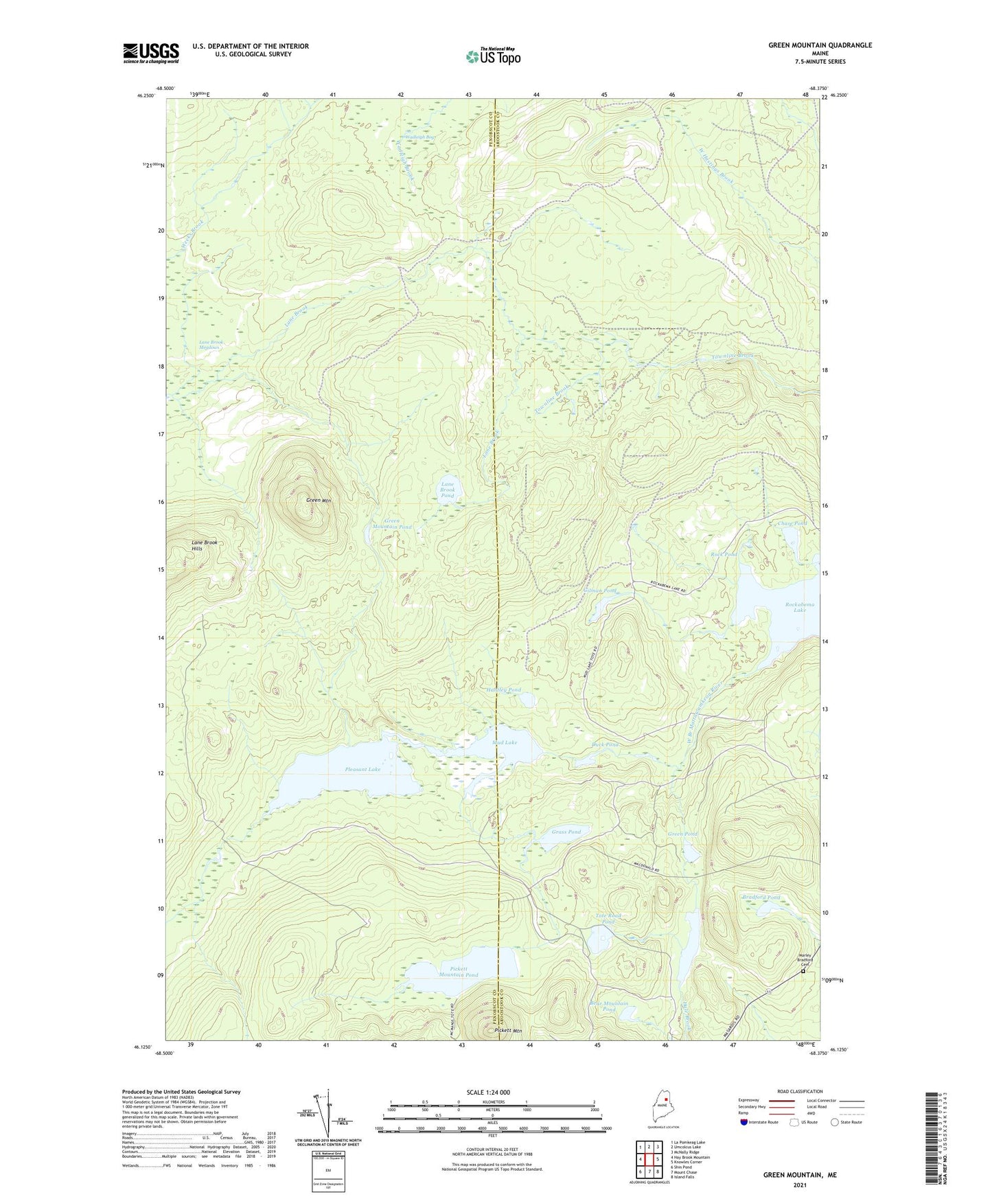
2024 topographic map quadrangle Green Mountain in the state of Maine. Scale: 1:24000. Based on the newly updated USGS 7.5' US Topo map series, this map is in the following counties: Penobscot, Aroostook. The map contains contour data, water features, and other items you are used to seeing on USGS maps, but also has updated roads and other features. This is the next generation of topographic maps. Printed on high-quality waterproof paper with UV fade-resistant inks.
Quads adjacent to this one:
West: Hay Brook Mountain
Northwest: La Pomkeag Lake
North: Umcolcus Lake
Northeast: McNally Ridge
East: Knowles Corner
Southeast: Island Falls
South: Mount Chase
Southwest: Shin Pond
This map covers the same area as the classic USGS quad with code o46068b4.
Contains the following named places: Bear Mountain Pond, Bradford Pond, Chase Pond, Duck Pond, Gilman Pond, Grass Pond, Green Mountain, Green Mountain Pond, Green Pond, Hale Pond, Huntley Pond, Lane Brook Hills, Lane Brook Meadows, Lane Brook Pond, Lost Pond, Marley Bradford Cemetery, Mud Lake, Pickett Mountain, Pickett Mountain Pond, Pleasant Lake, Rock Pond, Rockabema Lake, Tote Road Pond, Wadleigh Bog