MyTopo
Mount Chase Maine US Topo Map
Couldn't load pickup availability
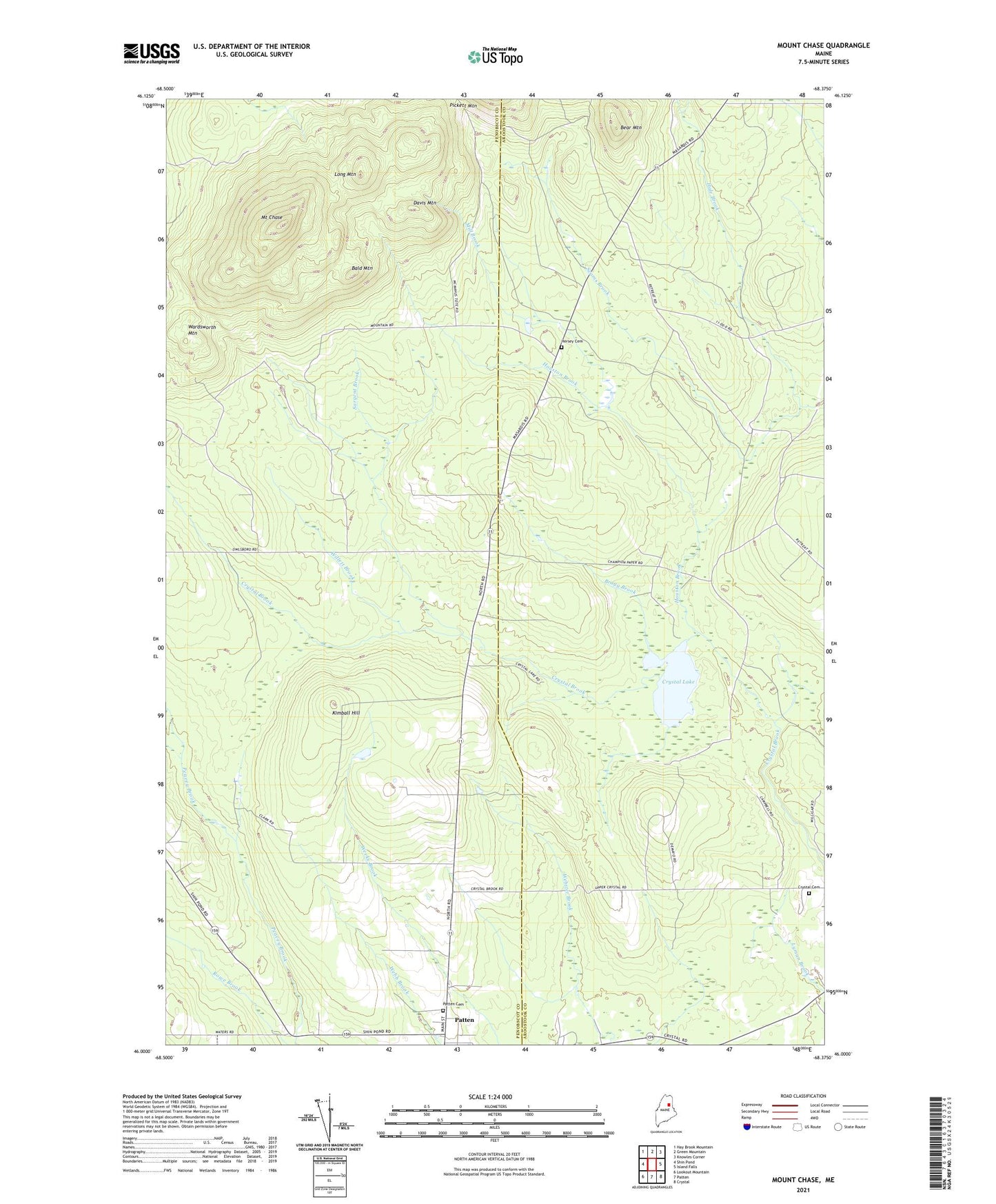
2024 topographic map quadrangle Mount Chase in the state of Maine. Scale: 1:24000. Based on the newly updated USGS 7.5' US Topo map series, this map is in the following counties: Penobscot, Aroostook. The map contains contour data, water features, and other items you are used to seeing on USGS maps, but also has updated roads and other features. This is the next generation of topographic maps. Printed on high-quality waterproof paper with UV fade-resistant inks.
Quads adjacent to this one:
West: Shin Pond
Northwest: Hay Brook Mountain
North: Green Mountain
Northeast: Knowles Corner
East: Island Falls
Southeast: Crystal
South: Patten
Southwest: Lookout Mountain
This map covers the same area as the classic USGS quad with code o46068a4.
Contains the following named places: Allsbury School, Bald Mountain, Bear Mountain, Bragg Brook, Crystal Cemetery, Crystal Lake, Davis Mountain, Davis School, Hale Brook, Halls Corner, Hersey, Hersey Cemetery, Houston Brook, Kimball Hill, Long Mountain, Mill Brook, Mount Chase, Myrick School, Patten Academy, Patten Cemetery, Patten Census Designated Place, Patten Lumbermans Museum, Peasley Brook, Peasley Brook Dam, Rowe Brook, Sargent Brook, Seams Brook, Wardsworth Mountain, Willett Brook