MyTopo
Island Falls Maine US Topo Map
Couldn't load pickup availability
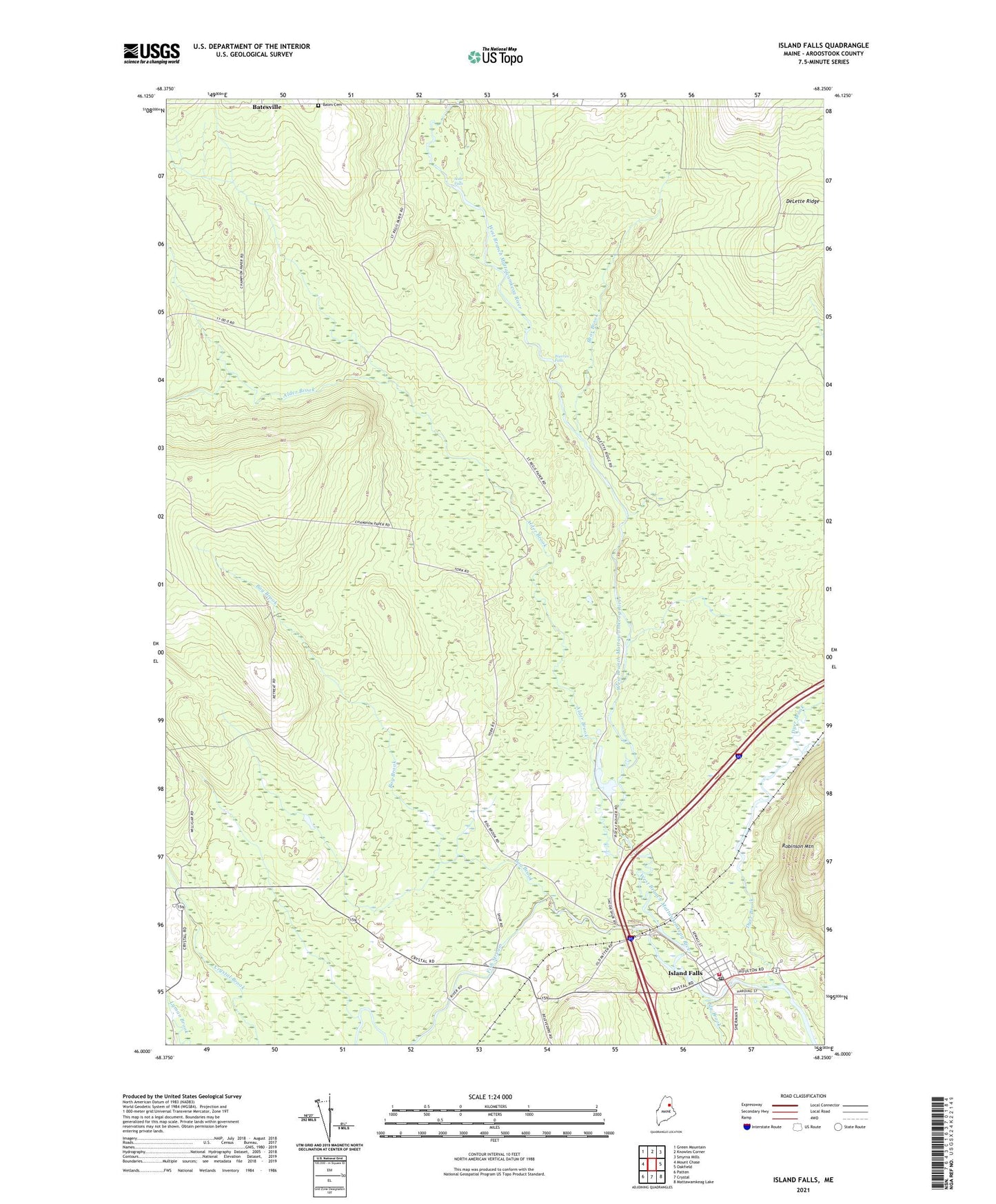
2024 topographic map quadrangle Island Falls in the state of Maine. Scale: 1:24000. Based on the newly updated USGS 7.5' US Topo map series, this map is in the following counties: Aroostook. The map contains contour data, water features, and other items you are used to seeing on USGS maps, but also has updated roads and other features. This is the next generation of topographic maps. Printed on high-quality waterproof paper with UV fade-resistant inks.
Quads adjacent to this one:
West: Mount Chase
Northwest: Green Mountain
North: Knowles Corner
Northeast: Smyrna Mills
East: Oakfield
Southeast: Mattawamkeag Lake
South: Crystal
Southwest: Patten
This map covers the same area as the classic USGS quad with code o46068a3.
Contains the following named places: Alder Brook, Bates Cemetery, Bear Brook, Belvedere Church, Bog Brook, Dyer Brook, Fish Stream, Hackett School, Hersey School, Island Falls, Island Falls Ambulance Service, Island Falls Census Designated Place, Island Falls Fire Department, Island Falls Opera House, Island Falls Post Office, Island Falls United Baptist Church, Katahdin Public Library, Robinson Mountain, Saint Agnes Roman Catholic Church, Sly Brook, Stair Falls, Stevens School, Town of Hersey, Warren Falls, Whittier Congregational Church, Wilbur School