MyTopo
Oakfield Maine US Topo Map
Couldn't load pickup availability
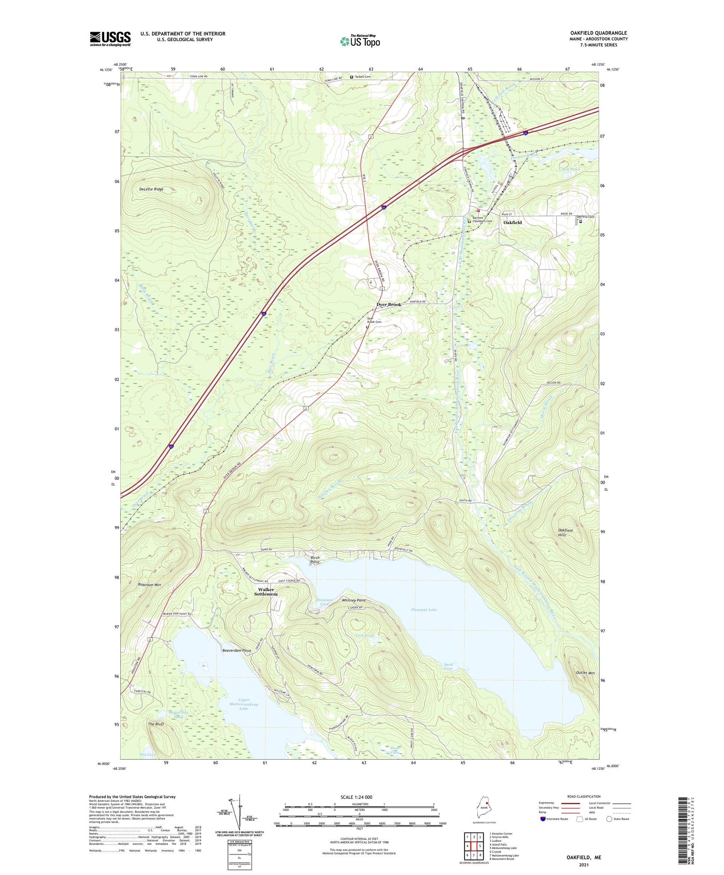
2024 topographic map quadrangle Oakfield in the state of Maine. Scale: 1:24000. Based on the newly updated USGS 7.5' US Topo map series, this map is in the following counties: Aroostook. The map contains contour data, water features, and other items you are used to seeing on USGS maps, but also has updated roads and other features. This is the next generation of topographic maps. Printed on high-quality waterproof paper with UV fade-resistant inks.
Quads adjacent to this one:
West: Island Falls
Northwest: Knowles Corner
North: Smyrna Mills
Northeast: Ludlow
East: Meduxnekeag Lake
Southeast: Monument Brook
South: Mattawamkeag Lake
Southwest: Crystal
This map covers the same area as the classic USGS quad with code o46068a2.
Contains the following named places: Barrows Chambers Cemetery, Battle Brook, Beaverdam Point, Birch Point, Clark Pond, Colbroth Brook, DeLette Ridge, Dinsmore Cove, Downing Brook, Dyer Brook, Dyer Brook Cemetery, Dyer Brook Community Church, Huntley Brook, Long Lake, Lost Pond, Moose Brook, Morgridge Pond, Oakfield, Oakfield Cemetery, Oakfield Census Designated Place, Oakfield Post Office, Oakfield Seventh Day Adventist Church, Oakfield Volunteer Fire Department, Outlet Mountain, Pea Cove, Pleasant Lake, Pratt Cove, Red Bridge, Sand Cove, Southern Aroostook Community School, Tarbell Cemetery, The Bluff, Thomas Brook, Town of Dyer Brook, Upper Mattawamkeag Lake, Va-Jo-Wa Golf Club, Walker Settlement, Whitney Point, ZIP Code: 04747