MyTopo
Mattawamkeag Lake Maine US Topo Map
Couldn't load pickup availability
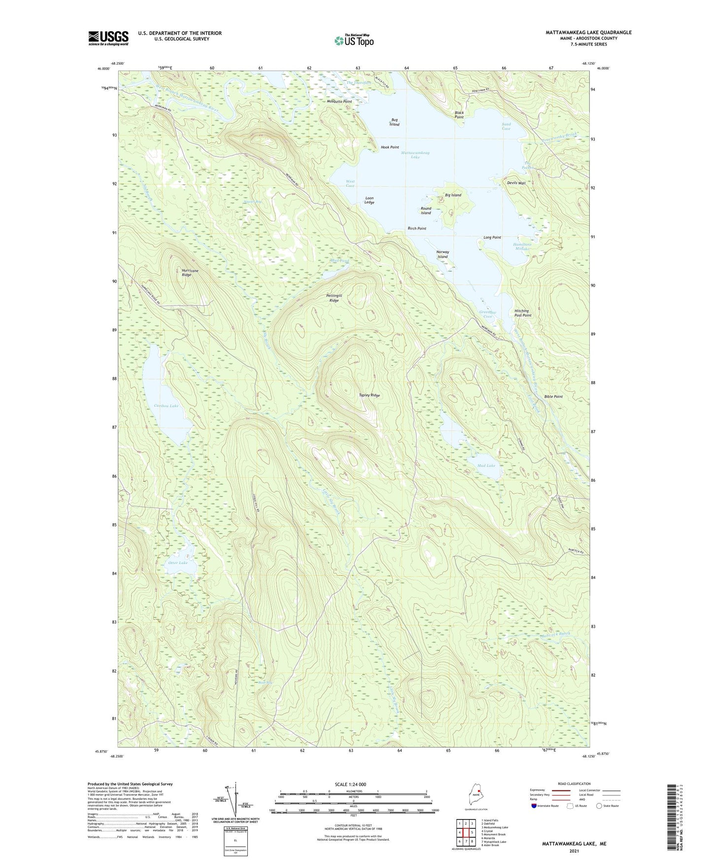
2024 topographic map quadrangle Mattawamkeag Lake in the state of Maine. Scale: 1:24000. Based on the newly updated USGS 7.5' US Topo map series, this map is in the following counties: Aroostook. The map contains contour data, water features, and other items you are used to seeing on USGS maps, but also has updated roads and other features. This is the next generation of topographic maps. Printed on high-quality waterproof paper with UV fade-resistant inks.
Quads adjacent to this one:
West: Crystal
Northwest: Island Falls
North: Oakfield
Northeast: Meduxnekeag Lake
East: Monument Brook
Southeast: Alder Brook
South: Wytopitlock Lake
Southwest: Monarda
This map covers the same area as the classic USGS quad with code o45068h2.
Contains the following named places: Bible Point, Big Island, Birch Point, Black Point, Bug Island, Bush Bog, Caribou Lake, Devils Wall, First Brook, Greenlaw Cove, Hamiltons Mistake, Hitching Post Point, Hook Point, Hurricane Ridge, Little Sly Brook, Long Point, Loon Ledge, Mattawamkeag Lake, Mosquito Point, Mud Lake, Mud Pond, Norway Island, Otter Lake, Otter Lake Firetower, Pettingill Ridge, Round Island, Sand Cove, Soucier Bog, T3 R4 WELS, Tapley Ridge, The Pocket, The Thorofare, Town of Island Falls, Trueworthy Brook, West Cove