MyTopo
Wytopitlock Maine US Topo Map
Couldn't load pickup availability
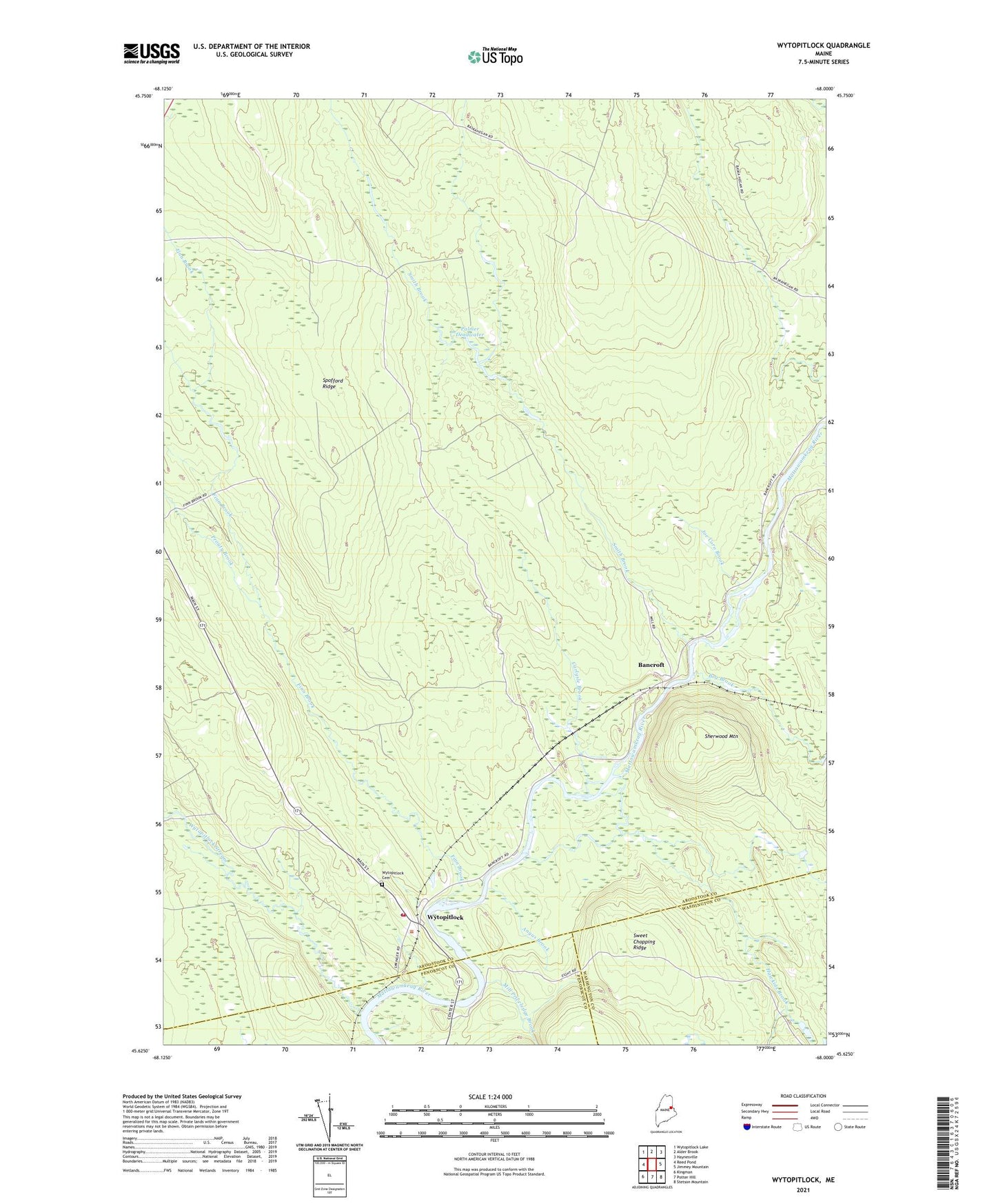
2024 topographic map quadrangle Wytopitlock in the state of Maine. Scale: 1:24000. Based on the newly updated USGS 7.5' US Topo map series, this map is in the following counties: Aroostook, Washington, Penobscot. The map contains contour data, water features, and other items you are used to seeing on USGS maps, but also has updated roads and other features. This is the next generation of topographic maps. Printed on high-quality waterproof paper with UV fade-resistant inks.
Quads adjacent to this one:
West: Reed Pond
Northwest: Wytopitlock Lake
North: Alder Brook
Northeast: Haynesville
East: Jimmey Mountain
Southeast: Stetson Mountain
South: Potter Hill
Southwest: Kingman
This map covers the same area as the classic USGS quad with code o45068f1.
Contains the following named places: Angus Brook, Bancroft, Bog Brook, Carlysle Brook, Drew School, Finn Brook, Hawkins Brook, Joe Coro Brook, Knoxville School, Mill Priveledge Brook, Palmer Deadwater, Plantation of Reed, Prouty Brook, Sherwood Mountain, Smith Brook, Spofford Ridge, Sweet Chopping Ridge, Upper Drew, Wytopitlock, Wytopitlock Cemetery, Wytopitlock Elementary School, Wytopitlock Post Office, Wytopitlock Stream