MyTopo
Reed Pond Maine US Topo Map
Couldn't load pickup availability
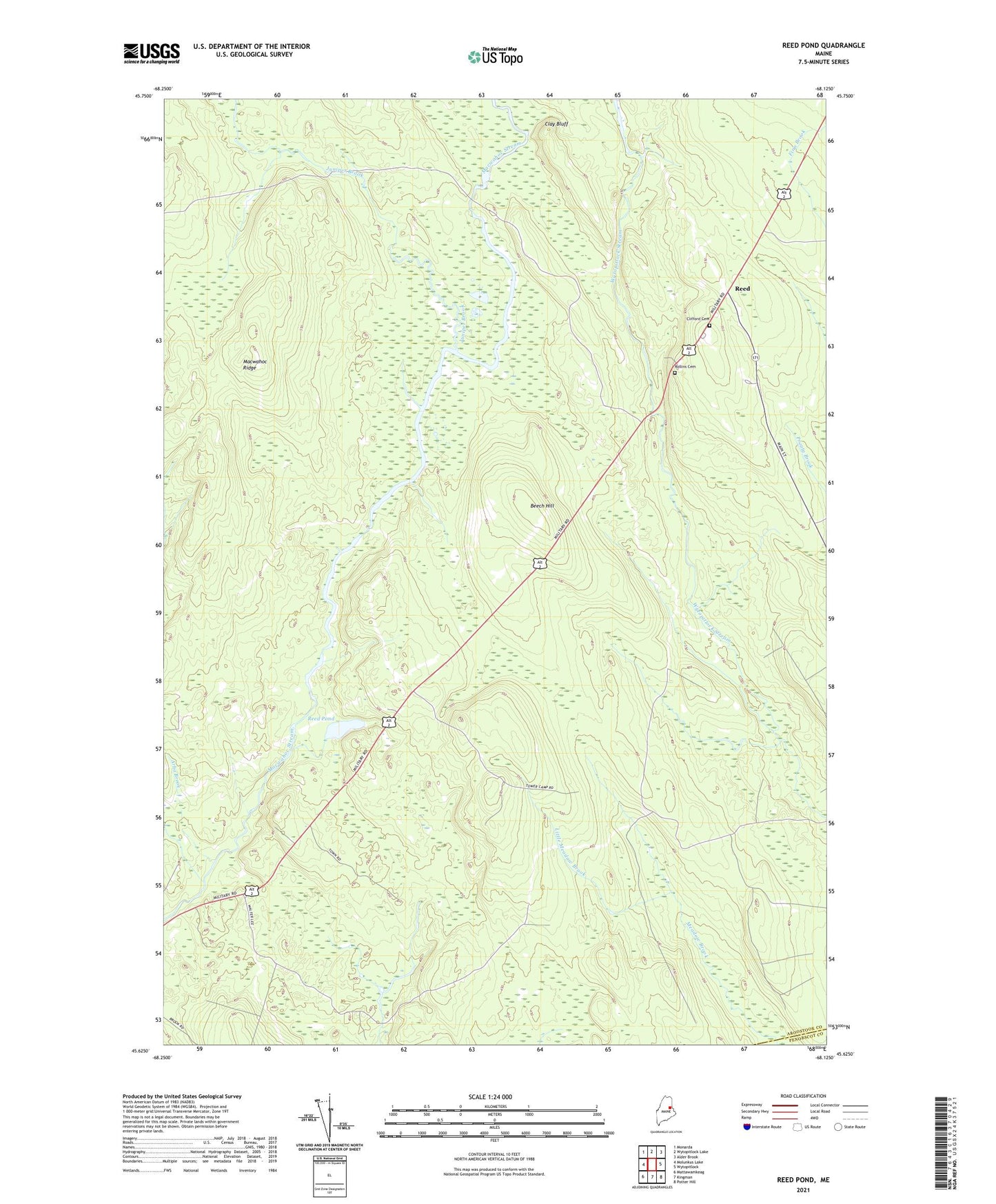
2024 topographic map quadrangle Reed Pond in the state of Maine. Scale: 1:24000. Based on the newly updated USGS 7.5' US Topo map series, this map is in the following counties: Aroostook, Penobscot. The map contains contour data, water features, and other items you are used to seeing on USGS maps, but also has updated roads and other features. This is the next generation of topographic maps. Printed on high-quality waterproof paper with UV fade-resistant inks.
Quads adjacent to this one:
West: Molunkus Lake
Northwest: Monarda
North: Wytopitlock Lake
Northeast: Alder Brook
East: Wytopitlock
Southeast: Potter Hill
South: Kingman
Southwest: Mattawamkeag
This map covers the same area as the classic USGS quad with code o45068f2.
Contains the following named places: Arbo Brook, Beech Hill, Clay Bluff, Clifford Cemetery, Juniper Brook, Little Meadow Brook, Macwahoc Ridge, Plantation of Macwahoc, Reed, Reed Deadwater, Reed Pond, Rollins Cemetery, Township of North Yarmouth Academy Grant, Upper Molunkus Township, Whitney Fire Tower