MyTopo
Mattawamkeag Maine US Topo Map
Couldn't load pickup availability
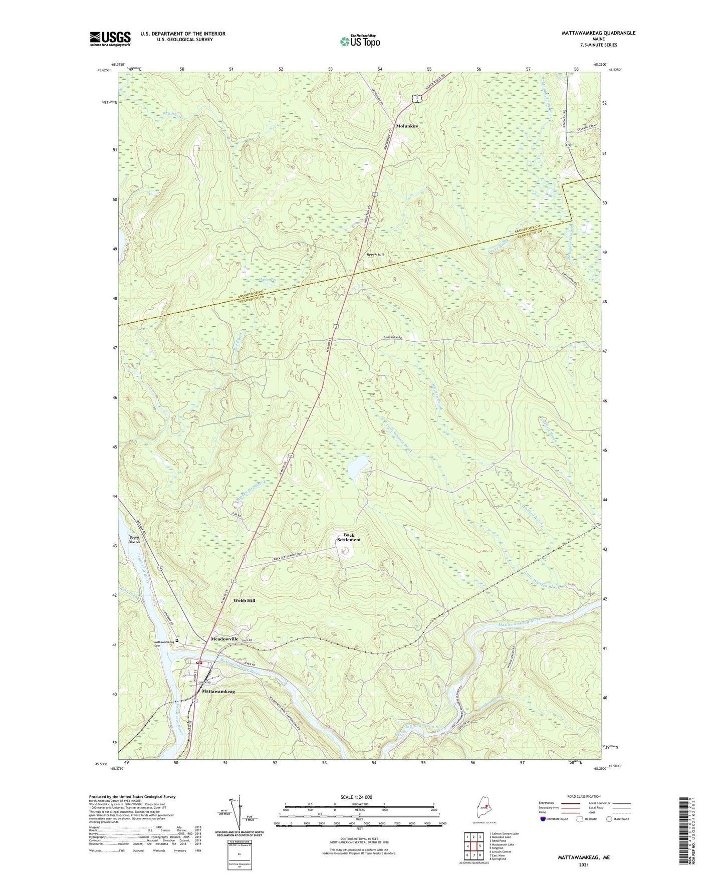
2024 topographic map quadrangle Mattawamkeag in the state of Maine. Scale: 1:24000. Based on the newly updated USGS 7.5' US Topo map series, this map is in the following counties: Penobscot, Aroostook. The map contains contour data, water features, and other items you are used to seeing on USGS maps, but also has updated roads and other features. This is the next generation of topographic maps. Printed on high-quality waterproof paper with UV fade-resistant inks.
Quads adjacent to this one:
West: Mattaseunk Lake
Northwest: Salmon Stream Lake
North: Molunkus Lake
Northeast: Reed Pond
East: Kingman
Southeast: Springfield
South: East Winn
Southwest: Lincoln Center
This map covers the same area as the classic USGS quad with code o45068e3.
Contains the following named places: Back Settlement, Back Settlement Pond, Beech Hill, Bog Brook, Boom Islands, Church of God, Davis Farm, Doctor Carl E Troutt School, Fog Brook, Gordon, Gordon Brook, Gordon Falls, Little Gordon Brook, Little Whitten Brook, Martin Bog, Mattawamkeag, Mattawamkeag Bible Baptist Church, Mattawamkeag Cemetery, Mattawamkeag Census Designated Place, Mattawamkeag Fire Department, Mattawamkeag Library, Mattawamkeag Post Office, Mattawamkeag River, Mattawamkeag Wilderness County Park, Meadow Brook, Meadowville, Molunkus, Rush Brook, Snake Brook, Sunken Bog Brook, Town of Mattawamkeag, Webb Hill, ZIP Code: 04459