MyTopo
Lincoln West Maine US Topo Map
Couldn't load pickup availability
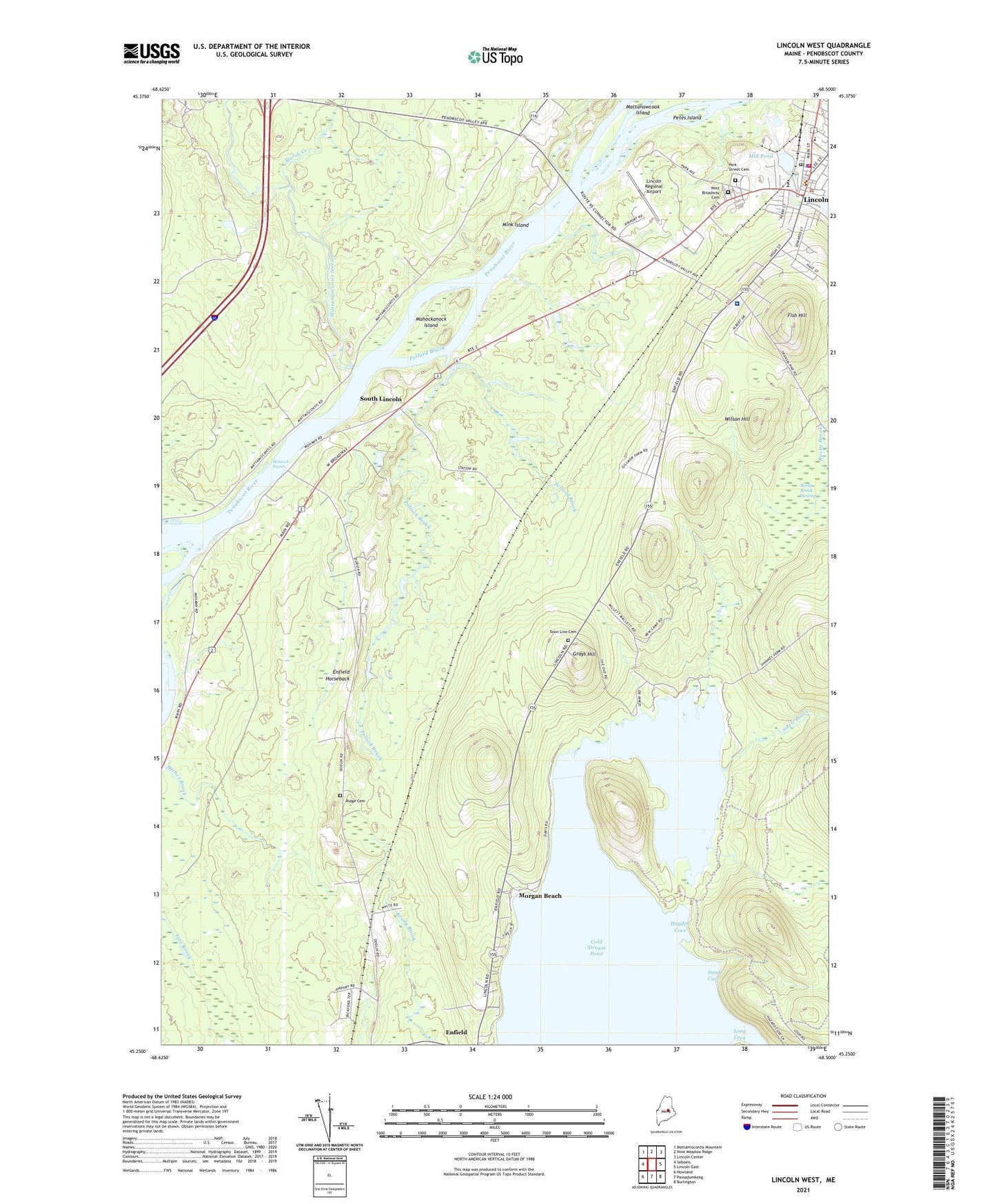
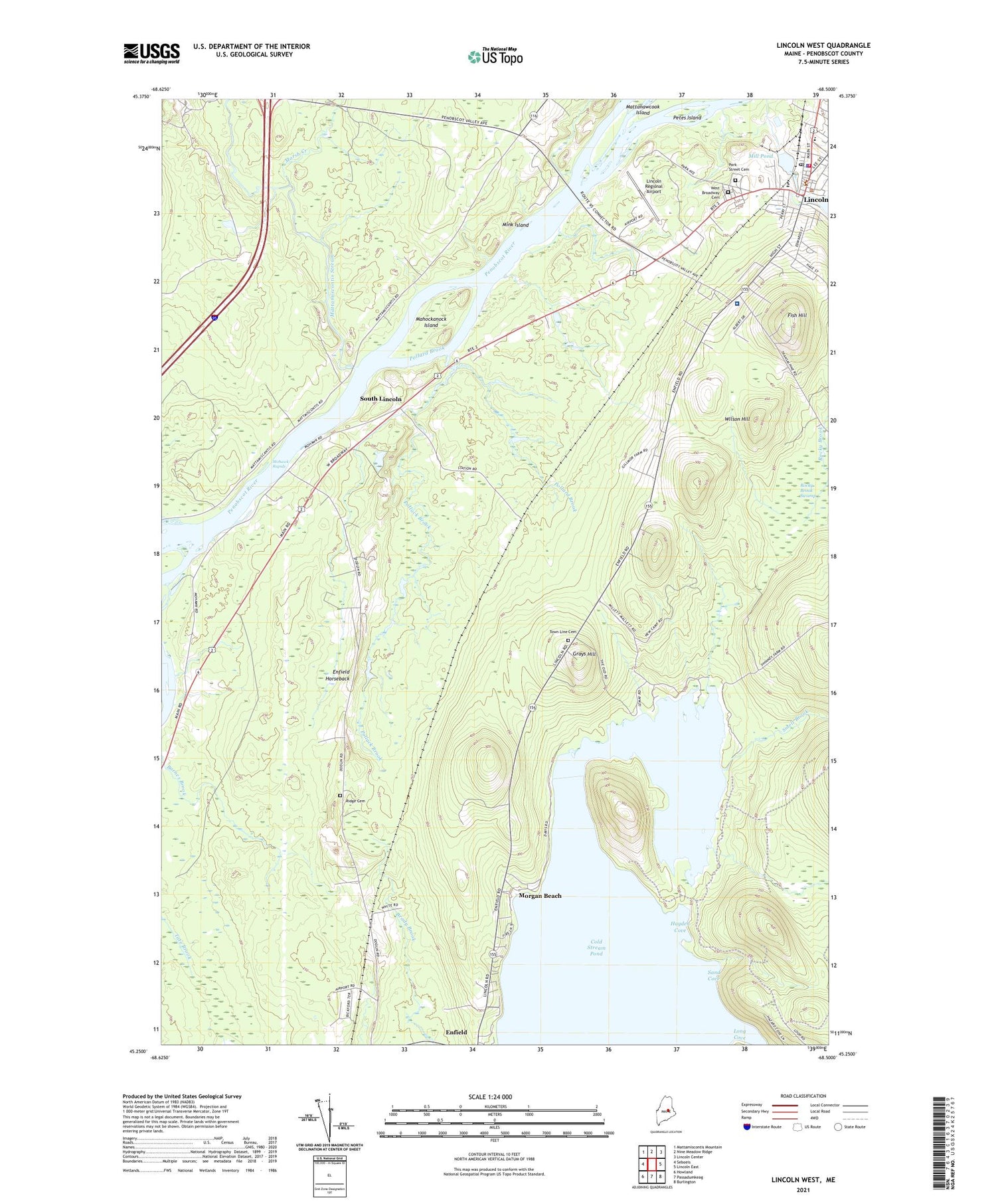
2021 topographic map quadrangle Lincoln West in the state of Maine. Scale: 1:24000. Based on the newly updated USGS 7.5' US Topo map series, this map is in the following counties: Penobscot. The map contains contour data, water features, and other items you are used to seeing on USGS maps, but also has updated roads and other features. This is the next generation of topographic maps. Printed on high-quality waterproof paper with UV fade-resistant inks.
Quads adjacent to this one:
West: Seboeis
Northwest: Mattamiscontis Mountain
North: Nine Meadow Ridge
Northeast: Lincoln Center
East: Lincoln East
Southeast: Burlington
South: Passadumkeag
Southwest: Howland
Contains the following named places: Bible Baptist Church, Church of the Nazarene, Cold Stream Beach Recreation Area, Cold Stream Pond, Community Evangelical Temple, Congregational Church, Fish Hill, Grays Hill, Greater Lincoln Christian Academy, Hayden Cove, Kingdom Hall of Jehovahs Witnesses, Lakeside Camping and Cabins, Lincoln, Lincoln Fire Department, Lincoln Memorial Library, Lincoln Methodist Church, Lincoln Police Department, Lincoln Post Office, Lincoln Regional Airport, Lincoln Town Offices, Long Cove, Mahockanock Island, Maranatha Baptist Church, Marsh Creek, Mattamiscontis Stream, Mattanawcook Dam, Mattanawcook Stream, Mill Pond, Mill Pond Dam, Mink Island, Mohawk Rapids, Morgan Beach, Northern Penobscot Technical Region 3 School, Park Street Cemetery, Penobscot Valley Hospital, Pentecostal Church of God, Petes Island, Pollack Brook, Pollard Brook, Ridge Cemetery, Rocky Brook Swamp, Saint Marys Catholic Church, Sand Cove, Smelt Brook, South Lincoln, Town Line Cemetery, Town of Enfield, Town of Lincoln Sewage Treatment Plant, West Broadway Cemetery, WHMX-FM (Lincoln), Wilson Hill, WTOX-AM (Lincoln)