MyTopo
Ludlow Maine US Topo Map
Couldn't load pickup availability
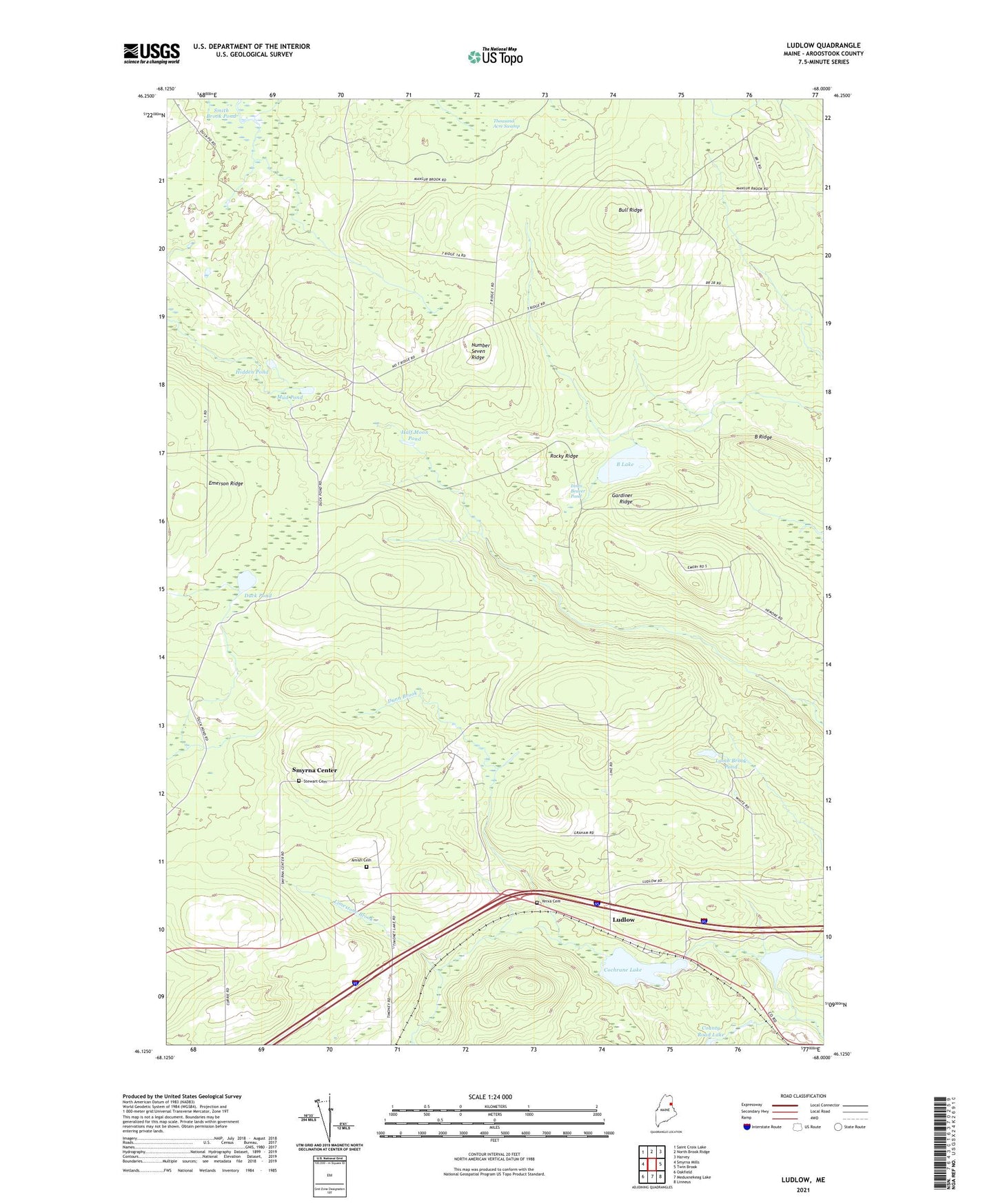
2024 topographic map quadrangle Ludlow in the state of Maine. Scale: 1:24000. Based on the newly updated USGS 7.5' US Topo map series, this map is in the following counties: Aroostook. The map contains contour data, water features, and other items you are used to seeing on USGS maps, but also has updated roads and other features. This is the next generation of topographic maps. Printed on high-quality waterproof paper with UV fade-resistant inks.
Quads adjacent to this one:
West: Smyrna Mills
Northwest: Saint Croix Lake
North: North Brook Ridge
Northeast: Harvey
East: Twin Brook
Southeast: Linneus
South: Meduxnekeag Lake
Southwest: Oakfield
This map covers the same area as the classic USGS quad with code o46068b1.
Contains the following named places: Amish Cemetery, B Lake, B Ridge, Beaver Pond, Bradbury Lake, Bull Ridge, Cochrane Lake, Collis Brook, Duck Pond, Dunn Brook, Gardiner Ridge, Hale Brook, Half Moon Pond, Hidden Pond, Innes Beaver Pond, Kennedy Tote Road, Lamb Brook Dam, Lamb Brook Pond, Limestone Brook, Little Mill Brook, Longfellow School, Ludlow, Marley Brook, McCain School, Mud Pond, Number Seven Ridge, Pierce Tote Road, Rocky Ridge, Smyrna Center, Stewart Cemetery, Thousand Acre Swamp, Town of Smyrna, Yerxa Cemetery