MyTopo
Mapleton Maine US Topo Map
Couldn't load pickup availability
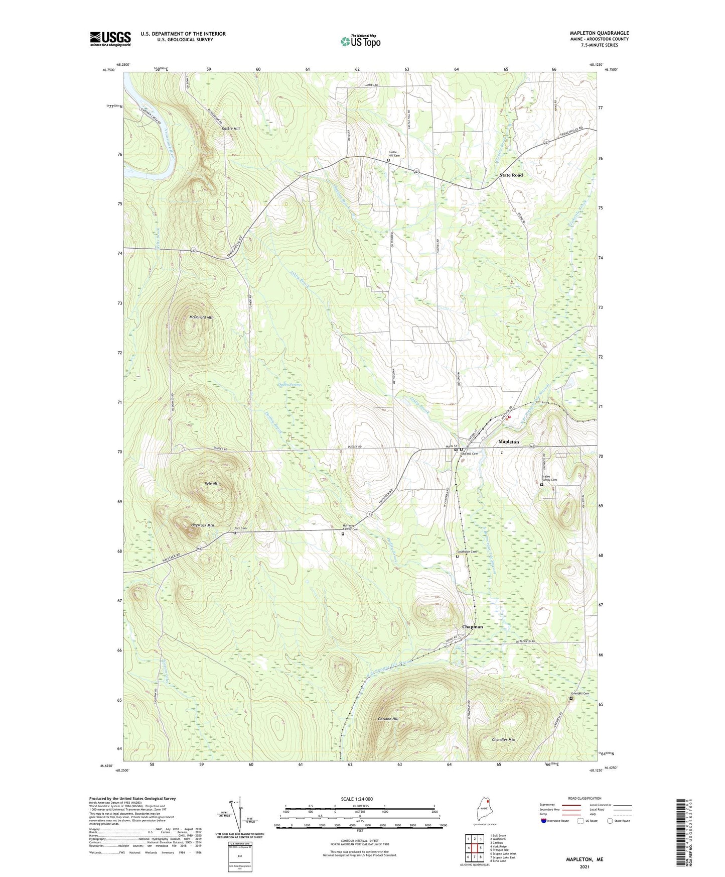
2024 topographic map quadrangle Mapleton in the state of Maine. Scale: 1:24000. Based on the newly updated USGS 7.5' US Topo map series, this map is in the following counties: Aroostook. The map contains contour data, water features, and other items you are used to seeing on USGS maps, but also has updated roads and other features. This is the next generation of topographic maps. Printed on high-quality waterproof paper with UV fade-resistant inks.
Quads adjacent to this one:
West: York Ridge
Northwest: Bull Brook
North: Washburn
Northeast: Caribou
East: Presque Isle
Southeast: Echo Lake
South: Scopan Lake East
Southwest: Scopan Lake West
This map covers the same area as the classic USGS quad with code o46068f2.
Contains the following named places: Braley Family Cemetery, Castle Hill, Castle Hill Cemetery, Chandler Mountain, Chapman, Dudley Brook, Dudley Swamp, Garland Hill, Grendell Cemetery, Haystack Mountain, Hillside School, Hoffeses Family Cemetery, Libby Brook, Mapleton, Mapleton Castle Hill Chapman Fire Department, Mapleton Census Designated Place, Mapleton Dam, Mapleton Elementary School, Mapleton Post Office, McDonald Mountain, Old Mill Cemetery, Pyle Mountain, Southside Cemetery, State Road, Tarr Cemetery, Teakettle Brook, Town of Castle Hill, Welts Brook, ZIP Code: 04757