MyTopo
Washburn Maine US Topo Map
Couldn't load pickup availability
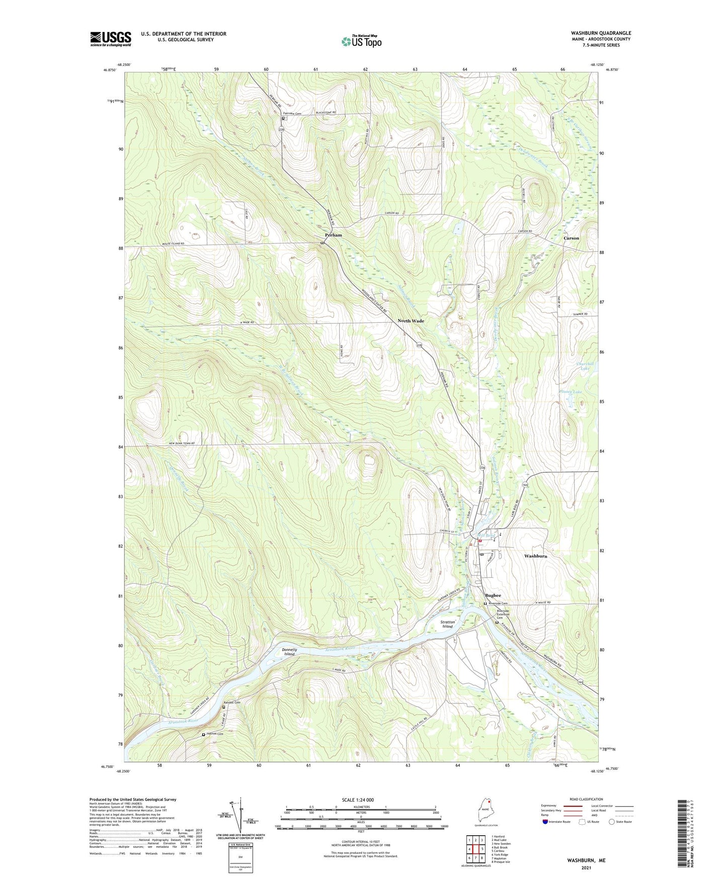
2024 topographic map quadrangle Washburn in the state of Maine. Scale: 1:24000. Based on the newly updated USGS 7.5' US Topo map series, this map is in the following counties: Aroostook. The map contains contour data, water features, and other items you are used to seeing on USGS maps, but also has updated roads and other features. This is the next generation of topographic maps. Printed on high-quality waterproof paper with UV fade-resistant inks.
Quads adjacent to this one:
West: Bull Brook
Northwest: Hanford
North: Mud Lake
Northeast: New Sweden
East: Caribou
Southeast: Presque Isle
South: Mapleton
Southwest: York Ridge
This map covers the same area as the classic USGS quad with code o46068g2.
Contains the following named places: Bugbee, Carson, David J Lyon Washburn District Elementary School, Deadwater Brook, Donnelly Brook, Donnelly Brook School, Donnelly Island, Fairview Cemetery, Gardner Brook, Holmes Cemetery, Mill Pond, North Wade, Perham, Perham First Baptist Church, Perham Post Office, Plissey Lake, Randell Cemetery, Riverside Cemetery, Riverside Extension Cemetery, Salmon Brook, Stratton Island, Town of Wade, Washburn, Washburn Census Designated Place, Washburn Community Pond, Washburn Dam, Washburn District High School, Washburn Fire Department, Washburn Memorial Library, Washburn Police Department, Washburn Post Office, West Branch Salmon Brook, Wilder Camp, ZIP Code: 04786