MyTopo
Medunkeunk Lake Maine US Topo Map
Couldn't load pickup availability
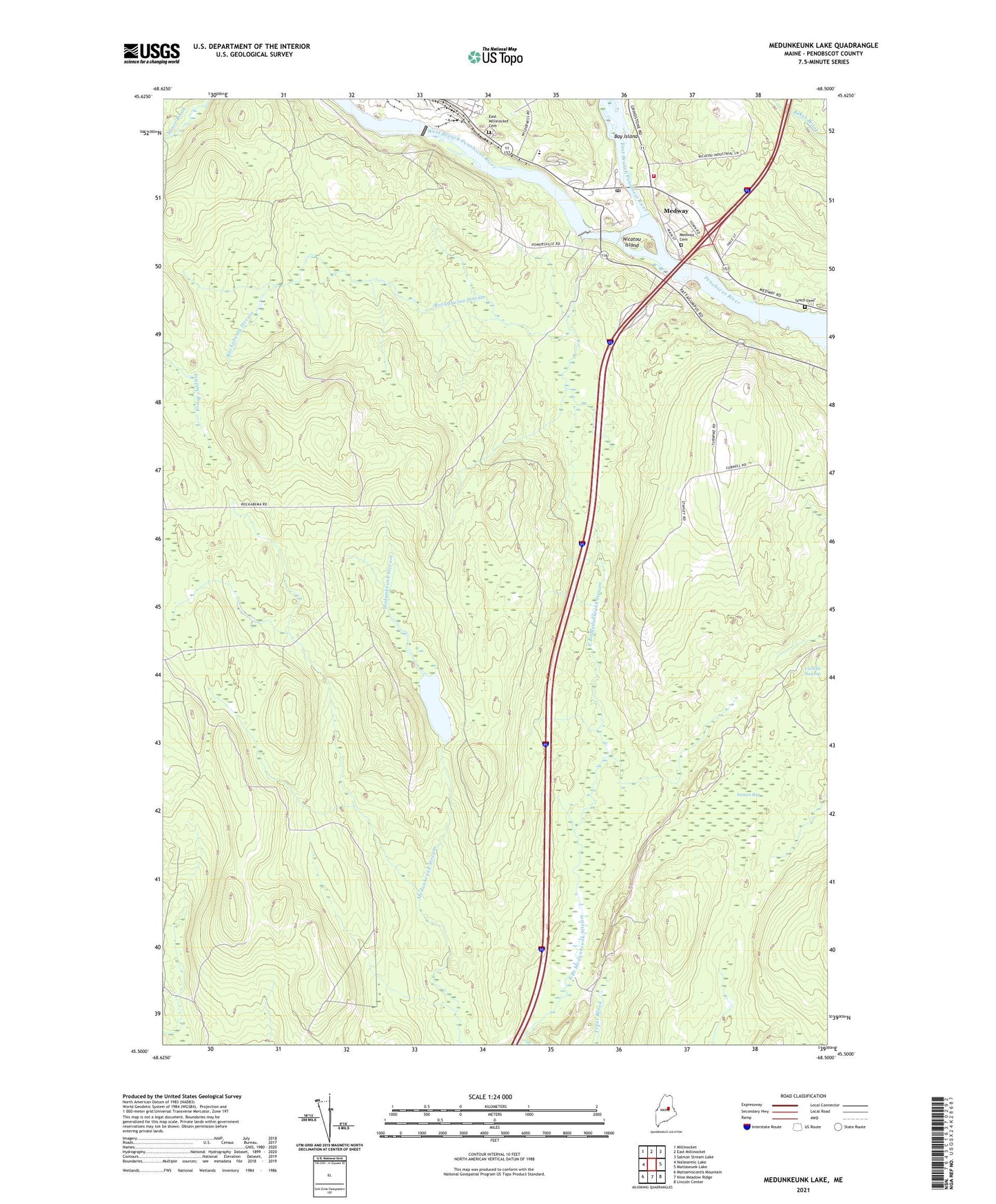
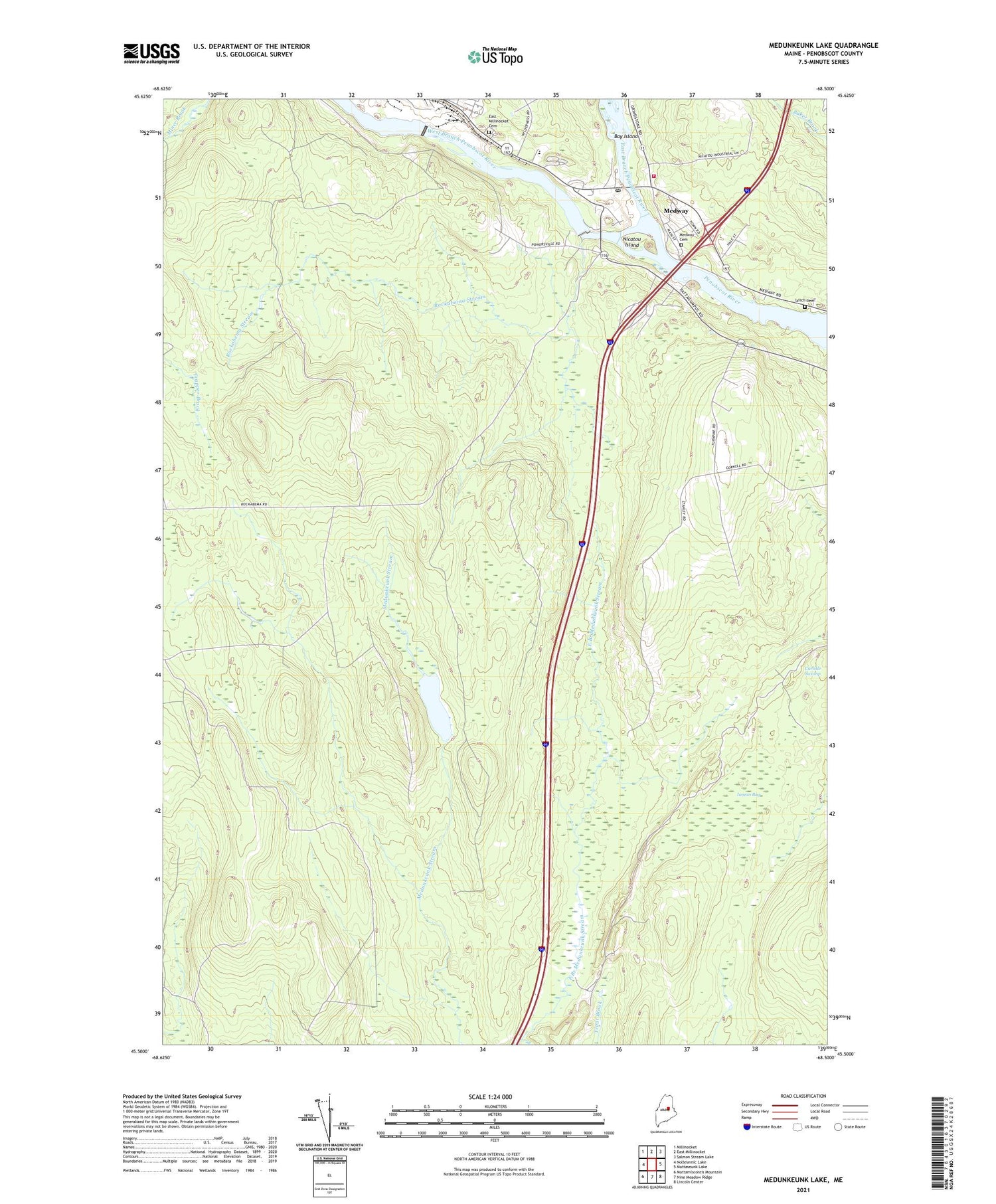
2021 topographic map quadrangle Medunkeunk Lake in the state of Maine. Scale: 1:24000. Based on the newly updated USGS 7.5' US Topo map series, this map is in the following counties: Penobscot. The map contains contour data, water features, and other items you are used to seeing on USGS maps, but also has updated roads and other features. This is the next generation of topographic maps. Printed on high-quality waterproof paper with UV fade-resistant inks.
Quads adjacent to this one:
West: Nollesemic Lake
Northwest: Millinocket
North: East Millinocket
Northeast: Salmon Stream Lake
East: Mattaseunk Lake
Southeast: Lincoln Center
South: Nine Meadow Ridge
Southwest: Mattamiscontis Mountain
Contains the following named places: Bay Island, Bethel Church, East Branch Penobscot River, East Millinocket Cemetery, East Millinocket Dam, First Baptist Church, Inman Bog, Katahdin Shadows Campground, Lynch Cemetery, Medunkeunk Lake, Medway, Medway Cemetery, Medway Dam, Medway Fire Department, Medway Middle School, Medway Post Office, Medway Primary School, Nicatou Island, Oak Park Manor, Rockabema Stream, Silverwood Court, T2 R9 NWP, TA R7 WELS, West Branch Penobscot River, West Branch Penobscot River Reservoir