MyTopo
Lead Mountain Maine US Topo Map
Couldn't load pickup availability
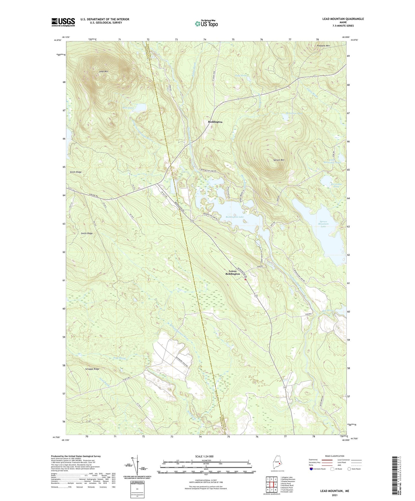
2024 topographic map quadrangle Lead Mountain in the state of Maine. Scale: 1:24000. Based on the newly updated USGS 7.5' US Topo map series, this map is in the following counties: Washington, Hancock. The map contains contour data, water features, and other items you are used to seeing on USGS maps, but also has updated roads and other features. This is the next generation of topographic maps. Printed on high-quality waterproof paper with UV fade-resistant inks.
Quads adjacent to this one:
West: Rocky Pond
Northwest: Alligator Lake
North: Quillpig Mountain
Northeast: Peaked Mountain
East: Northeast Bluff
Southeast: Schoodic Lake
South: Tunk Mountain
Southwest: Molasses Pond
This map covers the same area as the classic USGS quad with code o44068g1.
Contains the following named places: Bear Pond, Beddington, Beddington Lake, Beddington Volunteer Fire Department, Bobcat Brook, Bog Brook, Bog Brook Dam, Chalk Pond, Gray Pond, Horseshoe Pond, Humpback Brook, Lead Mountain, Lead Mountain Trail, Little Horseshoe Pond, Little Narraguagus River, Lower Beddington, Meadow Brook, Mountain Pond, Pork Brook, Shorey Brook, Sinclair Brook, Smith Ridge, Spruce Mountain, Spruce Mountain Lake, Town of Beddington