MyTopo
Tunk Mountain Maine US Topo Map
Couldn't load pickup availability
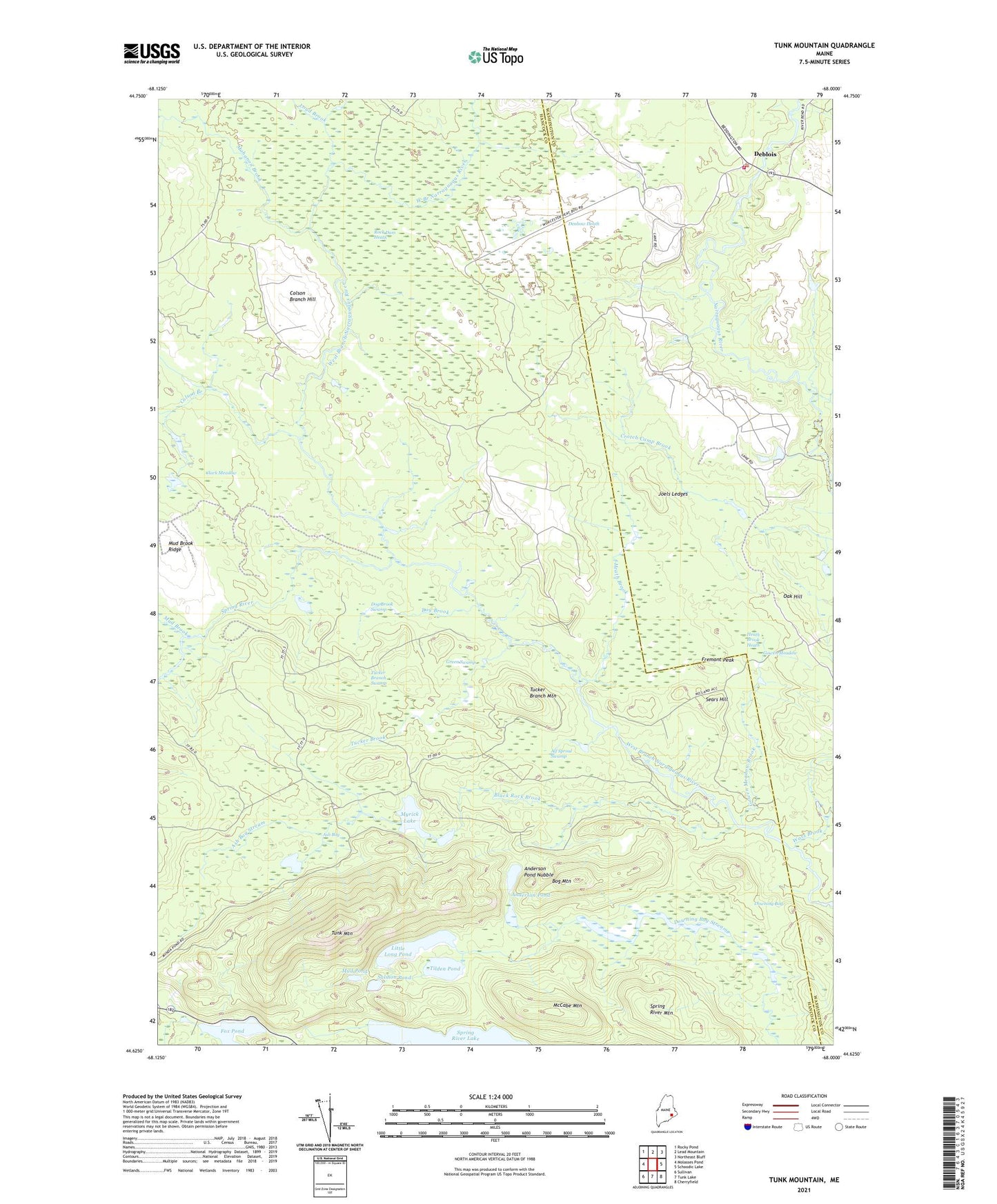
2024 topographic map quadrangle Tunk Mountain in the state of Maine. Scale: 1:24000. Based on the newly updated USGS 7.5' US Topo map series, this map is in the following counties: Hancock, Washington. The map contains contour data, water features, and other items you are used to seeing on USGS maps, but also has updated roads and other features. This is the next generation of topographic maps. Printed on high-quality waterproof paper with UV fade-resistant inks.
Quads adjacent to this one:
West: Molasses Pond
Northwest: Rocky Pond
North: Lead Mountain
Northeast: Northeast Bluff
East: Schoodic Lake
Southeast: Cherryfield
South: Tunk Lake
Southwest: Sullivan
This map covers the same area as the classic USGS quad with code o44068f1.
Contains the following named places: Alf Sproul Swamp, Anderson Pond, Anderson Pond Nubble, Ash Bog, Ash Bog Stream, Black Rock Brook, Bog Mountain, Clark Meadow, Colson Branch, Colson Branch Hill, Deblois, Deblois Volunteer Fire Department, Denbow Heath, Dog Brook, Dog Brook Swamp, Downing Bog, Downing Bog Stream, Fremont Peak, Gowen Meadow, Gowen Meadow Brook, Green Swamp, Heath Brook, Heath Brook Heath, Joels Ledges, Little Long Pond, Longfellow Brook, Loud Brook, Mahanon Brook, McCabe Mountain, Mud Brook, Mud Pond, Myrick Lake, Narraguagus Lake Dam, Oak Hill, Rock Dam Heath, Salmon Pond, Sears Hill, Spring River, Spring River Dam, Spring River Mountain, T10 SD BPP, T16 MD BPP, Tilden Pond, Tucker Branch Mountain, Tucker Branch Swamp, Tucker Brook, Tunk Mountain, Wass Brook, West Barrens