MyTopo
Passadumkeag Maine US Topo Map
Couldn't load pickup availability
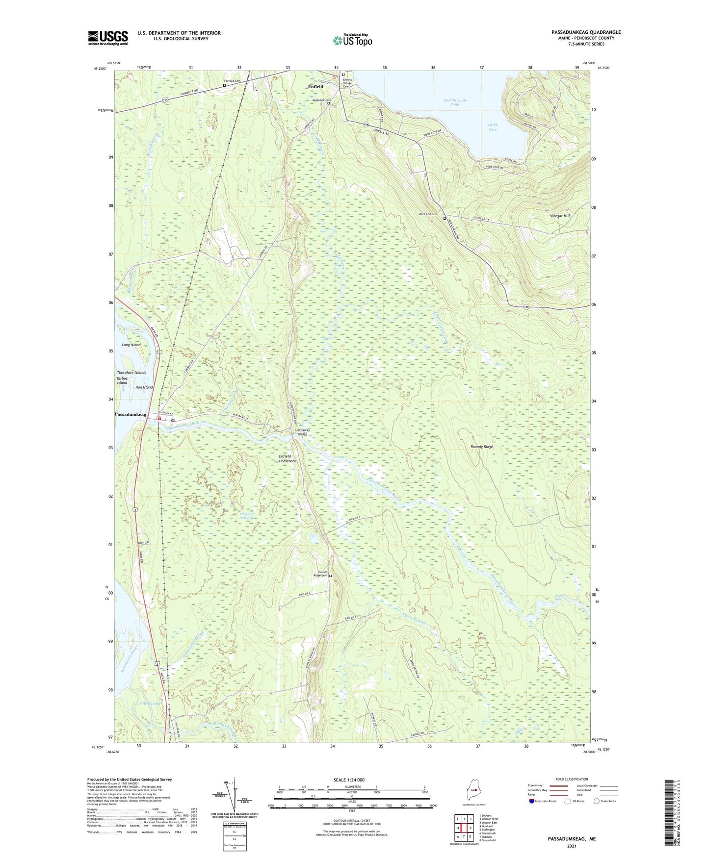
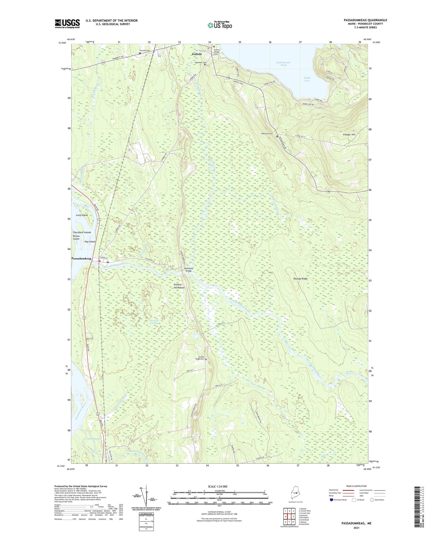
2021 topographic map quadrangle Passadumkeag in the state of Maine. Scale: 1:24000. Based on the newly updated USGS 7.5' US Topo map series, this map is in the following counties: Penobscot. The map contains contour data, water features, and other items you are used to seeing on USGS maps, but also has updated roads and other features. This is the next generation of topographic maps. Printed on high-quality waterproof paper with UV fade-resistant inks.
Quads adjacent to this one:
West: Howland
Northwest: Seboeis
North: Lincoln West
Northeast: Lincoln East
East: Burlington
Southeast: Greenfield
South: Olamon
Southwest: Greenbush
Contains the following named places: Applebee Cemetery, Ayers Brook, Beaver Brook, Brady Brook, Cobb Hatchery, Cold Stream, Cold Stream Pond Dam, Cole Memorial Library, Edgecombe School, Enfield, Enfield Station, Enfield Station School, Enfield Village Cemetery, Fernald Cemetery, Goulds Ridge Cemetery, Hathaway Bridge, Hog Island, Lancaster Brook, Little Cold Stream, Long Island, Olamon Dam, Olamon Stream, Onemile Brook, Passadumkeag, Passadumkeag Baptist Church, Passadumkeag Post Office, Passadumkeag River, Passadumkeag Volunteer Fire Department, Rocky Rips, Roundy Ridge, Tarbox Island, Thorofare Islands, Thousand Acre Bog, Town of Passadumkeag, Webb Cove, West End Cemetery, WPVM-FM (Howland), ZIP Codes: 04475, 04493