MyTopo
Saint John Maine US Topo Map
Couldn't load pickup availability
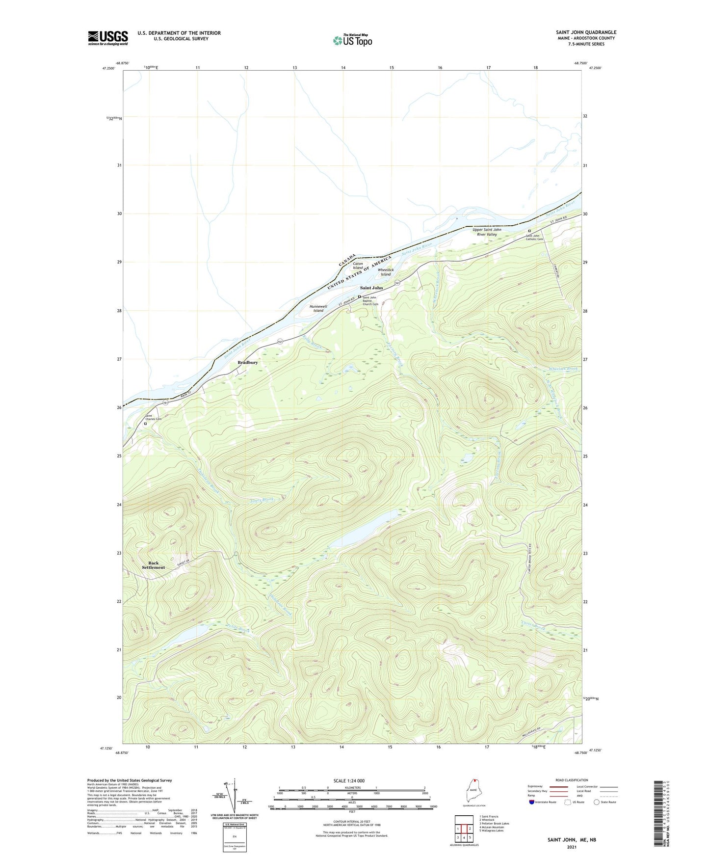
2024 topographic map quadrangle Saint John in the state of Maine. Scale: 1:24000. Based on the newly updated USGS 7.5' US Topo map series, this map is in the following counties: Aroostook. The map contains contour data, water features, and other items you are used to seeing on USGS maps, but also has updated roads and other features. This is the next generation of topographic maps. Printed on high-quality waterproof paper with UV fade-resistant inks.
Quads adjacent to this one:
West: Saint Francis
East: Wheelock
Southeast: Wallagrass Lakes
South: McLean Mountain
Southwest: Pelletier Brook Lakes
This map covers the same area as the classic USGS quad with code o47068b7.
Contains the following named places: Back Settlement, Bradbury, Bran Lake, Caton Island, Factory Brook, Harding School, Hunnewell Island, Hunnewell Lake, Hunnewell Lake Dam, Jones Brook, Kelly Brook, Paradis Brook, Plantation of Saint John, Saint Charles Cemetery, Saint John, Saint John Baptist Church Cemetery, Saint John Catholic Cemetery, Saint John Church, Thibideau Brook, West Branch Wheelock Brook, Wheelock Brook, Wheelock Island