MyTopo
Stetson Mountain Maine US Topo Map
Couldn't load pickup availability
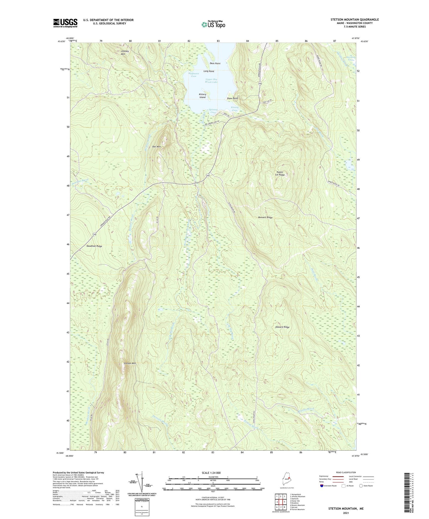
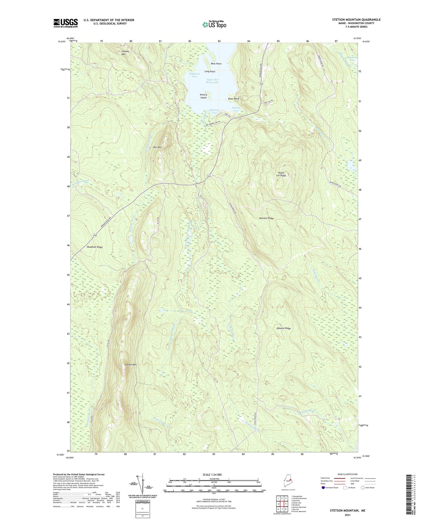
2021 topographic map quadrangle Stetson Mountain in the state of Maine. Scale: 1:24000. Based on the newly updated USGS 7.5' US Topo map series, this map is in the following counties: Washington. The map contains contour data, water features, and other items you are used to seeing on USGS maps, but also has updated roads and other features. This is the next generation of topographic maps. Printed on high-quality waterproof paper with UV fade-resistant inks.
Quads adjacent to this one:
West: Potter Hill
Northwest: Wytopitlock
North: Jimmey Mountain
Northeast: Danforth
East: Brookton
Southeast: Farrow Mountain
South: Dill Hill
Southwest: Bowers Mountain
Contains the following named places: Bennett Ridge, Dark Point, Deadman Camp, Deadman Ridge, East Branch Hot Brook, Frye Camp, Halfmoon Cove, Harding Brook, Howard Ridge, Kinney Cove, Kittery Island, Long Point, Owl Mountain, Public Lot Ridge, Shaw Point, Shaw School, Spinney Cove, Stetson Mountain, T8 R3 NBPP, T8 R4 NBPP, Township of Brookton, Upper Hot Brook Lake, Webster Brook, West Branch Hot Brook, Wyman Brook