MyTopo
Bernardston Massachusetts US Topo Map
Couldn't load pickup availability
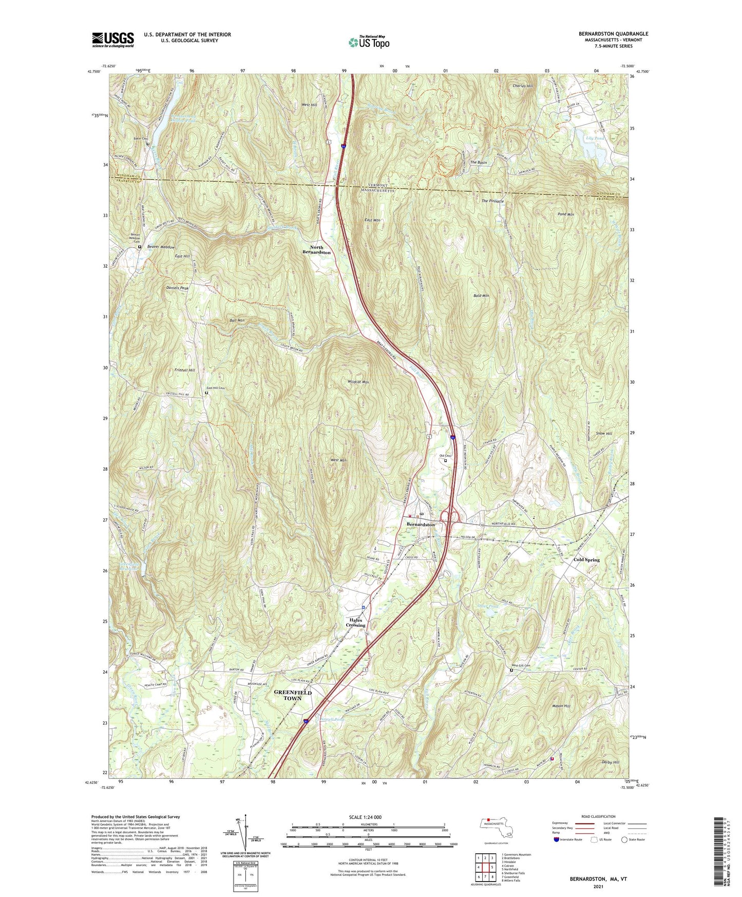
2024 topographic map quadrangle Bernardston in the states of Massachusetts, Vermont. Scale: 1:24000. Based on the newly updated USGS 7.5' US Topo map series, this map is in the following counties: Franklin, Windham. The map contains contour data, water features, and other items you are used to seeing on USGS maps, but also has updated roads and other features. This is the next generation of topographic maps. Printed on high-quality waterproof paper with UV fade-resistant inks.
Quads adjacent to this one:
West: Colrain
Northwest: Governors Mountain
North: Brattleboro
Northeast: Hinsdale
East: Northfield
Southeast: Millers Falls
South: Greenfield
Southwest: Shelburne Falls
Contains the following named places: Baker Cemetery, Bald Mountain, Ball Mountain, Beaver Meadow, Beaver Meadow Brook, Beaver Meadow Cemetery, Bernardston, Bernardston Fire Department, Bernardston Police Department, Bernardston Post Office, Bernardstown Elementary School, Camp Avery, Charles Hill, Cold Spring, Couch Brook, Crumpin-Fox Club Golf Course, Cushman Library, Cushman Park, Daniels Peak, Darby Hill, Deane Pond, East Glen Brook, East Hill, East Hill Cemetery, East Mountain, Fall River Reservoir, Frizzell Hill, Gill Fire Department, Gill Police Department, Glen Brook, Greenfield Meadows, Greenfield Reservoir, Greenfield Reservoir - Lower Glen, Greenfield Reservoir Dam, Hales Crossing, J B Dunnell Dam, Keets Brook, Lily Pond, Long Woods, Lower Glen Reservoir Dam, Mason Hill, McCard Brook, Newell Pond, North Bernardston, Old Cemetery, Otter Brook, Otter Pond, Pond Mountain, Roaring Brook, Satans Kingdom Wildlife Management Area, Shatluck Brook, Shattuck Brook, Snow Hill, The Basin, The Pinnacle, Town of Bernardston, Town of Gill, United Church of Bernardston, Weatherhead Hollow Pond, Weatherhead Hollow Pond Dam, West Brook, West Hill, West Mountain, Wildcat Mountain, Wood Dam, WRSI-FM (Greenfield), ZIP Codes: 01301, 01337