MyTopo
Needmore Michigan US Topo Map
Couldn't load pickup availability
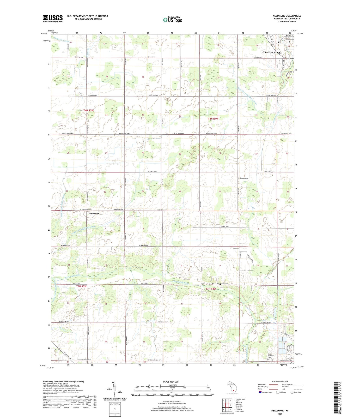
2023 topographic map quadrangle Needmore in the state of Michigan. Scale: 1:24000. Based on the newly updated USGS 7.5' US Topo map series, this map is in the following counties: Eaton. The map contains contour data, water features, and other items you are used to seeing on USGS maps, but also has updated roads and other features. This is the next generation of topographic maps. Printed on high-quality waterproof paper with UV fade-resistant inks.
Quads adjacent to this one:
West: Hoytville
Northwest: Portland South
North: Eagle
Northeast: Wacousta
East: Dimondale
Southeast: Eaton Rapids
South: Charlotte
Southwest: Chester
This map covers the same area as the classic USGS quad with code o42084f7.
Contains the following named places: Beagle School, Benton Township Cemetery, Charter Township of Oneida, Cole School, Cole Wright Helms Drain, Doane School, Earl School, Fox Memorial Park, Grand Ledge High School, Guinan Drain, Hayes Drain, Hovey School, Little Thornapple River, Martin School, Needmore, Needmore Cemetery, Needmore Church, New Life Assembly of God Church, Nickle School, Oneida Center, Oneida Gospel Church, Oneida Post Office, Patterson and Dubois Drain, Pinch Cemetery, Santee School, Strange Cemetery, Strange School, The Local Church, Township of Benton, Watson School, West Benton Church, WMMQ-FM (Charlotte), Wright Pardee Skinner Drain, ZIP Code: 48837