MyTopo
Kinross Michigan US Topo Map
Couldn't load pickup availability
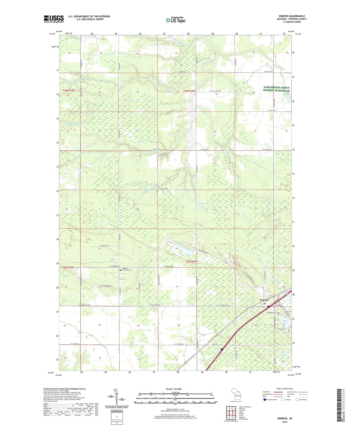
2023 topographic map quadrangle Kinross in the state of Michigan. Scale: 1:24000. Based on the newly updated USGS 7.5' US Topo map series, this map is in the following counties: Chippewa. The map contains contour data, water features, and other items you are used to seeing on USGS maps, but also has updated roads and other features. This is the next generation of topographic maps. Printed on high-quality waterproof paper with UV fade-resistant inks.
Quads adjacent to this one:
West: Raco
Northwest: Dollar Settlement
North: Brimley
Northeast: Shallows
East: Dafter
Southeast: Pickford NW
South: Rudyard
Southwest: Fibre
This map covers the same area as the classic USGS quad with code o46084c5.
Contains the following named places: Chippewa County, Christian School, Eagle Lake, Garkinghouse Lake, Hickler Creek, Holland School, Hutton Creek, Kinross, Kinross Lake, Kinross Post Office, Kinross Station, Kinross Tower, Lakeview Cemetery, McMahen Creek, Mud Lake, Open Door Baptist Indian Church, Rudyard Township Cemetery, South Branch Waiska River, West Branch Waiska River