MyTopo
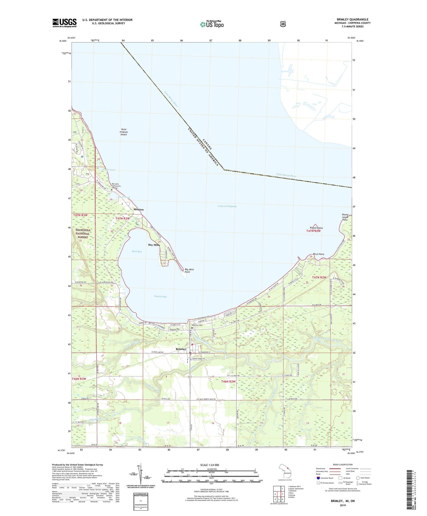
Brimley Michigan US Topo Map
Couldn't load pickup availability
Also explore the Brimley Forest Service Topo of this same quad for updated USFS data
2023 topographic map quadrangle Brimley in the state of Michigan. Scale: 1:24000. Based on the newly updated USGS 7.5' US Topo map series, this map is in the following counties: Chippewa. The map contains contour data, water features, and other items you are used to seeing on USGS maps, but also has updated roads and other features. This is the next generation of topographic maps. Printed on high-quality waterproof paper with UV fade-resistant inks.
Quads adjacent to this one:
West: Dollar Settlement
Northeast: Shallows OE N
East: Shallows
Southeast: Dafter
South: Kinross
Southwest: Raco
This map covers the same area as the classic USGS quad with code o46084d5.
Contains the following named places: Back Bay, Bay Mills, Bay Mills Charter School, Bay Mills Community College, Bay Mills Emergency Connection, Bay Mills Medical Clinic, Bay Mills Point, Bay Mills Post Office, Bay Mills Reservation, Bayview Cemetery, Birch Point, Blessed Kateri Tekakwitha Church, Brimley, Brimley Baptist Church, Brimley Census Designated Place, Brimley Middle / High School, Brimley Post Office, Brimley State Park, Brimley Station, Chippewa Landing Ramp, Dorgans Crossing, East Branch Waiska River, First Congregational Church, Gordons Landing Ramp, Hiawatha Mission, Indian Mission Church, Little Waiska Creek, Mission, North Branch Orrs Creek, North Pond, Old Indian Burial Ground, Orrs Creek, Point Iroquois Shoals, Round Island, Round Island Point, Saint Francis Xavier Church, South Branch Orrs Creek, South Pond, Superior Township Volunteer Fire Department, Waiska Bay, Waiska River, Wheels of History Museum, Wild Bluff Golf Course