MyTopo
Hersey Michigan US Topo Map
Couldn't load pickup availability
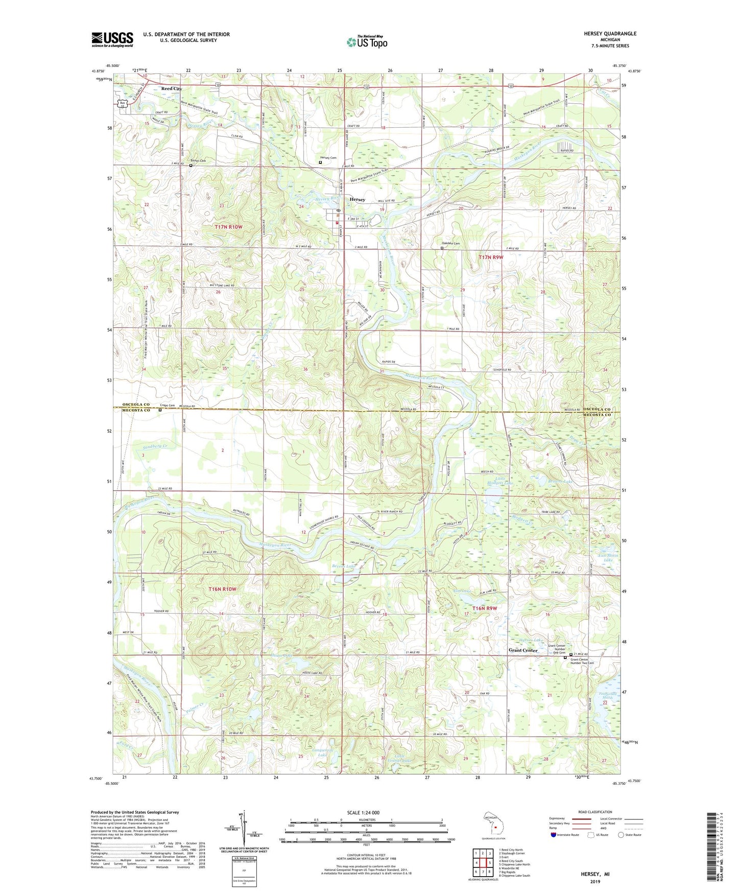
2023 topographic map quadrangle Hersey in the state of Michigan. Scale: 1:24000. Based on the newly updated USGS 7.5' US Topo map series, this map is in the following counties: Mecosta, Osceola. The map contains contour data, water features, and other items you are used to seeing on USGS maps, but also has updated roads and other features. This is the next generation of topographic maps. Printed on high-quality waterproof paper with UV fade-resistant inks.
Quads adjacent to this one:
West: Reed City South
Northwest: Reed City North
North: Slaybaugh Corner
Northeast: Evart
East: Chippewa Lake North
Southeast: Chippewa Lake South
South: Big Rapids
Southwest: Woodville NE
This map covers the same area as the classic USGS quad with code o43085g4.
Contains the following named places: Albright Camp, Albright Park, Bevens Lake, Bitner Cemetery, Blodgett Creek, Blodgett Lake, Brown Creek, Browns Lake, Charter Township of Green, Church of the Nazarene, Congregational Church Historical Marker, Crapo Cemetery, Crapo Post Office, Crapo Station, Elm Lake, Ford Creek, Grant Center, Grant Center Church, Grant Center Number One Cemetery, Grant Center Number Two Cemetery, Hersey, Hersey Cemetery, Hersey Congregational Church, Hersey Post Office, Hersey River, Hersey Station, Hersey Township Fire Department, Hersey United Methodist Church, House Lake, Hyrnes Lake, Langworth Lake, Little Blodgett Lake, Little Youngs Lake, Oakdale Cemetery, Palmer Creek, Pogy Creek, Sandberg Creek, Spring Valley Golf Course, Township of Grant, Township of Hersey, Van Alstin Lake, Village of Hersey, WDEE-AM (Reed City), Weaver Post Office, West Grant Church, ZIP Code: 49639