MyTopo
Fairview Michigan US Topo Map
Couldn't load pickup availability
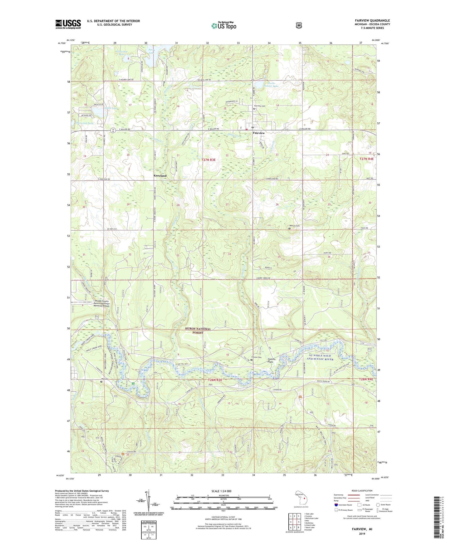
2019 topographic map quadrangle Fairview in the state of Michigan. Scale: 1:24000. Based on the newly updated USGS 7.5' US Topo map series, this map is in the following counties: Oscoda. The map contains contour data, water features, and other items you are used to seeing on USGS maps, but also has updated roads and other features. This is the next generation of topographic maps. Printed on high-quality waterproof paper with UV fade-resistant inks.
Quads adjacent to this one:
West: Mio
Northwest: Oak Lake
North: Comins
Northeast: McCollum Lake
East: McKinley
Southeast: Goodar
South: Mack Lake
Southwest: Island Lake
Contains the following named places: Au Sable Valley Health Center, Cauchy Creek, Cherry Creek, Comins Cemetery, Comins Creek, Comins Flats, Comins Township Hall, Fairview, Fairview Area Schools, Fairview Cemetery, Fairview Fire Department, Fairview Hills Golf Course, Fairview Mennonite Church, Fairview Post Office, Glennie Creek, Gusler Creek, Horseshoe Lake, Joslin Creek, Kneeland, Kneeland Post Office, Living Water Lutheran Church, Loud Creek, Mio Cemetery, Mio Foursquares Church, North Helmer Lake, Perry Creek, Perry Lake, Sherwood Pond, Smith Lake, Smith Lake Park, Township of Comins, Weaver Cemetery, Wolf Creek, ZIP Codes: 48621, 48647