MyTopo
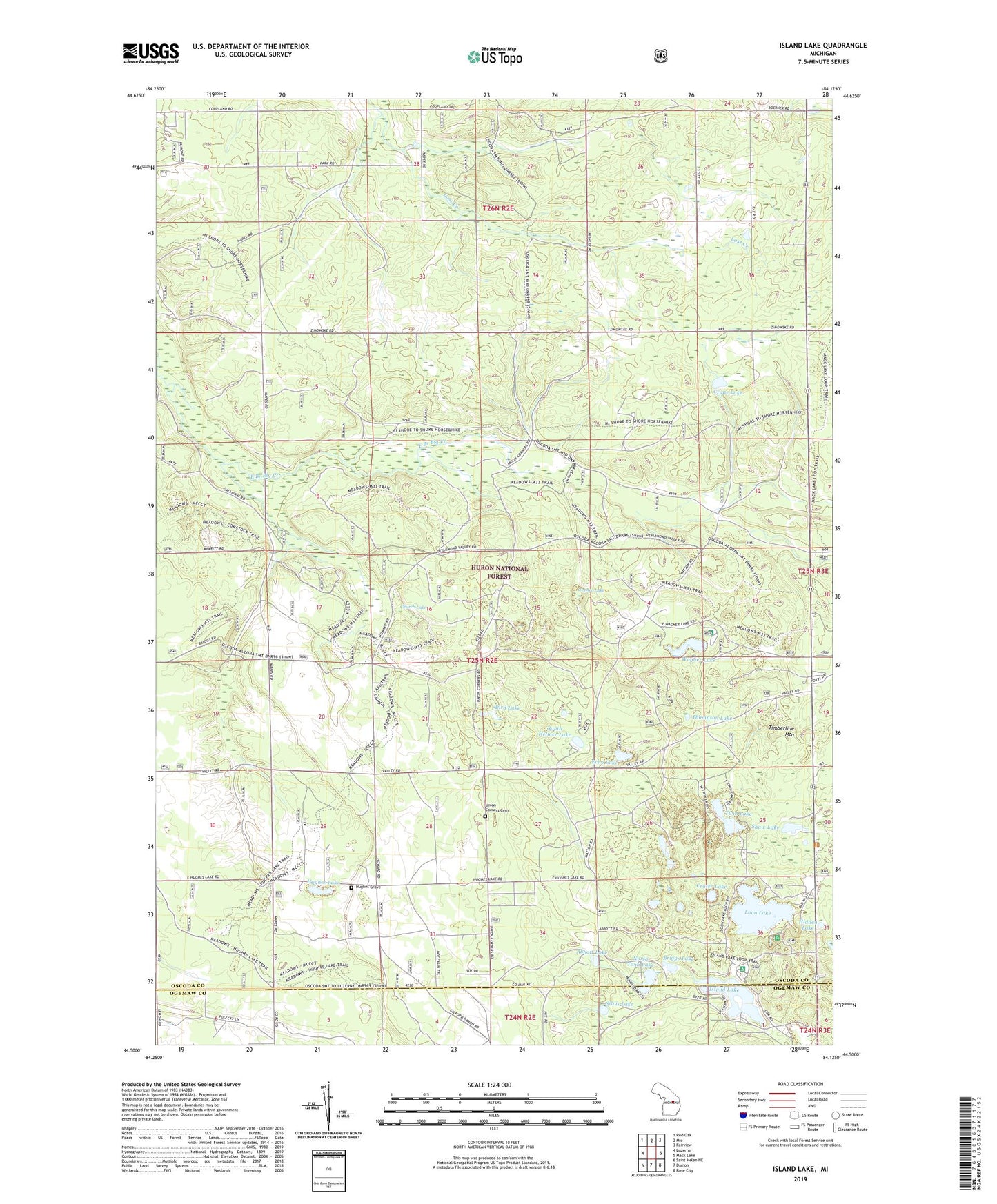
Island Lake Michigan US Topo Map
Couldn't load pickup availability
Also explore the Island Lake Forest Service Topo of this same quad for updated USFS data
2023 topographic map quadrangle Island Lake in the state of Michigan. Scale: 1:24000. Based on the newly updated USGS 7.5' US Topo map series, this map is in the following counties: Oscoda, Ogemaw. The map contains contour data, water features, and other items you are used to seeing on USGS maps, but also has updated roads and other features. This is the next generation of topographic maps. Printed on high-quality waterproof paper with UV fade-resistant inks.
Quads adjacent to this one:
West: Luzerne
Northwest: Red Oak
North: Mio
Northeast: Fairview
East: Mack Lake
Southeast: Rose City
South: Damon
Southwest: Saint Helen NE
This map covers the same area as the classic USGS quad with code o44084e2.
Contains the following named places: Abbott Lake, Bird Lake, Briggs Lake, Church Lake, Crane Lake, Crater Lake, Echo Lake, Gopher Lake, Hidden Lake, Hughes Grave, Hughes Lake, Indian Lake Post Office, Island Lake, Island Lake Recreation Area, Loon Lake, Loon Lake Recreation Site, Muleshoe Lake, North Twin Lake, Paul Bunyon Camp, Shaw Lake, Shotgun Corners, Sidewinder Golf Course, Silvis Lake, South Helmer Lake, Thompson Lake, Timberline Mountain, Twin Lake, Union Corners, Union Corners Cemetery, Wagner Lake, Wagner Lake Campground