MyTopo
Oak Lake Michigan US Topo Map
Couldn't load pickup availability
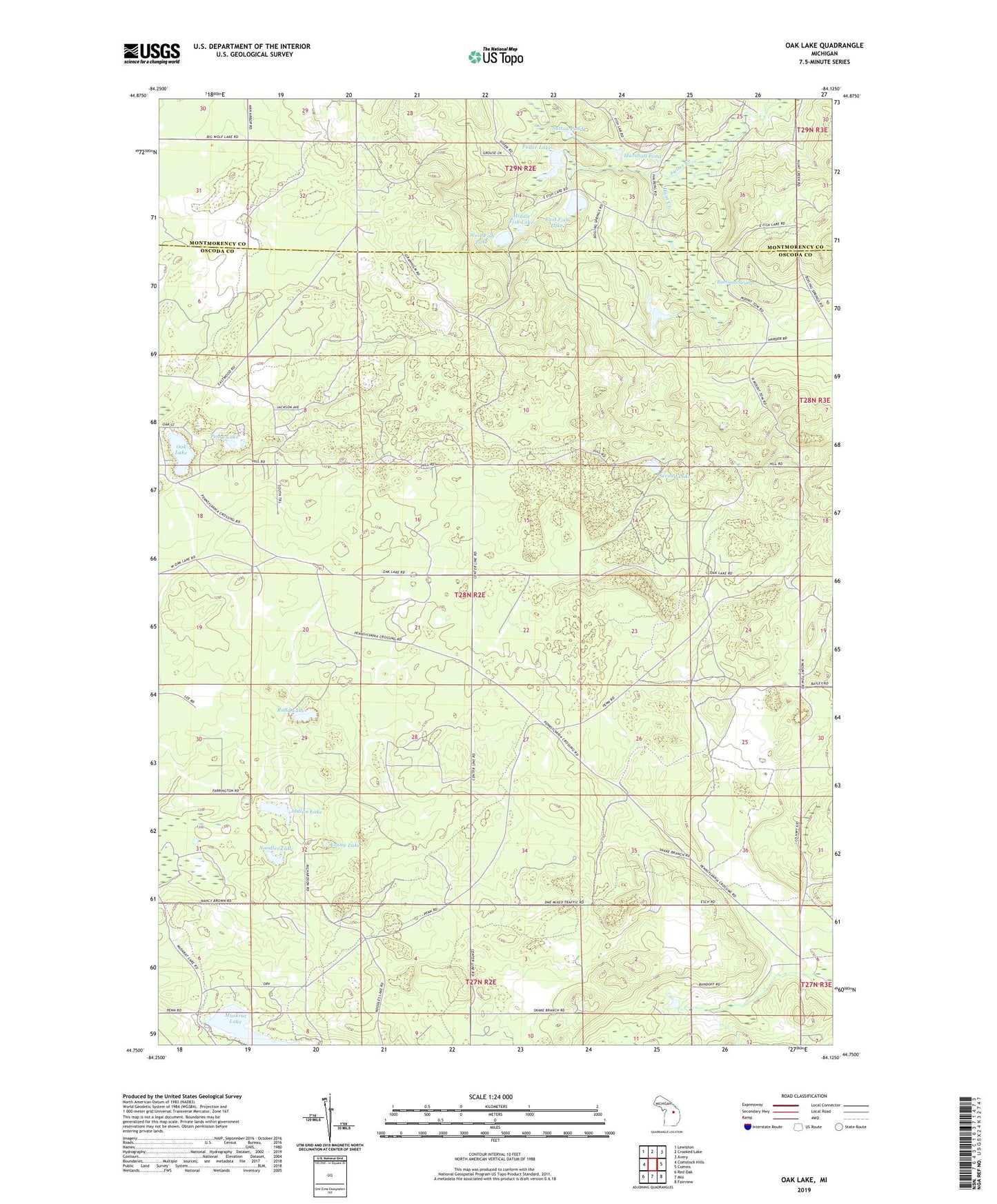
2023 topographic map quadrangle Oak Lake in the state of Michigan. Scale: 1:24000. Based on the newly updated USGS 7.5' US Topo map series, this map is in the following counties: Oscoda, Montmorency. The map contains contour data, water features, and other items you are used to seeing on USGS maps, but also has updated roads and other features. This is the next generation of topographic maps. Printed on high-quality waterproof paper with UV fade-resistant inks.
Quads adjacent to this one:
West: Comstock Hills
Northwest: Lewiston
North: Crooked Lake
Northeast: Avery
East: Comins
Southeast: Fairview
South: Mio
Southwest: Red Oak
This map covers the same area as the classic USGS quad with code o44084g2.
Contains the following named places: Bushman Swamp, East Fish Lake, Eleventh Lake, First Lake, Fuller Creek, Fuller Lake, Harder Lake, Hunt Creek Fisheries Research Area, Indian Lake, Marshall Pond, Middle Fish Lake, Muskrat Lake, Muskrat Lake State Forest Campground, Noodles Lake, Oak Lake, Perry Lake, Rudd Lake, Second Lake, Sutton Pond, Township of Elmer, West Fish Lake, Young Lake