MyTopo
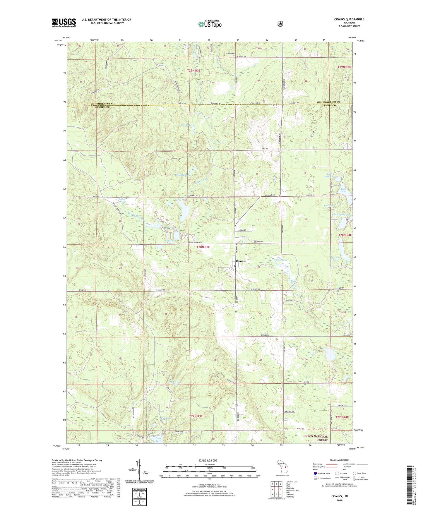
Comins Michigan US Topo Map
Couldn't load pickup availability
Also explore the Comins Forest Service Topo of this same quad for updated USFS data
2023 topographic map quadrangle Comins in the state of Michigan. Scale: 1:24000. Based on the newly updated USGS 7.5' US Topo map series, this map is in the following counties: Oscoda, Montmorency. The map contains contour data, water features, and other items you are used to seeing on USGS maps, but also has updated roads and other features. This is the next generation of topographic maps. Printed on high-quality waterproof paper with UV fade-resistant inks.
Quads adjacent to this one:
West: Oak Lake
Northwest: Crooked Lake
North: Avery
Northeast: Rust
East: McCollum Lake
Southeast: McKinley
South: Fairview
Southwest: Mio
This map covers the same area as the classic USGS quad with code o44084g1.
Contains the following named places: Bass Lake, Boiling Spring Creek, Boiling Springs, Cedar Valley Golf Club, Churchill Lake, Comins, Comins Marsh, Comins Mennonite Church, Comins Post Office, Comins Station, Grass Lake, Johnson Pond, Little Bass Lake, Loud Cemetery, McCreedie Lake, Michigan Magazine Museum, Millen Station, Mud Lake, Pots Lake, Rhoads Lake, Steiner Museum, Tote Road Lake, Township of Clinton, Whitabee Lake, ZIP Code: 48619