MyTopo
Fuller Michigan US Topo Map
Couldn't load pickup availability
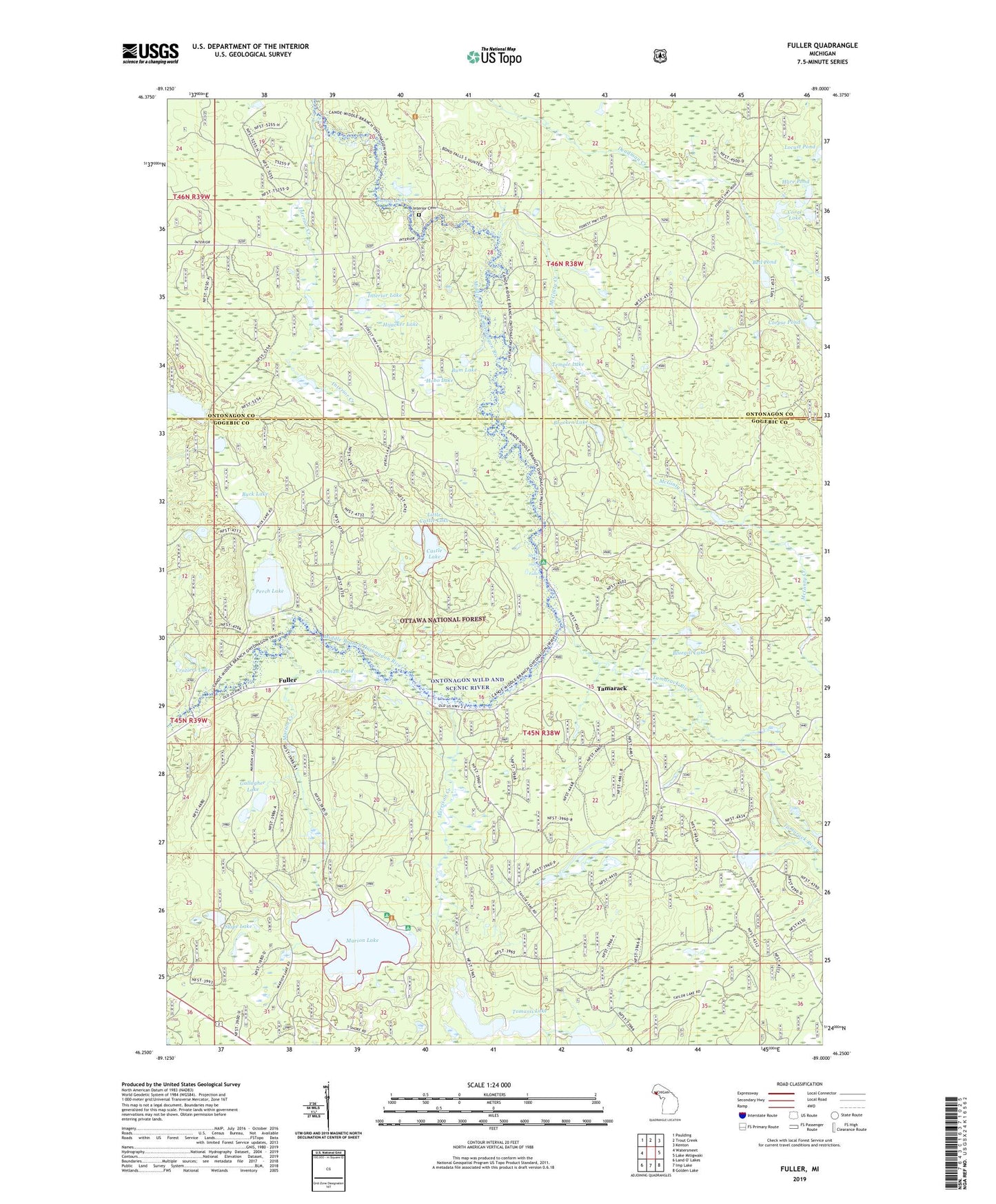
2019 topographic map quadrangle Fuller in the state of Michigan. Scale: 1:24000. Based on the newly updated USGS 7.5' US Topo map series, this map is in the following counties: Gogebic, Ontonagon. The map contains contour data, water features, and other items you are used to seeing on USGS maps, but also has updated roads and other features. This is the next generation of topographic maps. Printed on high-quality waterproof paper with UV fade-resistant inks.
Quads adjacent to this one:
West: Watersmeet
Northwest: Paulding
North: Trout Creek
Northeast: Kenton
East: Lake Mitigwaki
Southeast: Golden Lake
South: Imp Lake
Southwest: Land O' Lakes
Contains the following named places: Bell Pond, Bluegill Lake, Bracken Lake, Buck Lake, Bum Lake, Burned Dam Camp, Castle Lake, Coral Lake, Corpse Pond, Croziers Lake, Deadman Lake, Fuller, Gallagher Lake, Hare Pond, Hijacker Lake, Hobo Lake, Horseshoe Lake, Interior Cemetery, Interior Creek, Interior Lake, Little Castle Lake, Locust Pond, Marion Creek, Marion Lake, Marion Lake Campground and Picnic Area, McGinty Creek, Mex-i-min-e Falls, Morrison Creek, Perch Lake, Sherman Pond, Slope Lake, Sumac Lake, Tamarack, Tamarack River, Temple Lake, Tomassi Lake