MyTopo
Millersburg Michigan US Topo Map
Couldn't load pickup availability
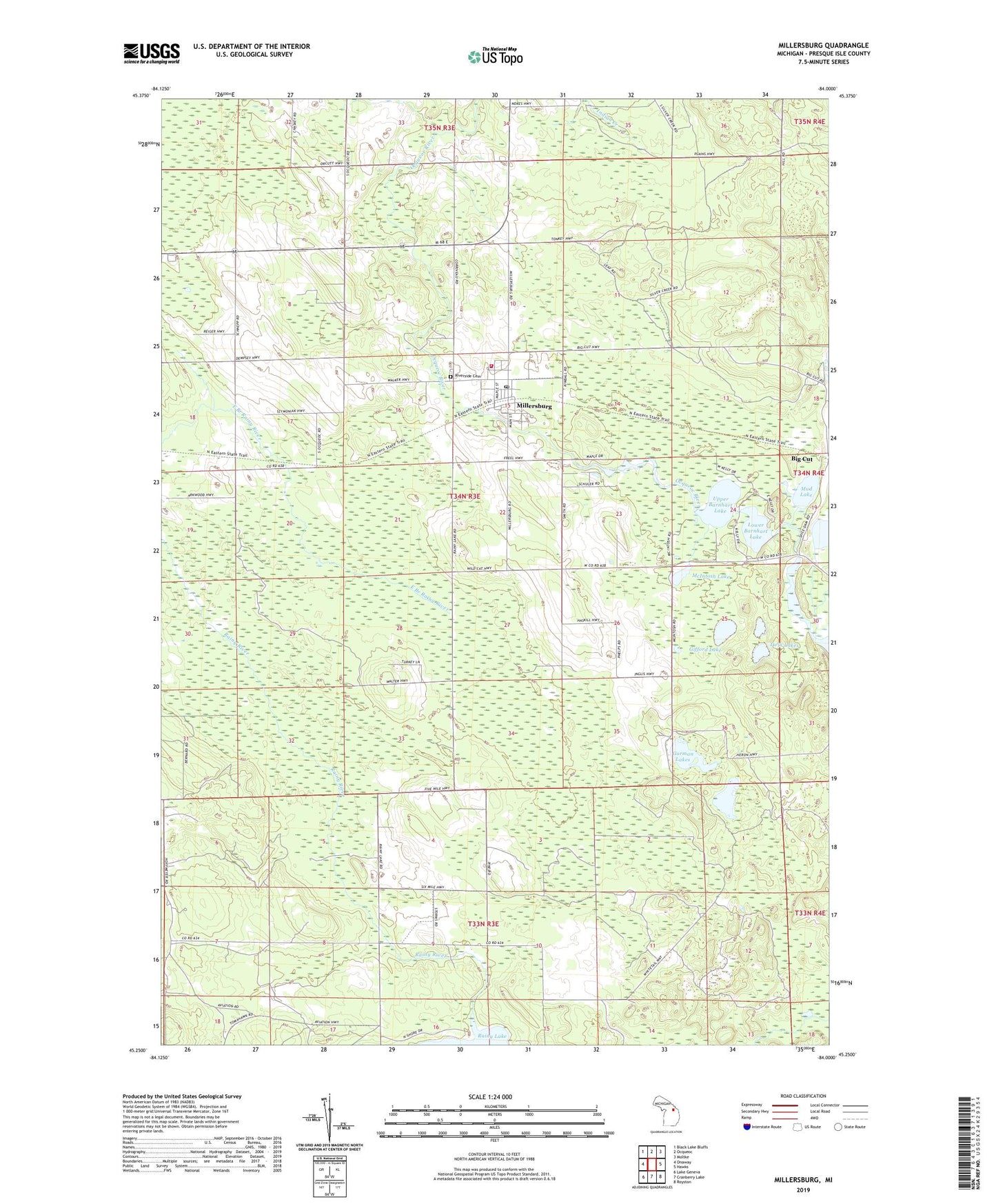
2023 topographic map quadrangle Millersburg in the state of Michigan. Scale: 1:24000. Based on the newly updated USGS 7.5' US Topo map series, this map is in the following counties: Presque Isle. The map contains contour data, water features, and other items you are used to seeing on USGS maps, but also has updated roads and other features. This is the next generation of topographic maps. Printed on high-quality waterproof paper with UV fade-resistant inks.
Quads adjacent to this one:
West: Onaway
Northwest: Black Lake Bluffs
North: Ocqueoc
Northeast: Moltke
East: Hawks
Southeast: Royston
South: Cranberry Lake
Southwest: Lake Geneva
This map covers the same area as the classic USGS quad with code o45084c1.
Contains the following named places: Bullhead Lake, Case Township Fire Department, Gifford Lake, Gorman Lakes, Lower Barnhart Lake, McIntosh Lake, Millersburg, Millersburg Elementary School, Millersburg Post Office, Millersburg Station, Millersburg United Methodist Church, Mud Lake, Ocqueoc Baptist Church, Presque Isle County Fairgrounds, Providence Post Office, Riverside Cemetery, Township of Case, Twin Lakes, Upper Barnhart Lake, Village of Millersburg