MyTopo
Hermansville Michigan US Topo Map
Couldn't load pickup availability
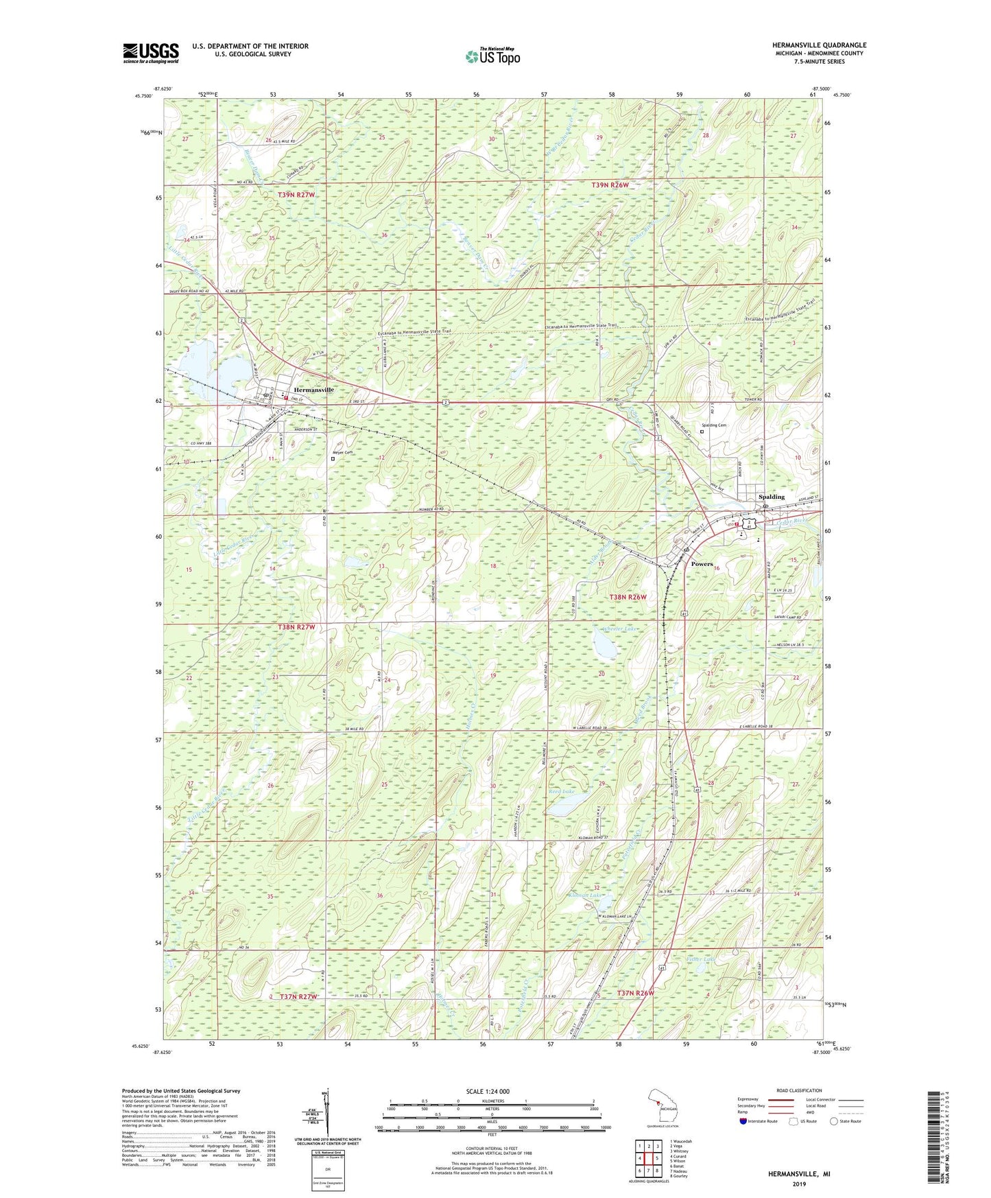
2023 topographic map quadrangle Hermansville in the state of Michigan. Scale: 1:24000. Based on the newly updated USGS 7.5' US Topo map series, this map is in the following counties: Menominee. The map contains contour data, water features, and other items you are used to seeing on USGS maps, but also has updated roads and other features. This is the next generation of topographic maps. Printed on high-quality waterproof paper with UV fade-resistant inks.
Quads adjacent to this one:
West: Cunard
Northwest: Waucedah
North: Vega
Northeast: Whitney
East: Wilson
Southeast: Gourley
South: Nadeau
Southwest: Banat
This map covers the same area as the classic USGS quad with code o45087f5.
Contains the following named places: Alder Brook, Beaver Dam Creek, Camp Two Creek, English Post Office, English Station, First United Methodist Church, Fisher Lake, Grace Evangelical Lutheran Church, Hermansville, Hermansville Branch Library, Hermansville Census Designated Place, Hermansville Historical Marker, Hermansville Lake, Hermansville Post Office, Hermansville Rescue Squad and Ambulance Service, Hermansville Station, IXL Historical Museum, Kloman Lake, Meyer Cemetery, Meyer Township Volunteer Fire Department, Nadeau Mission, North Central Elementary School, North Central Junior/Senior High School, Northern Menominee Health Center, OSF Medical Group, Powers, Powers Police Department, Powers Post Office, Powers Station, Reed Lake, Saint John Neumann Church, Spalding, Spalding Cemetery, Spalding Lookout Tower, Spalding Post Office, Spalding Station, Spalding Township Volunteer Fire Department, Veterans Memorial Park, Village of Powers, West Branch Cedar River, Wheeler Lake, ZIP Code: 49886