MyTopo
Holton Michigan US Topo Map
Couldn't load pickup availability
Also explore the Holton Forest Service Topo of this same quad for updated USFS data
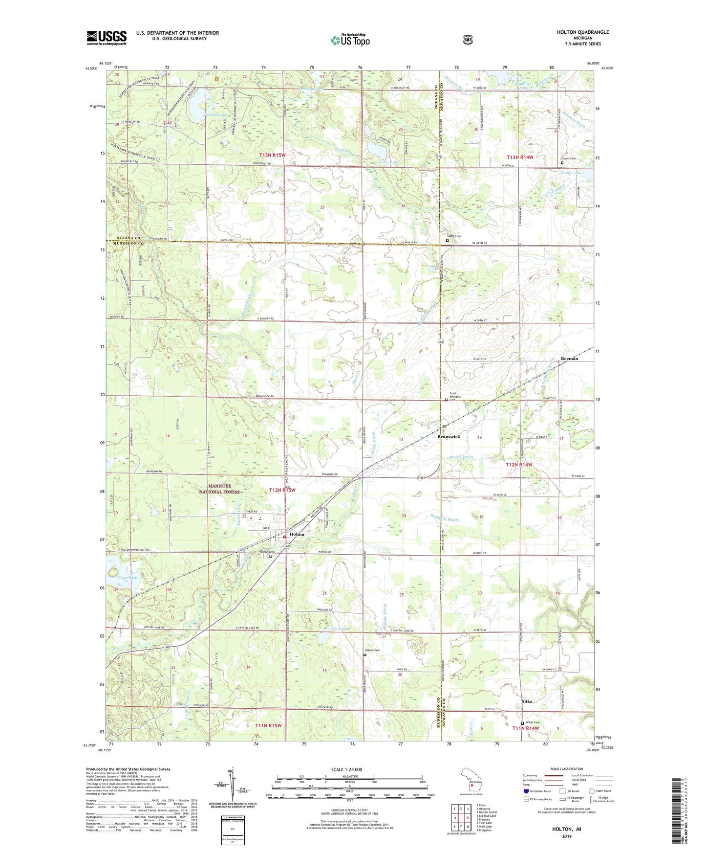
2023 topographic map quadrangle Holton in the state of Michigan. Scale: 1:24000. Based on the newly updated USGS 7.5' US Topo map series, this map is in the following counties: Muskegon, Newaygo, Oceana. The map contains contour data, water features, and other items you are used to seeing on USGS maps, but also has updated roads and other features. This is the next generation of topographic maps. Printed on high-quality waterproof paper with UV fade-resistant inks.
Quads adjacent to this one:
West: Big Blue Lake
Northwest: Ferry
North: Hesperia
Northeast: Dayton Center
East: Fremont
Southeast: Bridgeton
South: Wolf Lake
Southwest: Twin Lake
This map covers the same area as the classic USGS quad with code o43086d1.
Contains the following named places: Acker Lake, Bowman Drain, Brayden Creek, Brunswick, Brunswick Post Office, Brunswick School, Bunce School, Clark Cemetery, Cornerstone Free Methodist Church, Dobie Drain, Dragoo Creek, Evans Lake, Evens Cemetery, Folsom Drain, Forest City Post Office, Hazel Grove Post Office, Hazel Grove School, Hoffman Drain, Holton, Holton Cemetery, Holton Elementary School, Holton Family Life Worship Center, Holton High School, Holton Lutheran Church, Holton Middle School, Holton Post Office, Holton Station, Holton Township Fire Department, Holton United Methodist Church, Horseshoe Lake, John Beem Drain, Kempf School, Knowles Lake, Little Martin Lake, Markle Drain, Martin Drain, McCallum School, Nelson Drain, Olson Lake, Olson School, Poll Drain, Reeman, Reeman Christian Reformed Church, Reeman Post Office, Reeman Station, Robinson Drain, Ruper Drain, Saint Michael Church of Brunswick, Saint Michael School, Saint Michaels Cemetery, Saint Michaels School, Sitka, Sitka Post Office, Township of Holton, Tyndall School, Unger Lake, Wilde Cemetery, ZIP Code: 49425