MyTopo
Lake Geneva Michigan US Topo Map
Couldn't load pickup availability
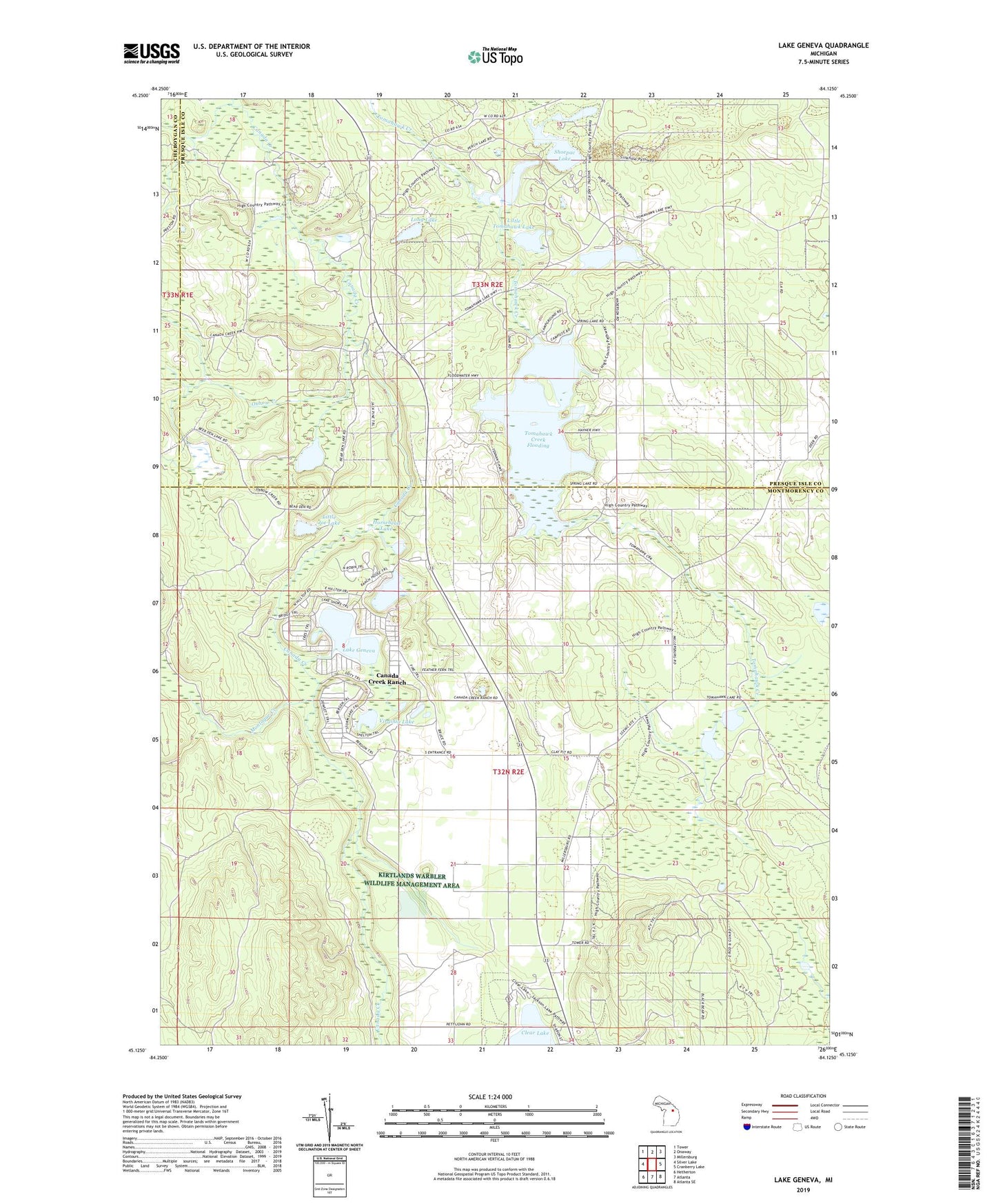
2023 topographic map quadrangle Lake Geneva in the state of Michigan. Scale: 1:24000. Based on the newly updated USGS 7.5' US Topo map series, this map is in the following counties: Montmorency, Presque Isle, Cheboygan. The map contains contour data, water features, and other items you are used to seeing on USGS maps, but also has updated roads and other features. This is the next generation of topographic maps. Printed on high-quality waterproof paper with UV fade-resistant inks.
Quads adjacent to this one:
West: Silver Lake
Northwest: Tower
North: Onaway
Northeast: Millersburg
East: Cranberry Lake
Southeast: Atlanta SE
South: Atlanta
Southwest: Hetherton
This map covers the same area as the classic USGS quad with code o45084b2.
Contains the following named places: Bear Den Lake, Canada Creek Post Office, Canada Creek Ranch, Canada Creek Ranch Census Designated Place, Clear Lake State Park, Francis Lake, Horsehead Lake, Lake Geneva, Little Joe Lake, Little Tomahawk Lake, Long Lake, Montague Creek, Mud Lake, Oxbow Creek, Presque Isle North Lookout Tower, Presque Isle South Lookout Tower, Shoepac Lake, Shoepac Lake State Forest Campground, Spring Lake, Tomahawk Creek Flooding, Tomahawk Creek Flooding State Forest Campground, Tomahawk Lake, Tomahawk Lake State Forest Campground, Twin Tomahawk Lakes, Virginia Lake, WCML-FM (Alpena), WCML-TV (Alpena), Wildfowl Lake, WPHN-FM (Gaylord)