MyTopo
Crooked Lake Michigan US Topo Map
Couldn't load pickup availability
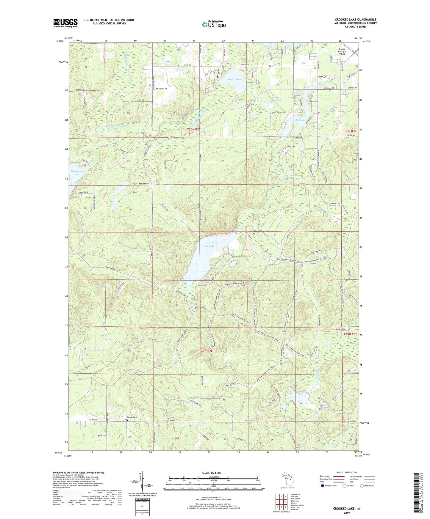
2023 topographic map quadrangle Crooked Lake in the state of Michigan. Scale: 1:24000. Based on the newly updated USGS 7.5' US Topo map series, this map is in the following counties: Montmorency. The map contains contour data, water features, and other items you are used to seeing on USGS maps, but also has updated roads and other features. This is the next generation of topographic maps. Printed on high-quality waterproof paper with UV fade-resistant inks.
Quads adjacent to this one:
West: Lewiston
Northwest: Hetherton
North: Atlanta
Northeast: Atlanta SE
East: Avery
Southeast: Comins
South: Oak Lake
Southwest: Comstock Hills
This map covers the same area as the classic USGS quad with code o44084h2.
Contains the following named places: Atlanta Junior-Senior High School, Atlanta Municipal Airport, Avery Creek, Avery Lake, Avery Lake State Forest Campground, Barger Creek, Big Oaks State Forest Campground, Camp Lunden Historical Marker, Chadwick Creek, Crooked Lake, Finnish Cemetery, First Baptist Church of Atlanta, Lake Fifteen, Lake Fifteen Campground, Lilypad Lake, Little Grass Lake, McCormick Lake, Mitchell Lake, Morning Star Lake, Sage Lakes, Sheridan Valley Ski Area