MyTopo
Hoytville Michigan US Topo Map
Couldn't load pickup availability
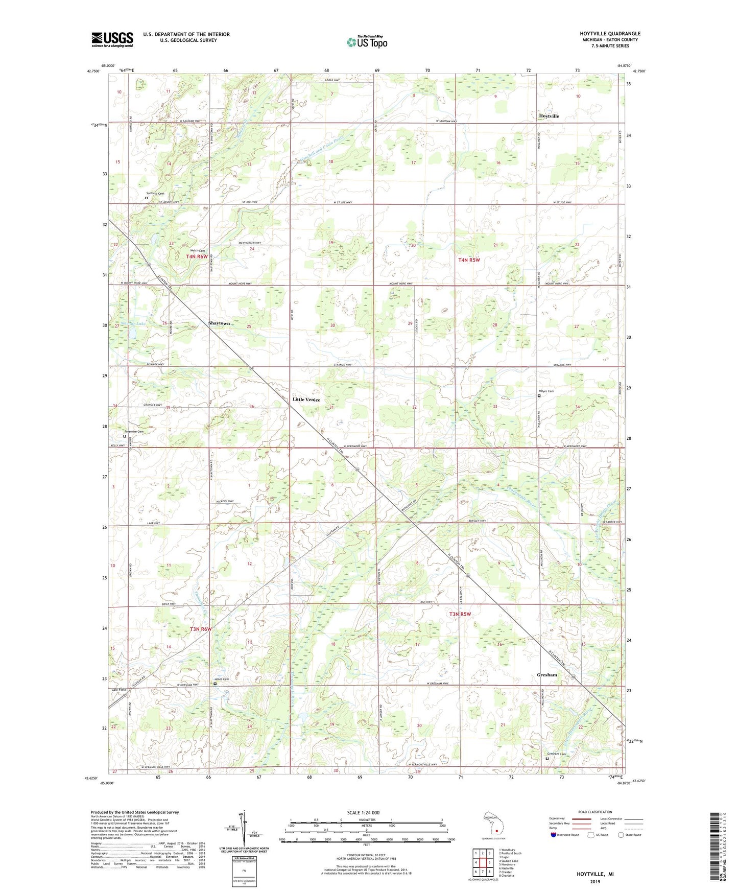
2019 topographic map quadrangle Hoytville in the state of Michigan. Scale: 1:24000. Based on the newly updated USGS 7.5' US Topo map series, this map is in the following counties: Eaton. The map contains contour data, water features, and other items you are used to seeing on USGS maps, but also has updated roads and other features. This is the next generation of topographic maps. Printed on high-quality waterproof paper with UV fade-resistant inks.
Quads adjacent to this one:
West: Saubee Lake
Northwest: Woodbury
North: Portland South
Northeast: Eagle
East: Needmore
Southeast: Charlotte
South: Chester
Southwest: Nashville
Contains the following named places: Allen's Post Office, Ames Cemetery, Ames School, Brethren Church, Brick School, Brown School, Chester Gospel Church, Dorman School, Dow School, Freemire Cemetery, Gresham, Gresham Cemetery, Gresham Post Office, Gresham United Methodist Church, Gresham United Methodist Church Historical Marker, Hallenbeck School, Hoytville, Hoytville Post Office, Kelly Post Office, Kelly School, Lake School, Law Field, Little Venice, Loucks School, Moyer Cemetery, Moyer School, Roxana Post Office, Roxand Center School, Shaytown, Shaytown Post Office, Shaytown School, Sinclair Lake, Smith School, Stalls Corner, Sunfield Cemetery, Thompson Creek, Township of Chester, Township of Roxand, Welch Cemetery, Who-Wit-Tah Church, Winchell and Union Drain, ZIP Code: 48861