MyTopo
Imp Lake Michigan US Topo Map
Couldn't load pickup availability
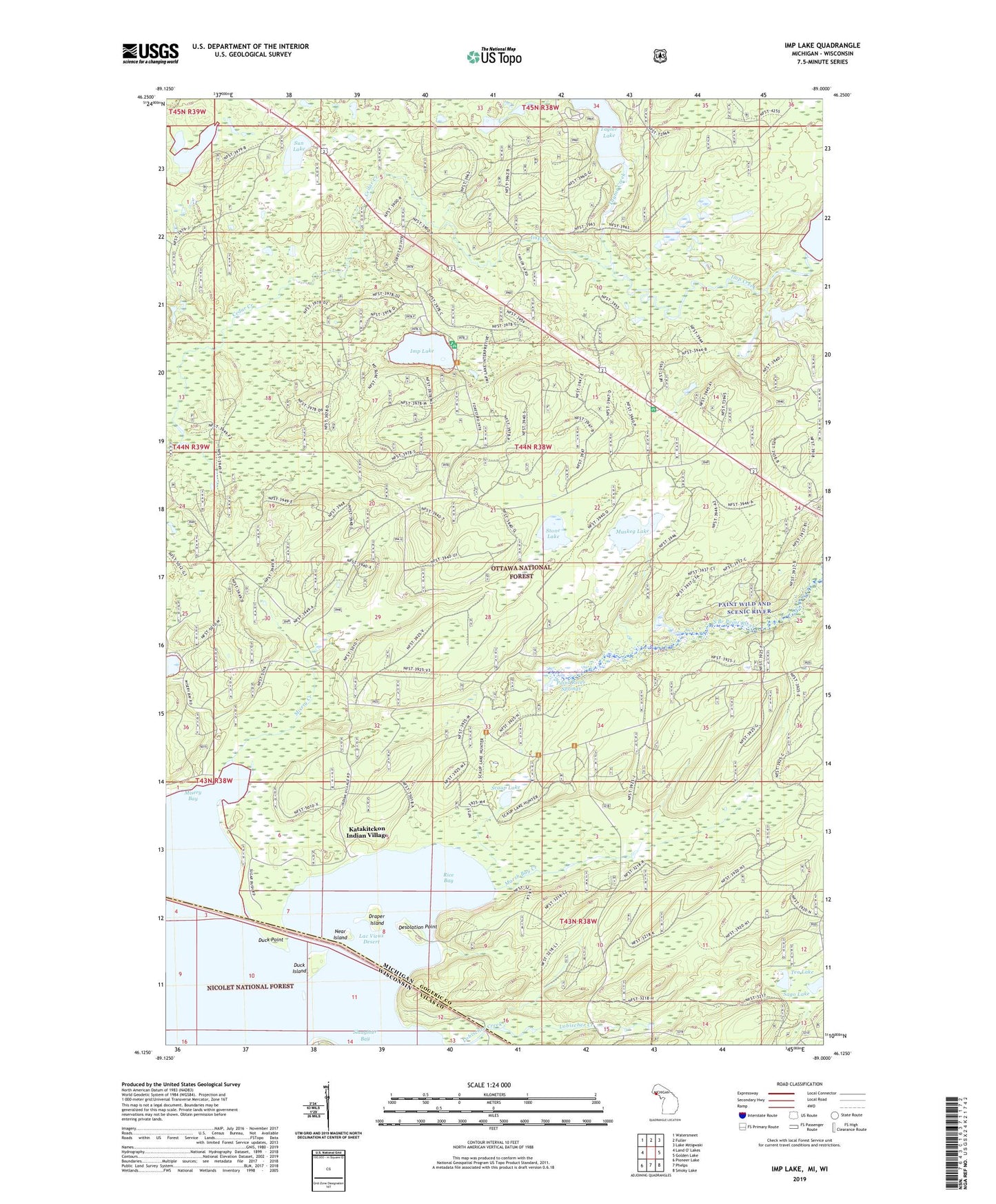
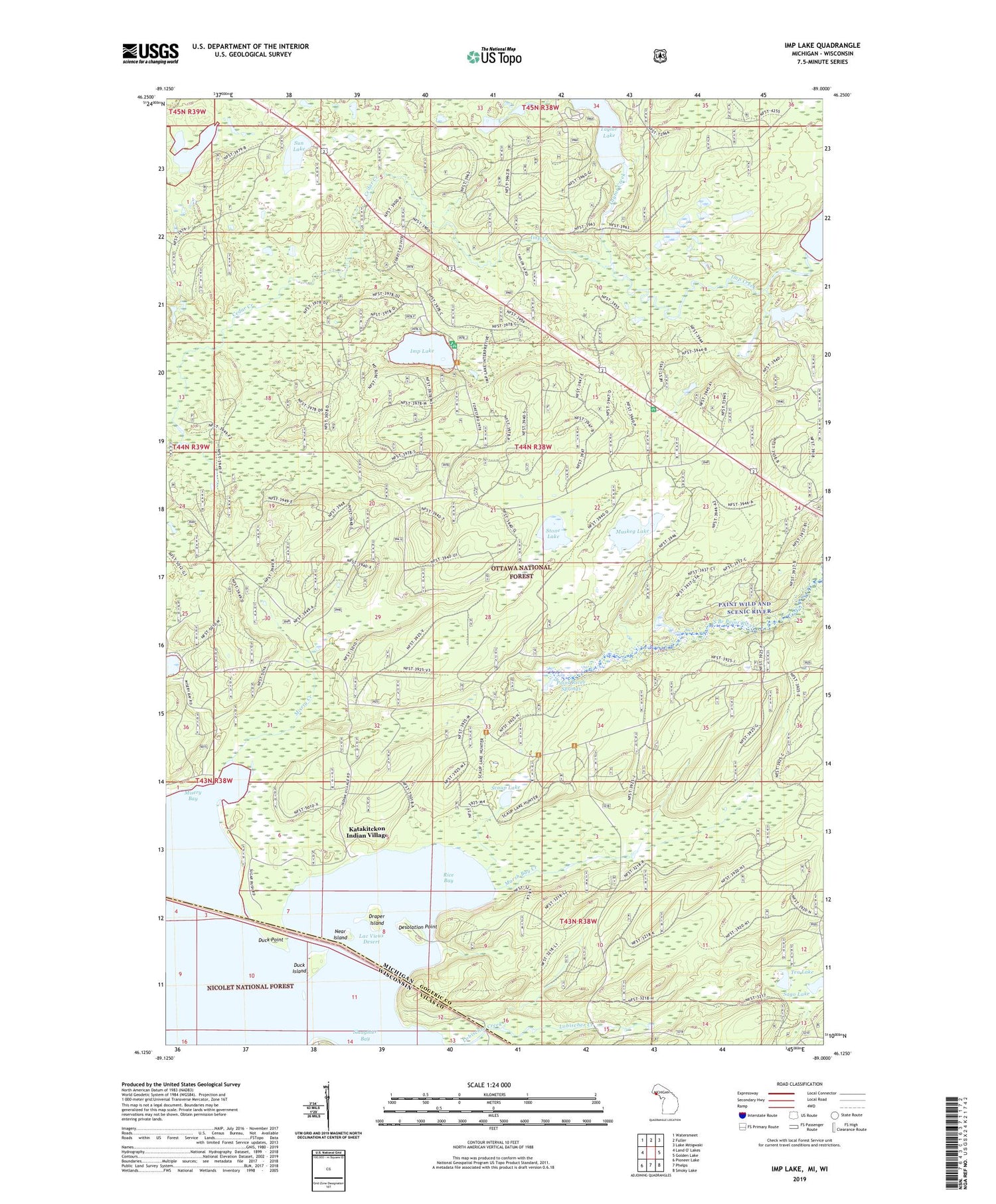
2019 topographic map quadrangle Imp Lake in the states of Michigan, Wisconsin. Scale: 1:24000. Based on the newly updated USGS 7.5' US Topo map series, this map is in the following counties: Gogebic, Vilas. The map contains contour data, water features, and other items you are used to seeing on USGS maps, but also has updated roads and other features. This is the next generation of topographic maps. Printed on high-quality waterproof paper with UV fade-resistant inks.
Quads adjacent to this one:
West: Land O' Lakes
Northwest: Watersmeet
North: Fuller
Northeast: Lake Mitigwaki
East: Golden Lake
Southeast: Smoky Lake
South: Phelps
Southwest: Pioneer Lake
Contains the following named places: Beaver Pond, Cedar Creek, Desolation Point, Draper Island, Duck Island, Duck Point, Imp Creek, Imp Lake, Imp Lake Lookout Tower, Imp Lake Recreation Site, Indian Village, Katakikon Indian Village Cemetery, Katakitckon Indian Village, Lac Vieux Desert, Lac Vieux Desert 21, Marsh Bay Creek, Misery Bay, Misery Creek, Muskeg Lake, Near Island, Paint River Springs, Powwow Lake, Rice Bay, Sago Lake, Scaup Lake, Slaughter Bay, Stone Lake, Sun Lake, Taylor Creek, Taylor Lake, Taylor Lake Recreation Site, Tea Lake, Watersmeet Roadside Park