
MyTopo
Karlin Michigan US Topo Map
Couldn't load pickup availability
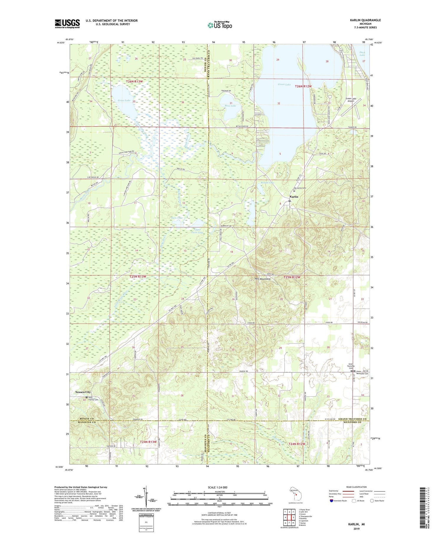
2019 topographic map quadrangle Karlin in the state of Michigan. Scale: 1:24000. Based on the newly updated USGS 7.5' US Topo map series, this map is in the following counties: Grand Traverse, Benzie, Wexford, Manistee. The map contains contour data, water features, and other items you are used to seeing on USGS maps, but also has updated roads and other features. This is the next generation of topographic maps. Printed on high-quality waterproof paper with UV fade-resistant inks.
Quads adjacent to this one:
West: Thompsonville
Northwest: Platte River
North: Lake Ann
Northeast: Grawn
East: Buckley
Southeast: Mesick
South: Harlan
Southwest: Copemish
Contains the following named places: Bass Lake, De Lorme Cemetery, Grant Church, Grant Methodist Cemetery, Grant Township Cemetery, Grass Lake, Grass Lake Campground, Grass Lake Creek, Green Lake, Green Lake Airport, Griner School, Holy Family Cemetery, Interlochen Green Lake Rustic Campground, Karlin, Karlin Post Office, Karlin Station, Kasson Post Office, Mud Lake, Nessen City Census Designated Place, Pavlovic Corner, Pickerel Creek, Ramsay School, Round Lake, Township of Grant, Twin Lake, Twin Mountains, Upper Twin Lake, Wormwood Post Office


