MyTopo
Copemish Michigan US Topo Map
Couldn't load pickup availability
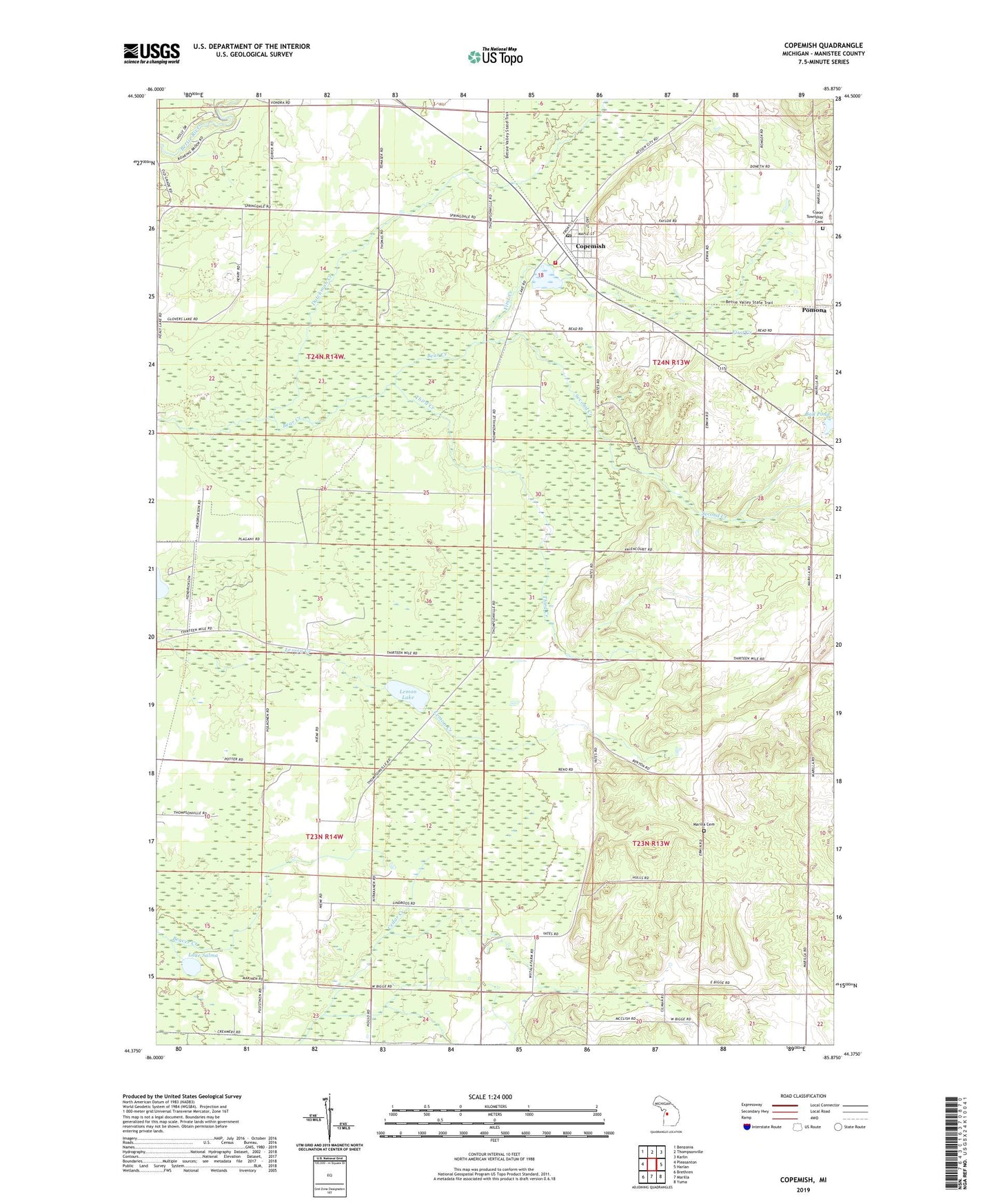
2023 topographic map quadrangle Copemish in the state of Michigan. Scale: 1:24000. Based on the newly updated USGS 7.5' US Topo map series, this map is in the following counties: Manistee. The map contains contour data, water features, and other items you are used to seeing on USGS maps, but also has updated roads and other features. This is the next generation of topographic maps. Printed on high-quality waterproof paper with UV fade-resistant inks.
Quads adjacent to this one:
West: Pleasanton
Northwest: Benzonia
North: Thompsonville
Northeast: Karlin
East: Harlan
Southeast: Yuma
South: Marilla
Southwest: Brethren
This map covers the same area as the classic USGS quad with code o44085d8.
Contains the following named places: Ball Pond, Betsie Valley Elementary School, Cleon Township Cemetery, Cleon Township Fire Department, Cleon Township Hall, Copemish, Copemish Post Office, Copemish Station, Dutchman Creek, First Creek, Healy Lake Campground, Henry Post Office, Henry Station, Horaks Airport, Lake Salma, Lemon Lake, Lemon Lake Post Office, Lemon Lake Station, Lewis Memorial Kids Park, Marilla Cemetery, Marilla Church, Pearl Park, Pomona, Pomona Bible Church, Pomona Post Office, Pomona Station, Saint Raphael Church, Second Creek, Third Creek, Township of Cleon, Township of Marilla, Township of Springdale, Village of Copemish, ZIP Code: 49625