MyTopo
Kingsley Michigan US Topo Map
Couldn't load pickup availability
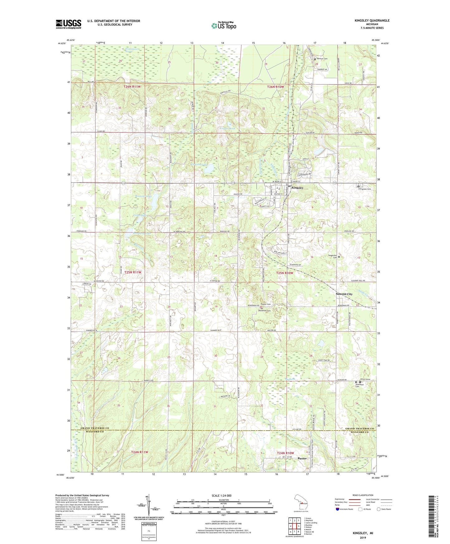
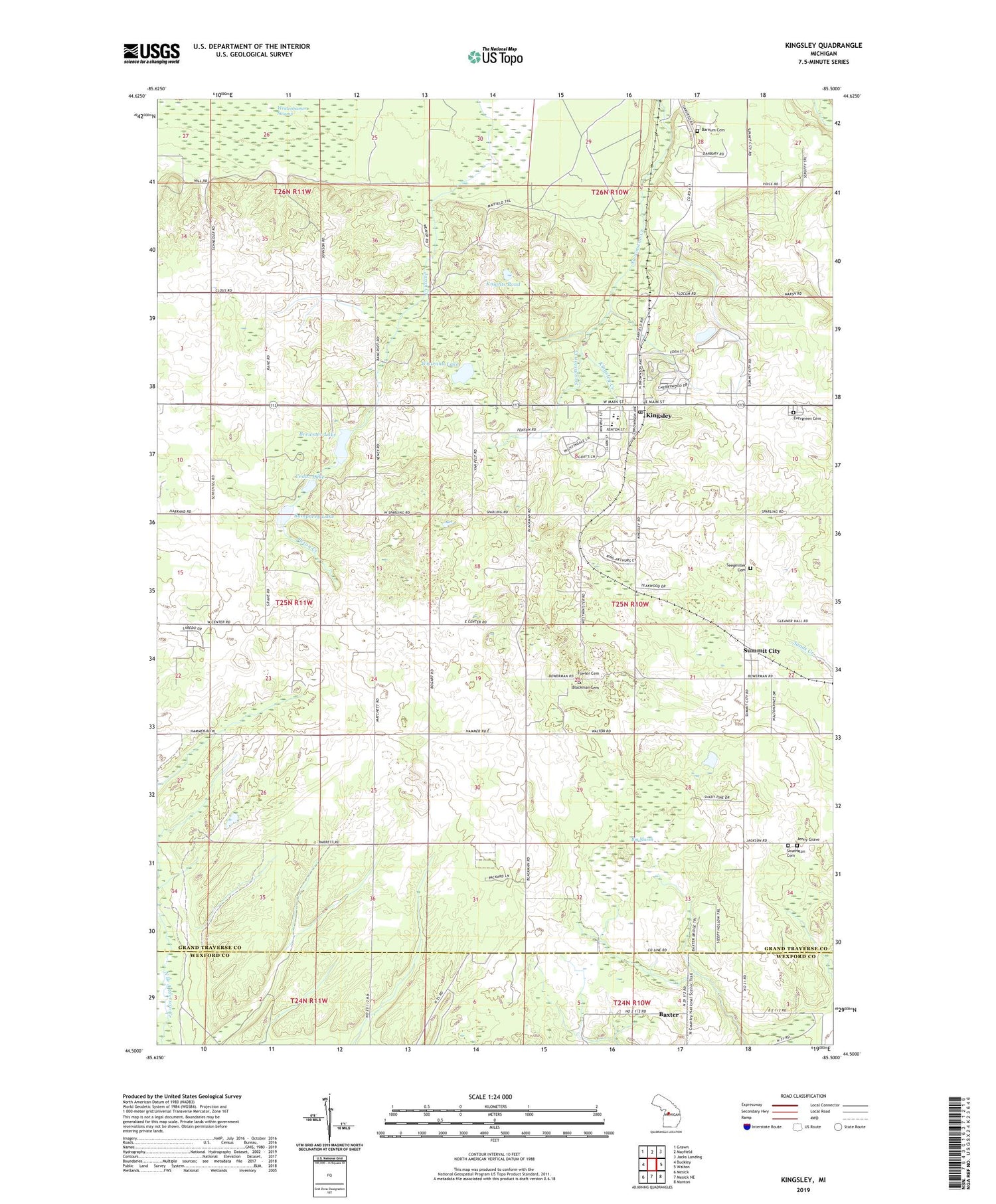
2019 topographic map quadrangle Kingsley in the state of Michigan. Scale: 1:24000. Based on the newly updated USGS 7.5' US Topo map series, this map is in the following counties: Grand Traverse, Wexford. The map contains contour data, water features, and other items you are used to seeing on USGS maps, but also has updated roads and other features. This is the next generation of topographic maps. Printed on high-quality waterproof paper with UV fade-resistant inks.
Quads adjacent to this one:
West: Buckley
Northwest: Grawn
North: Mayfield
Northeast: Jacks Landing
East: Walton
Southeast: Manton
South: Mesick NE
Southwest: Mesick
Contains the following named places: Barnum Cemetery, Baxter, Baxter Post Office, Big Marsh, Blackman Cemetery, Brewster Lake, Bumphrey Lake, Cedar Lake, Cherrywood Village Mobile Home Park, Evergreen Cemetery, Fowler Cemetery, Free Methodist Church, Grand Traverse County Sheriff Department, Jenny Grave, Kingdom Hall, Kingsley, Kingsley Baptist Church, Kingsley Creek, Kingsley High School, Kingsley Lookout Tower, Kingsley Middle School, Kingsley Post Office, Kingsley Public Library, Kingsley Station, Kingsley United Methodist Church, Knights Pond, Lake Brewster Post Office, Matchett School, Meadow Hill Care Center, Nickerson School, Paradise Fire and Emergency Services Station, Pioneer Park, Rodes Field, Saint Johannes Church, Seegmiller Cemetery, Summit City, Summit City Post Office, Summit City Station, Swainston Cemetery, The Kingsley Club, Township of Paradise, Village of Kingsley, Wistrand Lake, ZIP Codes: 49649, 49666