MyTopo
Tower Michigan US Topo Map
Couldn't load pickup availability
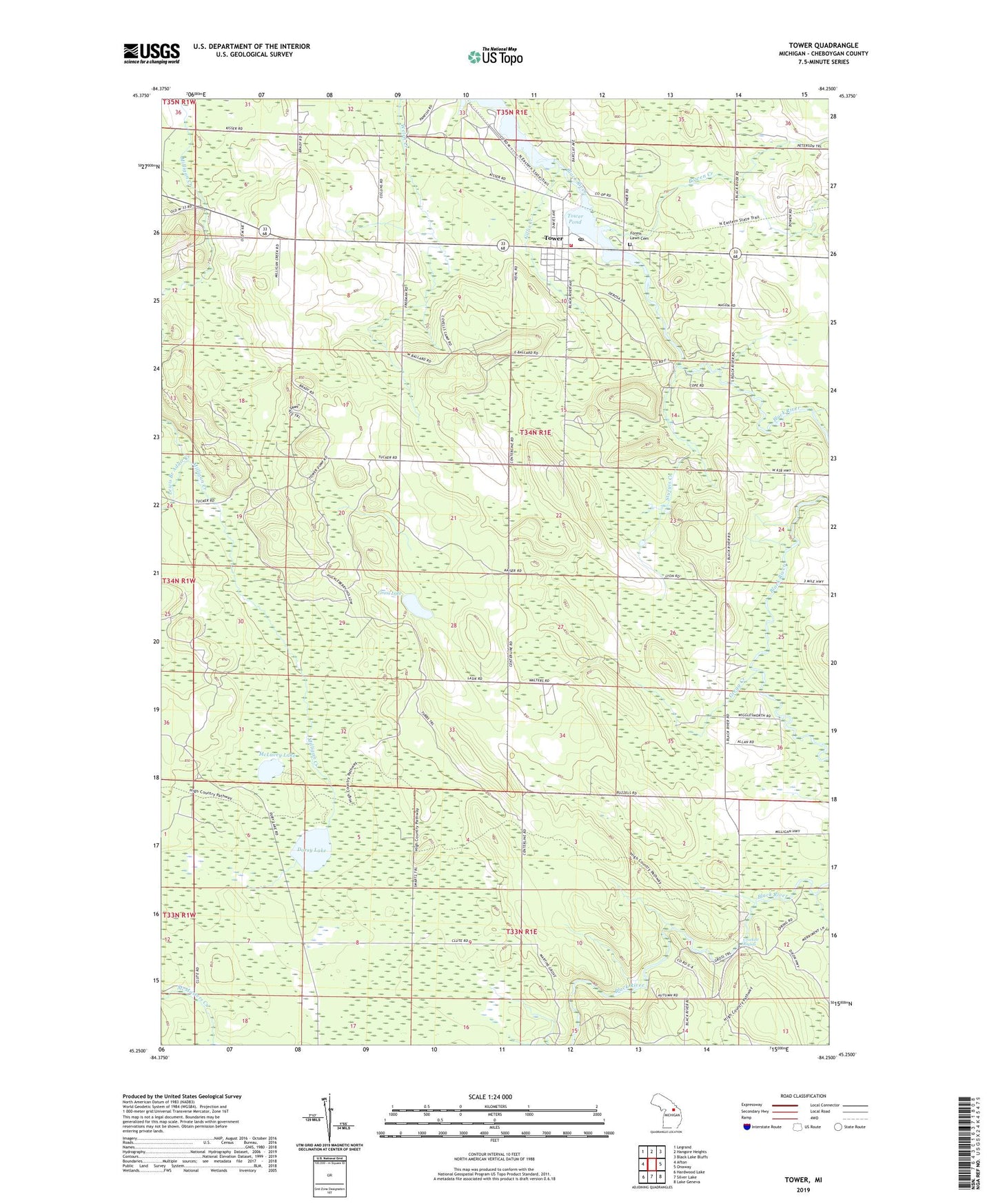
2023 topographic map quadrangle Tower in the state of Michigan. Scale: 1:24000. Based on the newly updated USGS 7.5' US Topo map series, this map is in the following counties: Cheboygan. The map contains contour data, water features, and other items you are used to seeing on USGS maps, but also has updated roads and other features. This is the next generation of topographic maps. Printed on high-quality waterproof paper with UV fade-resistant inks.
Quads adjacent to this one:
West: Afton
Northwest: Legrand
North: Hangore Heights
Northeast: Black Lake Bluffs
East: Onaway
Southeast: Lake Geneva
South: Silver Lake
Southwest: Hardwood Lake
This map covers the same area as the classic USGS quad with code o45084c3.
Contains the following named places: Bowen Creek, Canada Creek, Crockett Rapids, Dorsy Lake, Forest - Waverly Fire Department, Forest Lawn Cemetery, Gillis Creek, Grass Lake, Gregg Creek, Lewis Branch Adair Creek, Lyons Creek, Marsh Lake, McLavey Lake, Midway Post Office, Sturgis Creek, Tower, Tower Baptist Church, Tower Census Designated Place, Tower Pond, Tower Post Office, Tower Station, Township of Forest