MyTopo
Red Oak Michigan US Topo Map
Couldn't load pickup availability
Also explore the Red Oak Forest Service Topo of this same quad for updated USFS data
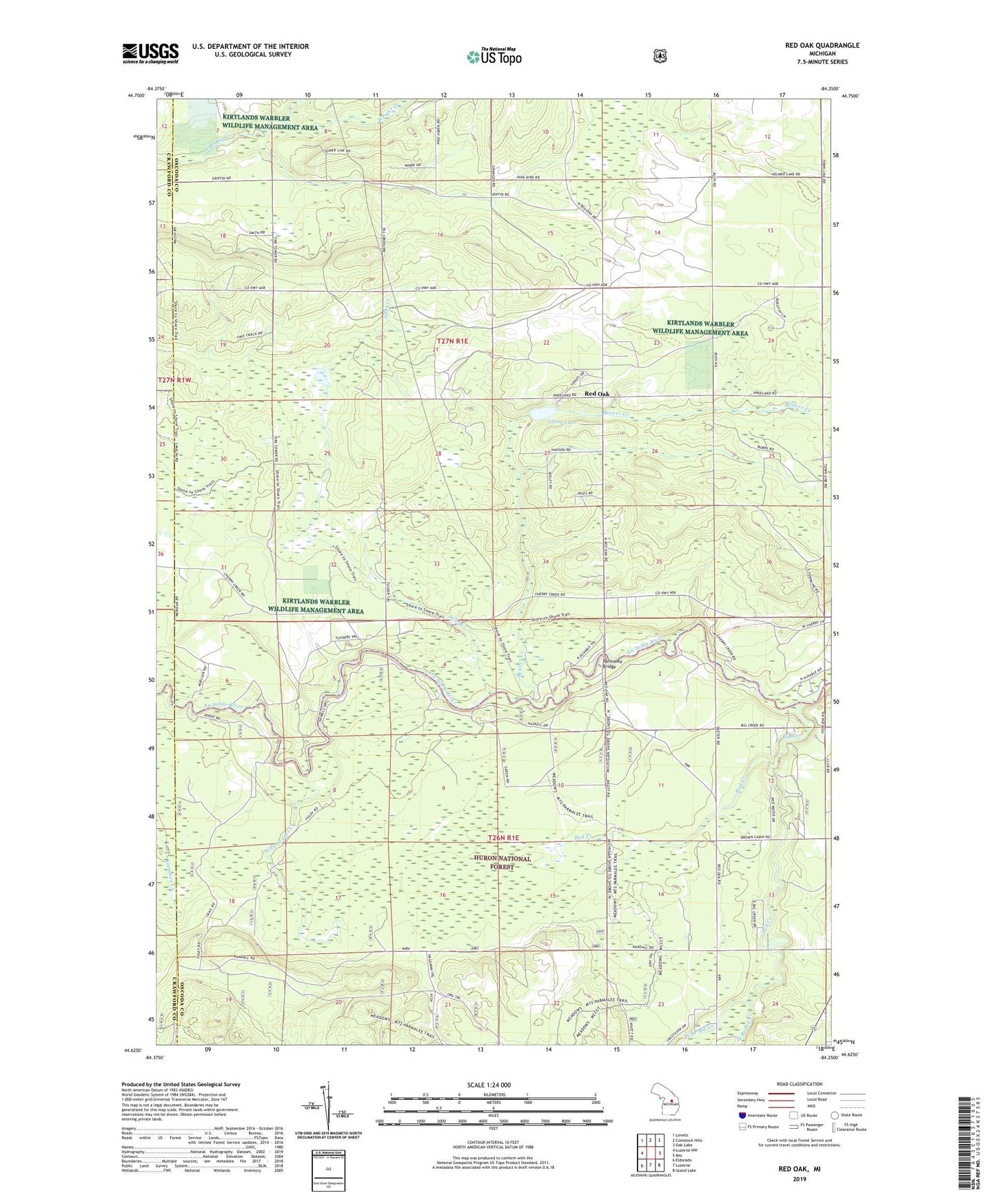
2023 topographic map quadrangle Red Oak in the state of Michigan. Scale: 1:24000. Based on the newly updated USGS 7.5' US Topo map series, this map is in the following counties: Oscoda, Crawford. The map contains contour data, water features, and other items you are used to seeing on USGS maps, but also has updated roads and other features. This is the next generation of topographic maps. Printed on high-quality waterproof paper with UV fade-resistant inks.
Quads adjacent to this one:
West: Luzerne NW
Northwest: Lovells
North: Comstock Hills
Northeast: Oak Lake
East: Mio
Southeast: Island Lake
South: Luzerne
Southwest: Eldorado
This map covers the same area as the classic USGS quad with code o44084f3.
Contains the following named places: Beaver Creek, Big Creek, East Branch Big Creek, Elk Hill Lookout Tower, Glenn Lake, Luzerne Park, Parmalee Bridge, Parmalee Bridge Recreation Site, Red Creek, Red Oak, Red Oak Post Office, Sohn Creek, West Branch Big Creek, Whitewater Creek, Wright Creek