MyTopo
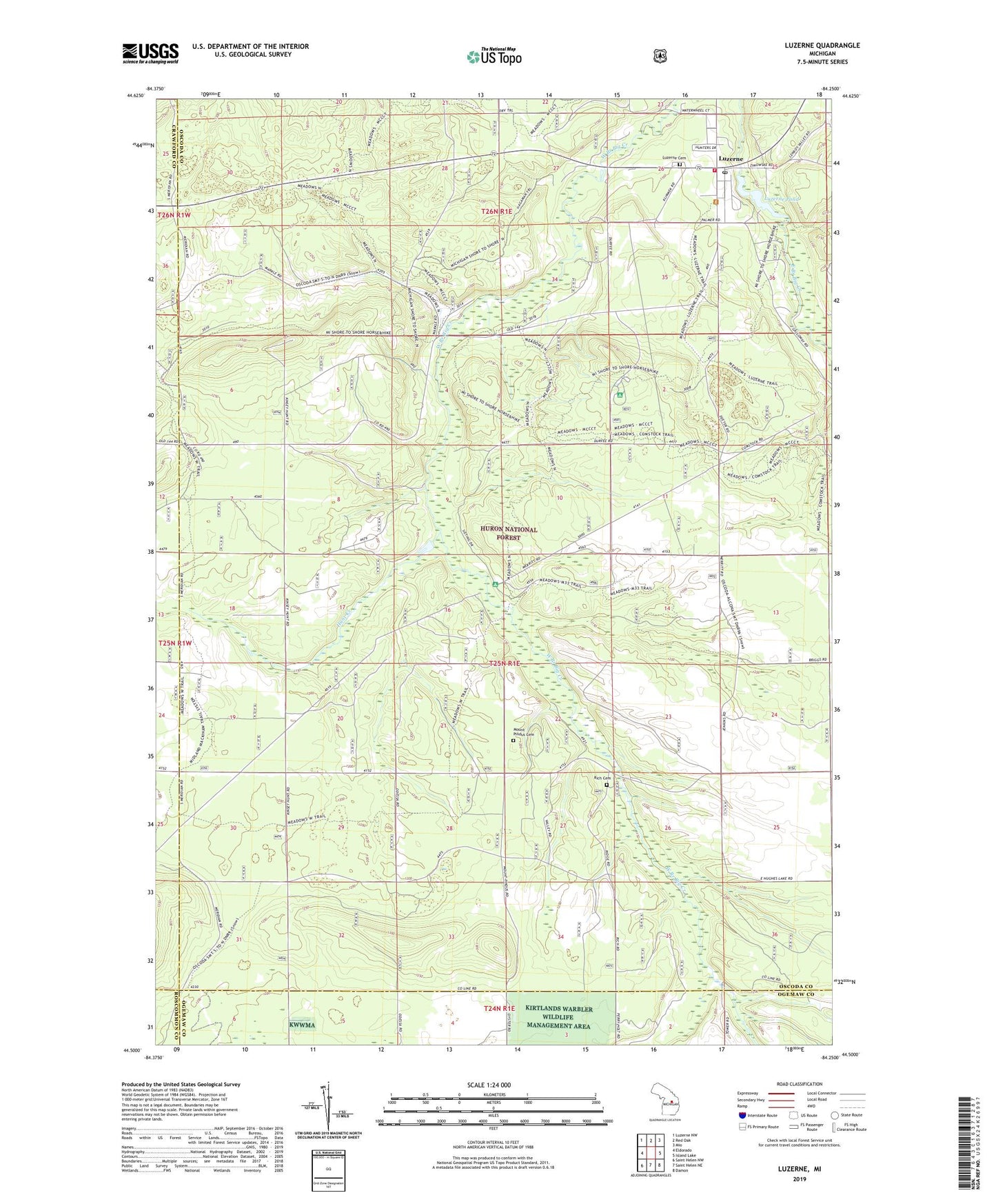
Luzerne Michigan US Topo Map
Couldn't load pickup availability
Also explore the Luzerne Forest Service Topo of this same quad for updated USFS data
2023 topographic map quadrangle Luzerne in the state of Michigan. Scale: 1:24000. Based on the newly updated USGS 7.5' US Topo map series, this map is in the following counties: Oscoda, Ogemaw, Crawford, Roscommon. The map contains contour data, water features, and other items you are used to seeing on USGS maps, but also has updated roads and other features. This is the next generation of topographic maps. Printed on high-quality waterproof paper with UV fade-resistant inks.
Quads adjacent to this one:
West: Eldorado
Northwest: Luzerne NW
North: Red Oak
Northeast: Mio
East: Island Lake
Southeast: Damon
South: Saint Helen NE
Southwest: Saint Helen NW
This map covers the same area as the classic USGS quad with code o44084e3.
Contains the following named places: Big Creek Township Hall, Emma Lowery Congregational Church, Hunt Creek, Indian Graves, Luzerne, Luzerne Baptist Church, Luzerne Campground, Luzerne Cemetery, Luzerne Fire Department, Luzerne Fire Point of Interest, Luzerne Lookout Tower, Luzerne Pond, Luzerne Post Office, Luzerne Trail Camp, Mount Pindus Cemetery, Odessa Post Office, Rich Cemetery, Township of Big Creek, Tyrrell Post Office, ZIP Code: 48636