MyTopo
Marion Michigan US Topo Map
Couldn't load pickup availability
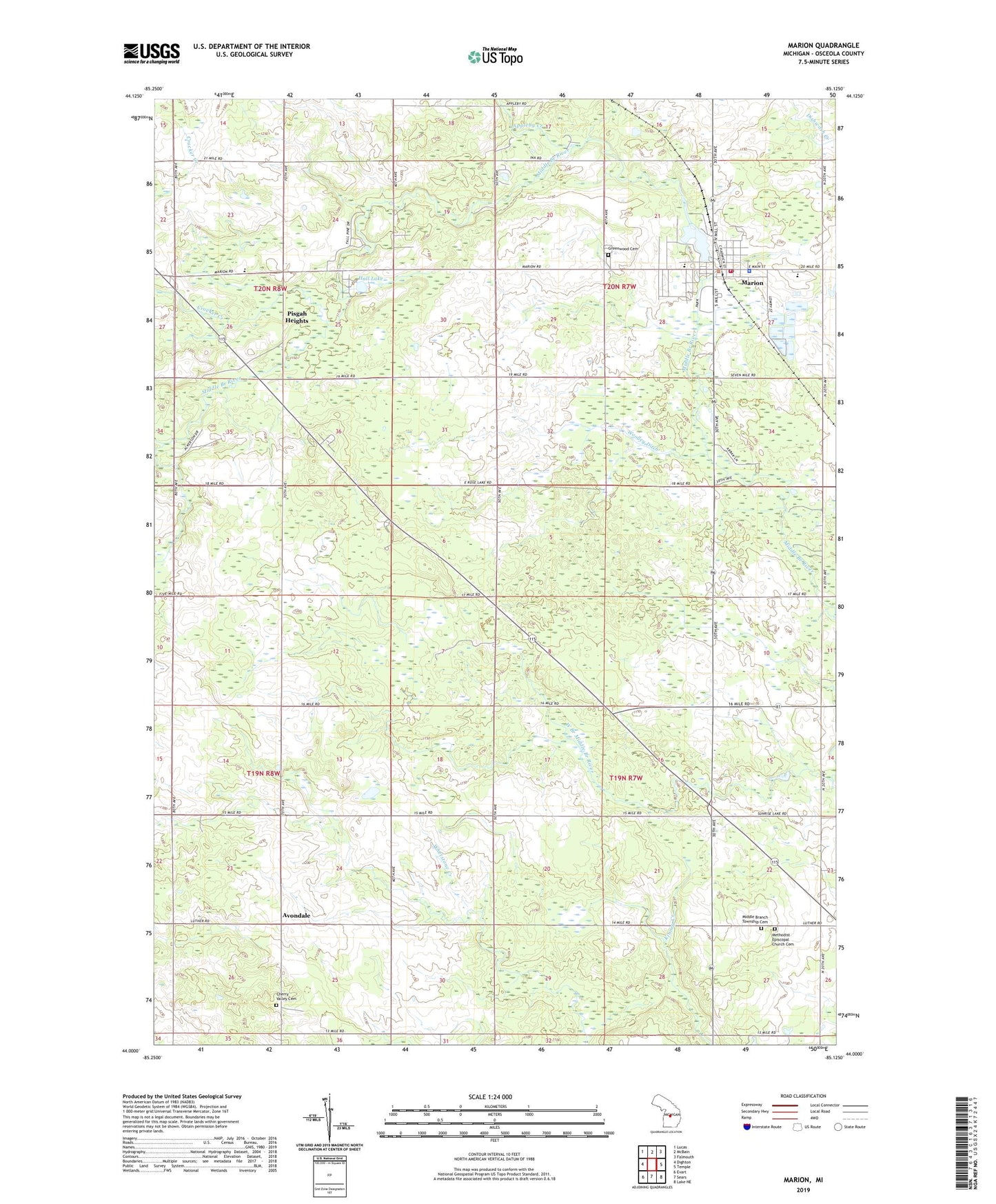
2019 topographic map quadrangle Marion in the state of Michigan. Scale: 1:24000. Based on the newly updated USGS 7.5' US Topo map series, this map is in the following counties: Osceola. The map contains contour data, water features, and other items you are used to seeing on USGS maps, but also has updated roads and other features. This is the next generation of topographic maps. Printed on high-quality waterproof paper with UV fade-resistant inks.
Quads adjacent to this one:
West: Dighton
Northwest: Lucas
North: McBain
Northeast: Falmouth
East: Temple
Southeast: Lake NE
South: Sears
Southwest: Evart
Contains the following named places: Appleby Creek, Avondale, Avondale Post Office, Avondale School, Bible Missionary Church, Cherry Valley Cemetery, Clark School, Community of Christ Church, Countryside Health Clinic, Crocker Creek, Founding of Marion Historical Marker, Franz Creek, Gormer Post Office, Gormer School, Greenwood Cemetery, Hall Lake, Marion, Marion Area Historical Museum, Marion Baptist Church, Marion Community Fire Department, Marion Elementary School, Marion Fairgrounds, Marion High School, Marion Medical Center, Marion Millpond and Dam Historical Marker, Marion Police Department, Marion Post Office, Marion Public Libary, Marion Seventh Day Adventist Church, Marion Station, Marion United Methodist Church, Methodist Episcopal Church Cemetery, Middle Branch Church, Middle Branch Township Cemetery, Mill Pond, Old Log Resort and Campground, Pisgah Heights, Pisgah Heights Wesleyan Church, Redding Township Hall, Saint Agnes Church, Sawyer School, Township of Marion, Township of Middle Branch, Village of Marion, Woolley Ditch