MyTopo
Falmouth Michigan US Topo Map
Couldn't load pickup availability
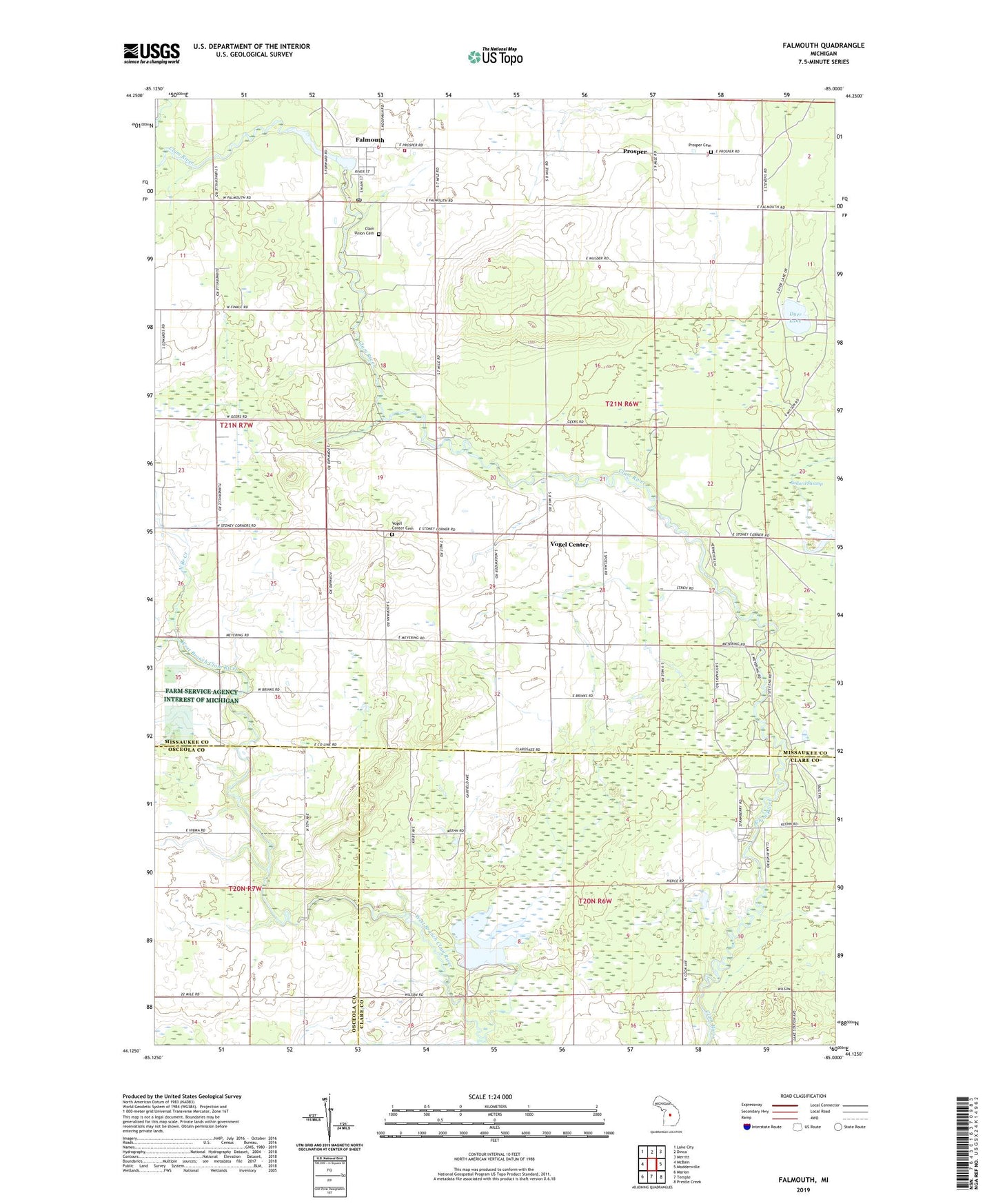
2023 topographic map quadrangle Falmouth in the state of Michigan. Scale: 1:24000. Based on the newly updated USGS 7.5' US Topo map series, this map is in the following counties: Missaukee, Clare, Osceola. The map contains contour data, water features, and other items you are used to seeing on USGS maps, but also has updated roads and other features. This is the next generation of topographic maps. Printed on high-quality waterproof paper with UV fade-resistant inks.
Quads adjacent to this one:
West: McBain
Northwest: Lake City
North: Dinca
Northeast: Merritt
East: Moddersville
Southeast: Prestle Creek
South: Temple
Southwest: Marion
This map covers the same area as the classic USGS quad with code o44085b1.
Contains the following named places: Austa Post Office, Ballard Swamp, Clam Union Cemetery, Clam Union Township Fire Department, Dyer Lake, Falmouth, Falmouth Area Library, Falmouth Census Designated Place, Falmouth Post Office, Falmouth Reformed Church, Falmouth Station, Forward Post Office, Hoekwater Park, Middle Branch Creek, Mosquito Creek, North Branch Creek, Prosper, Prosper Cemetery, Prosper Church, Prosper Post Office, Prosper School, Township of Clam Union, Vogel Center, Vogel Center Cemetery, Vogel Center Christian Church, Vogel Center Post Office